The projects below show our monitoring work in practice, across settings as diverse as a near-two-decade estuary record, streams crossed by a new mountain highway, the food safety of shellfish and wild kai, life inside a city’s piped streams, and the waterbodies of a subantarctic island 700 km offshore. Across all of them the task is the same: design monitoring that yields consistent, defensible data, and see it through from field surveys to analysis and reporting people can actually use. The real value shows up over time: several of these records run for years or even decades, which lets them do what a one-off survey can’t – tell genuine change from natural variation, and even capture the ecological signature of the Canterbury earthquakes.
Te Ihutai/Avon-Heathcote Estuary Health
A multi-agency, nationally standardised monitoring programme that has tracked the ecological health of Ōtautahi/Christchurch's estuary and tidal river mouths for close to two decades – a continuous record robust enough to have captured the ecological signature of the Canterbury earthquakes.
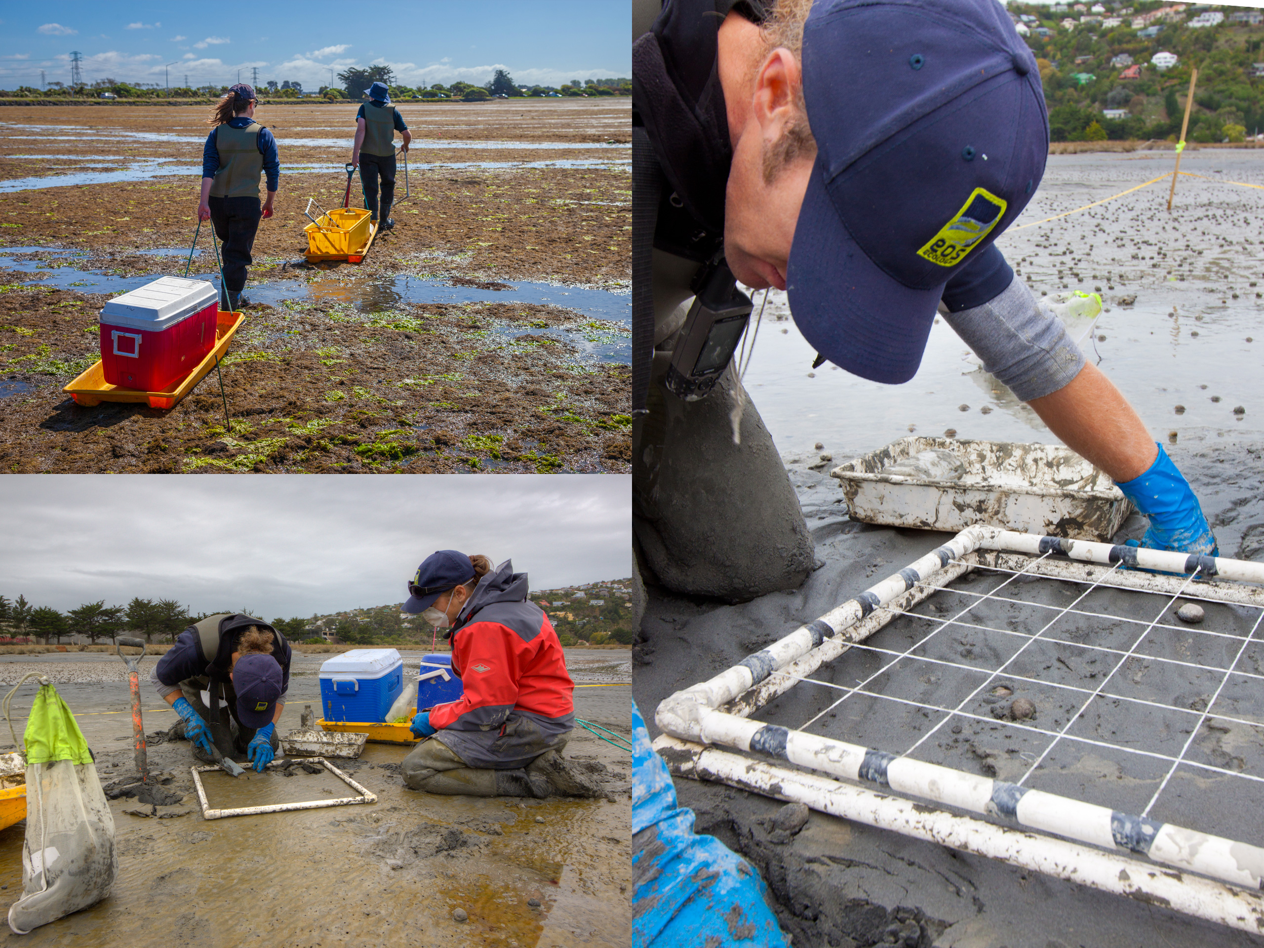
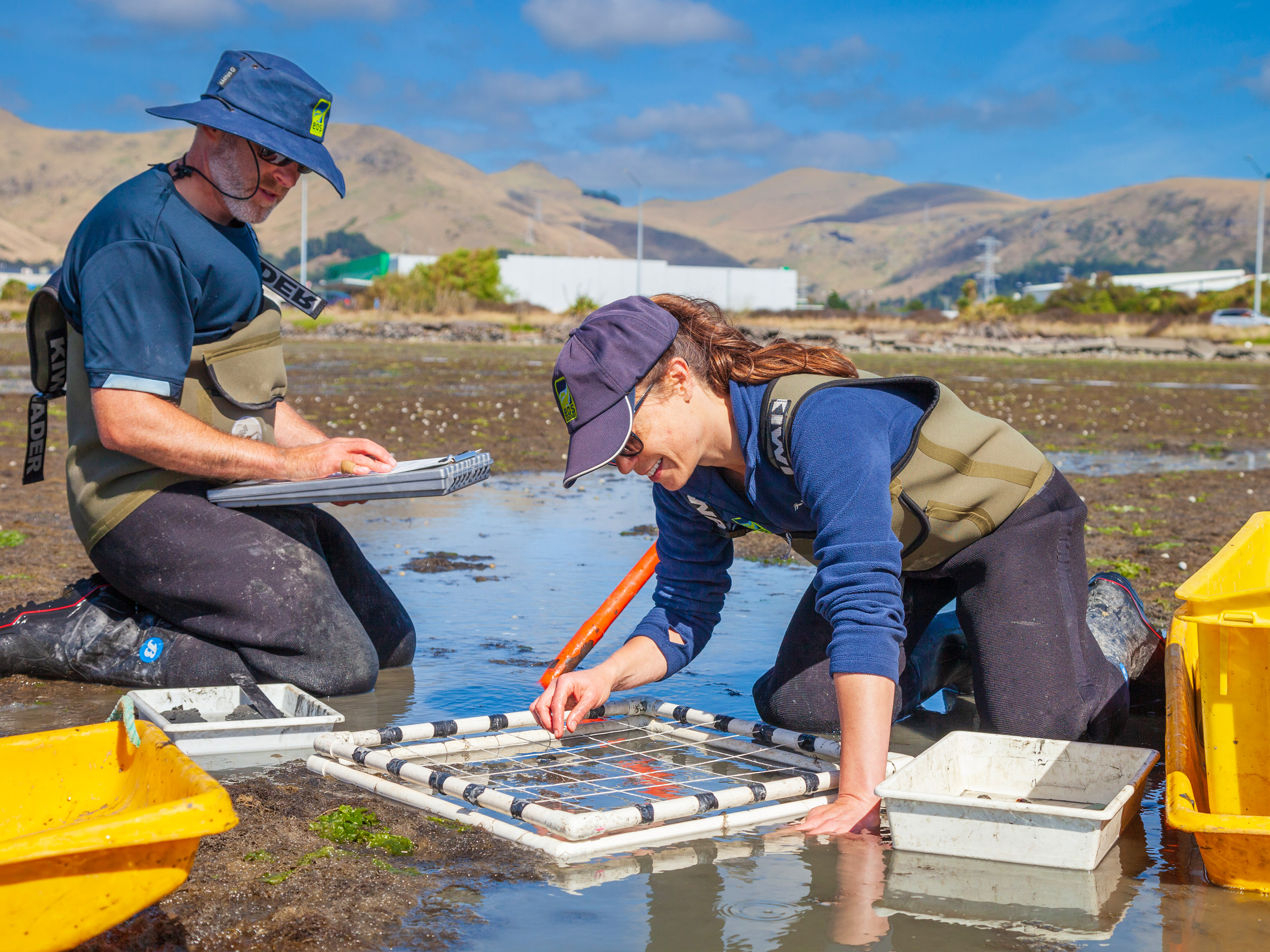
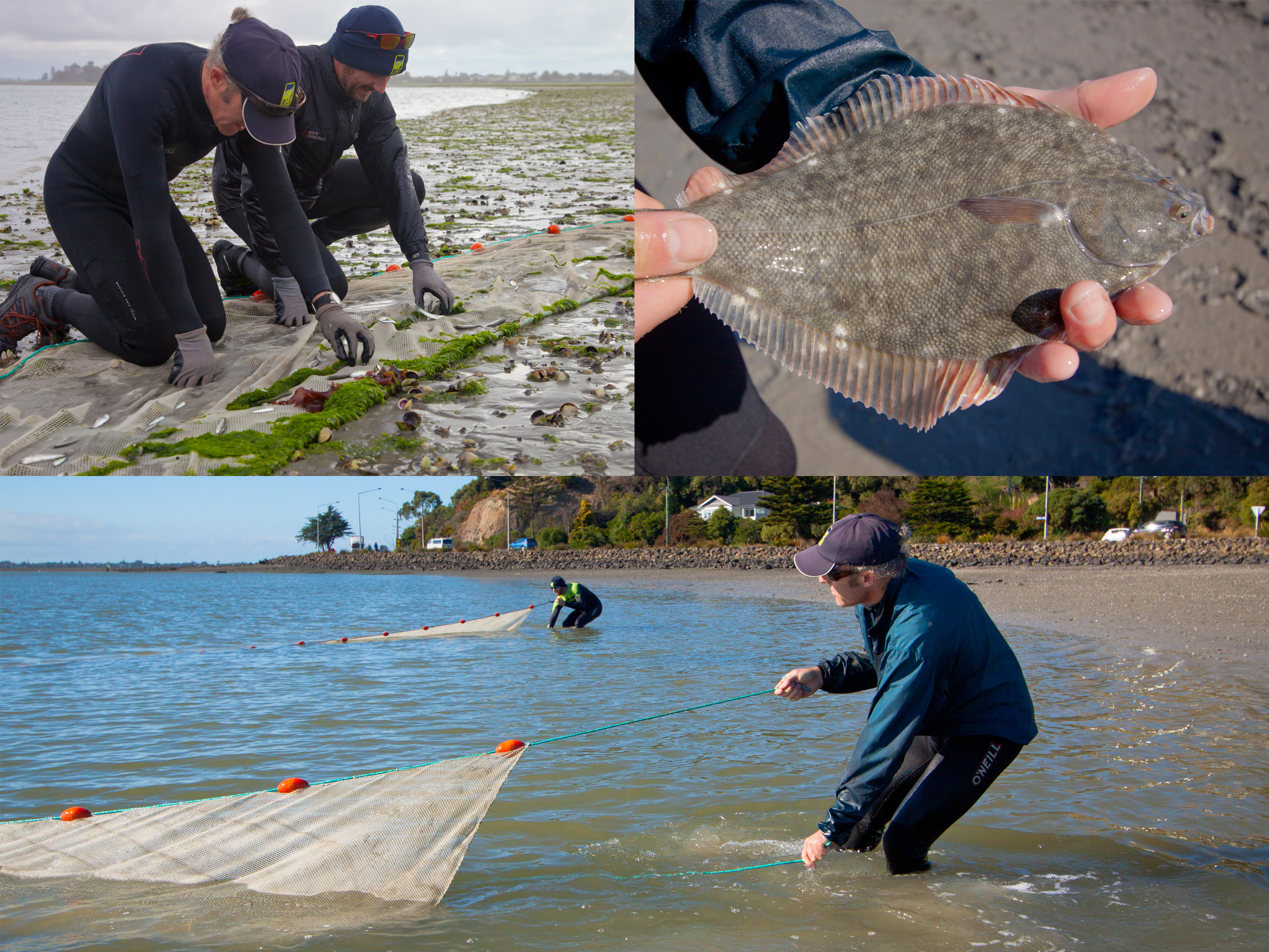
Te Ihutai/Avon-Heathcote Estuary is one of Aotearoa New Zealand’s largest urban estuaries – a tidal system on the edge of Ōtautahi/Christchurch that is both an important mahinga kai area and the receiving environment for the city’s two main rivers. In 2005, Christchurch City Council (CCC), Environment Canterbury (ECan), and the Avon-Heathcote Estuary Ihutai Trust agreed a ‘Healthy Estuary & Rivers of the City’ programme to provide a road map for coordinated, multi-agency investment in long-term monitoring, and EOS Ecology was commissioned to design and implement the estuary and tidal river mouth component. We built the survey methodology around recognised national estuary monitoring standards (jointly approved by CCC and ECan), focusing on the indicators that matter most for estuarine health: sediment contamination, nutrient levels, macroalgae cover, and the infaunal and epifaunal invertebrate communities (including cockle abundance), sampled across seven sites in the estuary and the mouths of the Ōpāwaho/Heathcote and Ōtākaro/Avon rivers.
Since 2007 we have been the consistent provider of annual field surveys and field and laboratory invertebrate identification which underpins the programme, and the resulting data forms the basis of Environment Canterbury’s Healthy Estuary & Rivers of the City reporting. The real value of that consistency became clear after the 2010/11 Canterbury earthquakes. Because we held a standardised, multi-site record reaching back years before the quakes, the dataset became a rare natural experiment for evaluating earthquake-driven change in an urban estuary, from physical shifts in the estuary bed (some sites rose by close to half a metre) through to changes in invertebrate community structure. Related shellfish monitoring – originally designed to track the closure of the estuary’s wastewater discharge and the move to an ocean outfall – was similarly well placed to capture the ecological effects of the unprecedented discharge of untreated wastewater into the estuary after the earthquakes.
In 2022 we worked with ECan to review and refresh the programme so it would sit more closely alongside the council’s monitoring in other Canterbury estuaries; the review confirmed the robustness of the original 2005 design, with only minor updates needed, which we implemented from 2023. That same year we also supported the Avon-Heathcote Estuary Ihutai Trust to establish its first community-based cockle population monitoring across the estuary’s intertidal and subtidal habitats. Nearly two decades on, the programme’s strength is its continuity: a single, defensible, methodologically consistent dataset that turns annual monitoring into genuine trend detection, and gives CCC and ECan a sound basis for decisions about a complex and changing estuary.
Tararua Dairy Farms Stream Health
Biological monitoring that gave a farmer-led water quality programme a defensible, regionally comparable measure of stream health, paired with the science communication outputs that put the results directly into farmers' hands.
DairyNZ’s Tararua Plantain Project is a seven-year initiative, running since 2018–19 with Horizons Regional Council (Horizons), Massey University, and agronomists, testing whether Aotearoa New Zealand-bred plantain cultivars can reduce the soil nitrate that leaches from beneath cows’ urine patches. Early research suggests reductions in soil nitrogen of roughly 5–30%, depending on soil type and how much plantain is in the cows’ diet. At the heart of the project is a farmer-led, monthly water quality monitoring programme spread across more than 20 dairy-farm waterway sites in the upper Manawatū River catchment. EOS Ecology was engaged to add a biological dimension to that effort.
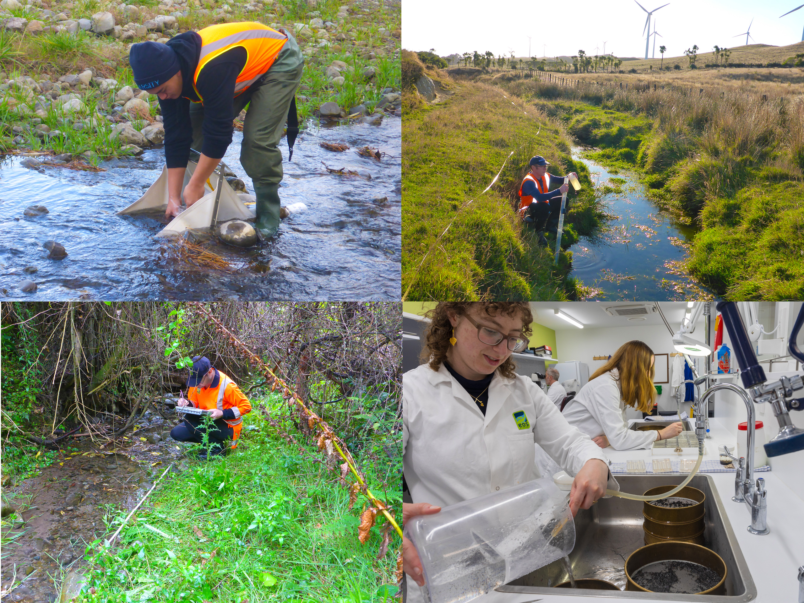
Our science team designed a macroinvertebrate biomonitoring programme deliberately aligned to Horizons’ State of the Environment monitoring methodology, so the project’s data would sit directly alongside the council’s long-term regional sites rather than standing in isolation. We sampled the stream invertebrate communities and habitat at the project sites over three years, then processed and analysed the samples to derive each site’s Macroinvertebrate Community Index (MCI), a well-established measure of stream health. Because macroinvertebrates respond to the cumulative condition of a waterway, rather than a single moment’s water chemistry, MCI gave the project a robust, holistic indicator against which the benefits of the plantain trial could be tracked over time.
Rigorous data only changes behaviour if people can make sense of it, so our scientists worked alongside our science interpreters to turn the results into something farmers could use. Each participating landowner received an individual report card carrying their site’s MCI score, a plain-English explanation of what it means, and photographs of the three most abundant macroinvertebrate taxa found at their site. We also produced a wall-map infographic showing MCI scores across all project sites alongside Horizons‘ monitoring sites, which DairyNZ used at Tararua Plantain Project open days, letting farmers see at a glance how their own stream health compared with others across the region. It’s a compact illustration of the EOS Ecology approach: defensible field science and laboratory analysis carried right through to interpretation and design, so the evidence lands with the audience that needs to act on it.

Te Ahu a Turanga: Manawatū Tararua Highway
Designing and delivering the sediment-focused, pre-construction freshwater baseline for the major new highway replacing the closed Manawatū Gorge route – the reference dataset against which the construction effects on Manawatū River tributaries can be measured.
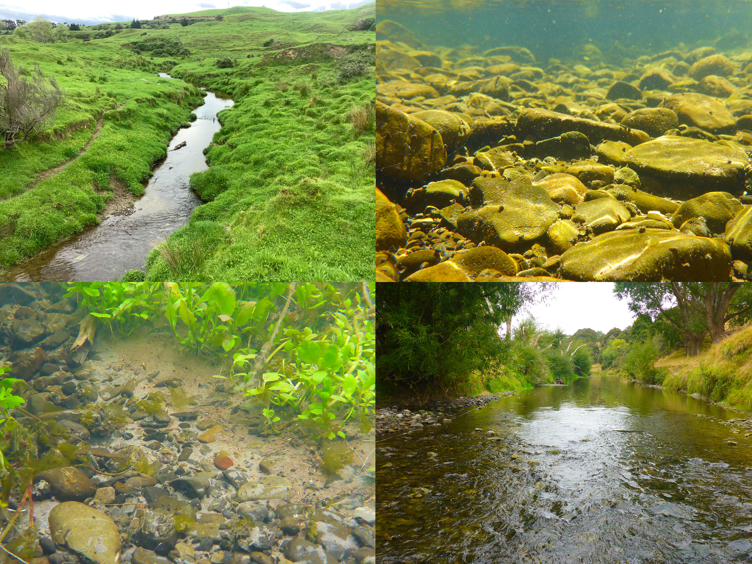
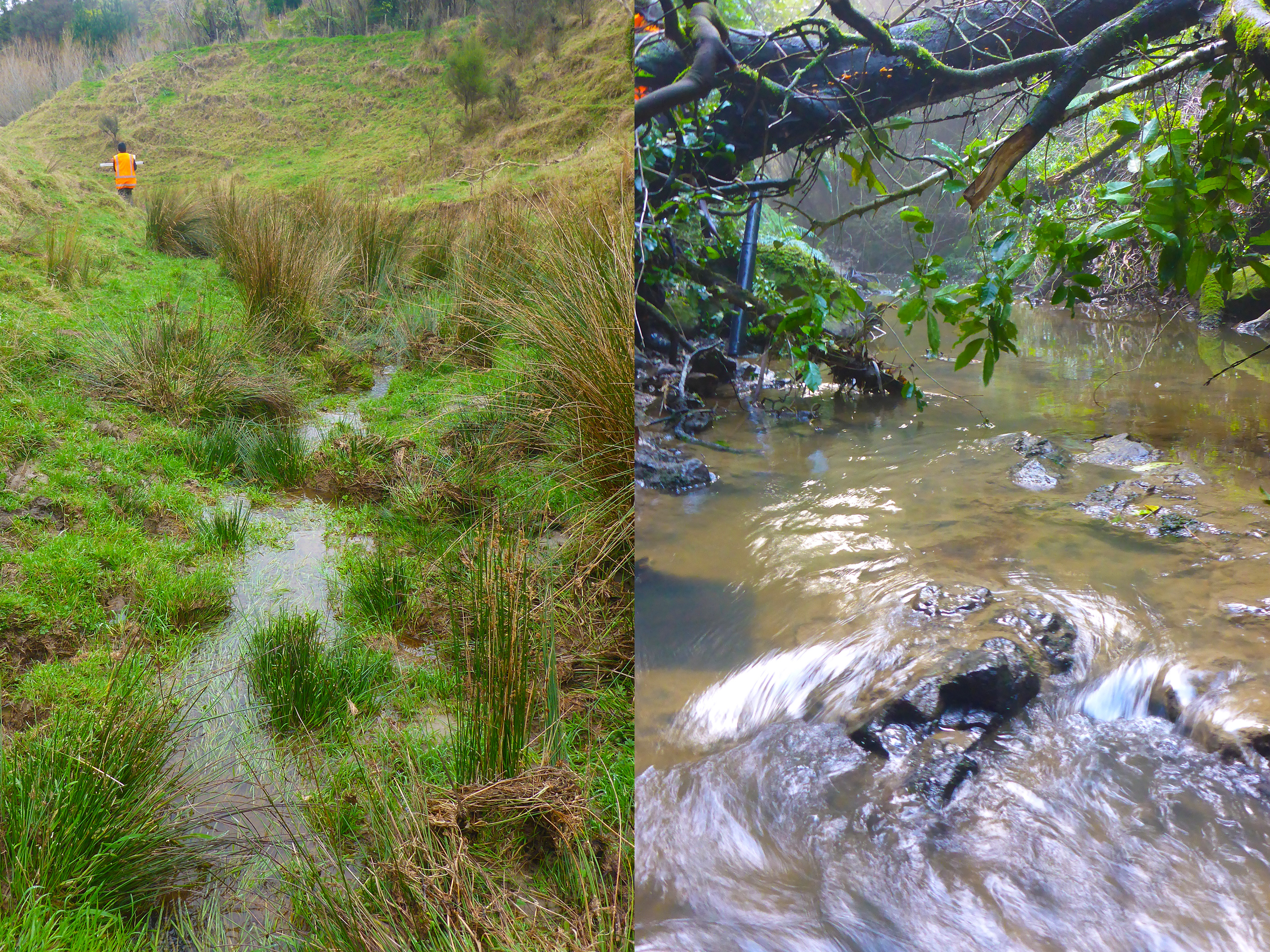
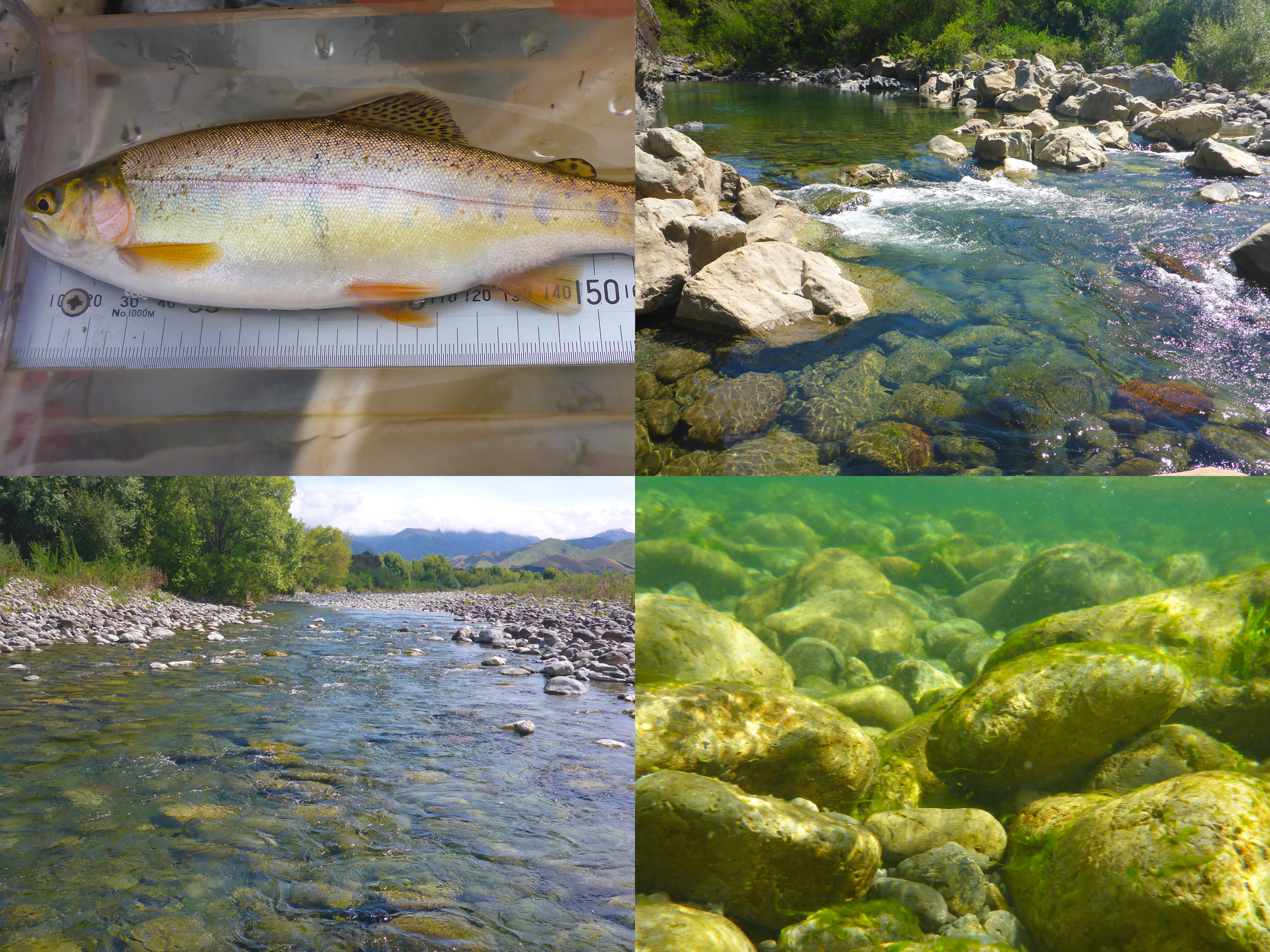
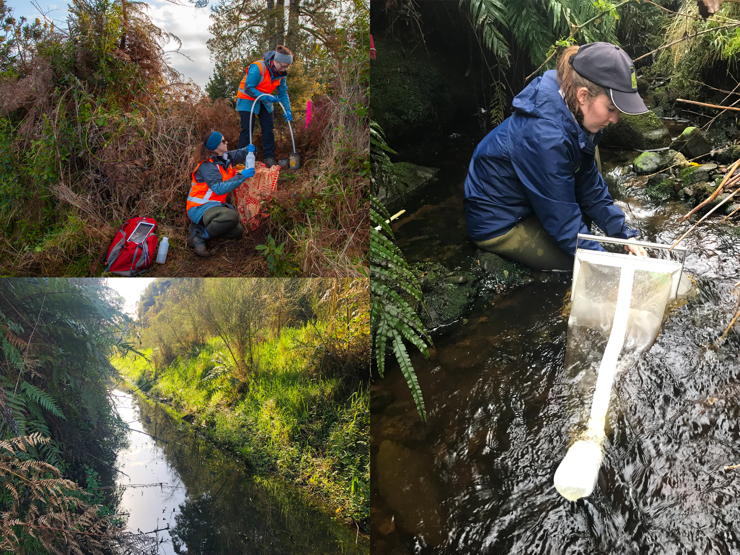
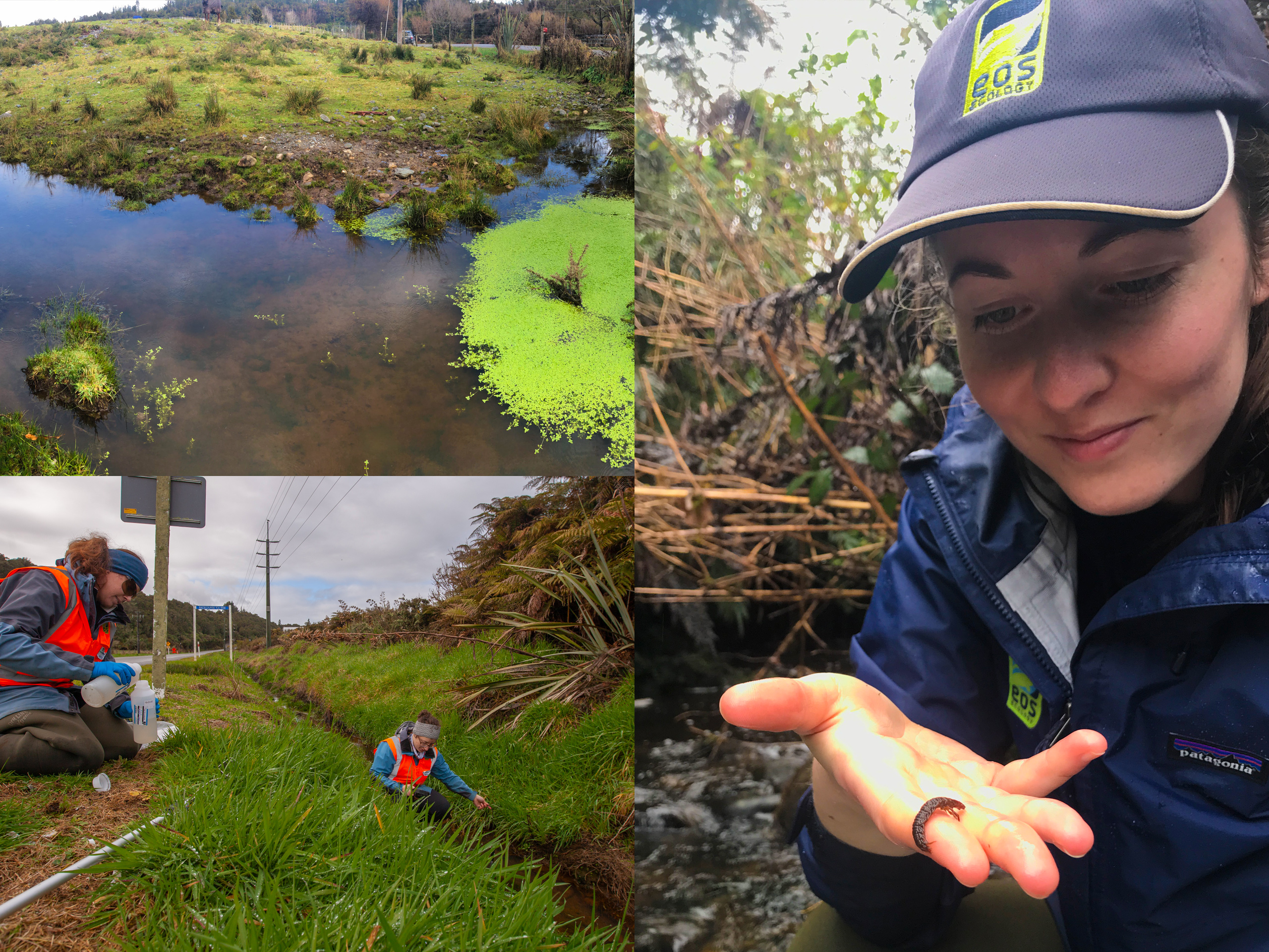
When the Manawatū Gorge section of State Highway 3 closed for good, NZ Transport Agency Waka Kotahi (NZTA) set about building Te Ahu a Turanga: Manawatū Tararua Highway, an 11.5 km replacement route that climbs through steep country in the Ruahine Range and crosses the headwaters of several small Manawatū River tributaries. Major earthworks in terrain like that carry a real risk of mobilising fine sediment into those streams, so following early discussions with Horizons Regional Council, NZTA commissioned EOS Ecology to design and run a sediment-focused baseline freshwater monitoring programme – a clear, defensible picture of stream condition before construction began, against which the effects of the build could later be measured.
We built the programme from the ground up, selecting 19 monitoring sites across six subcatchments through an ecological value-and-risk ranking so effort was concentrated where it mattered most. From December 2018 we tracked the sediment-related measures that matter for these streams (visual water clarity, total suspended solids, turbidity, and deposited fine sediment cover) across repeated dry- and wet-weather rounds, sampled macroinvertebrate communities across the seasons, and later added aluminium and pH in anticipation of the aluminium-based flocculants likely to be used in construction sediment-detention ponds. The catchments told distinctly different stories, mostly tracking land use, with sites in unfenced agricultural country and active bank erosion having higher sediment measures than forested gullies. That contrast carried a clear management message – construction trigger values should be derived from each catchment’s own baseline rather than from off-the-shelf national guidelines.
Midway through the baseline work, and under tight timeframes, we also produced a freshwater ecology AEE for the early enabling works – the access-track upgrades and stream crossings needed before the main build could start. Throughout the fieldwork, iwi representatives joined our sampling trips to get to know the affected waterways and the field techniques. The lasting value is the baseline itself: it fed directly into the resource-consent process, anchored construction-phase monitoring through to the highway’s June 2025 opening, and remains the reference point against which its operational effects on these streams can be measured – exactly the role a well-designed baseline is meant to play.

Masterton Town Water Abstraction
Providing technical specialist advice and ecological impact assessments for town-water abstraction from the Waingawa River.
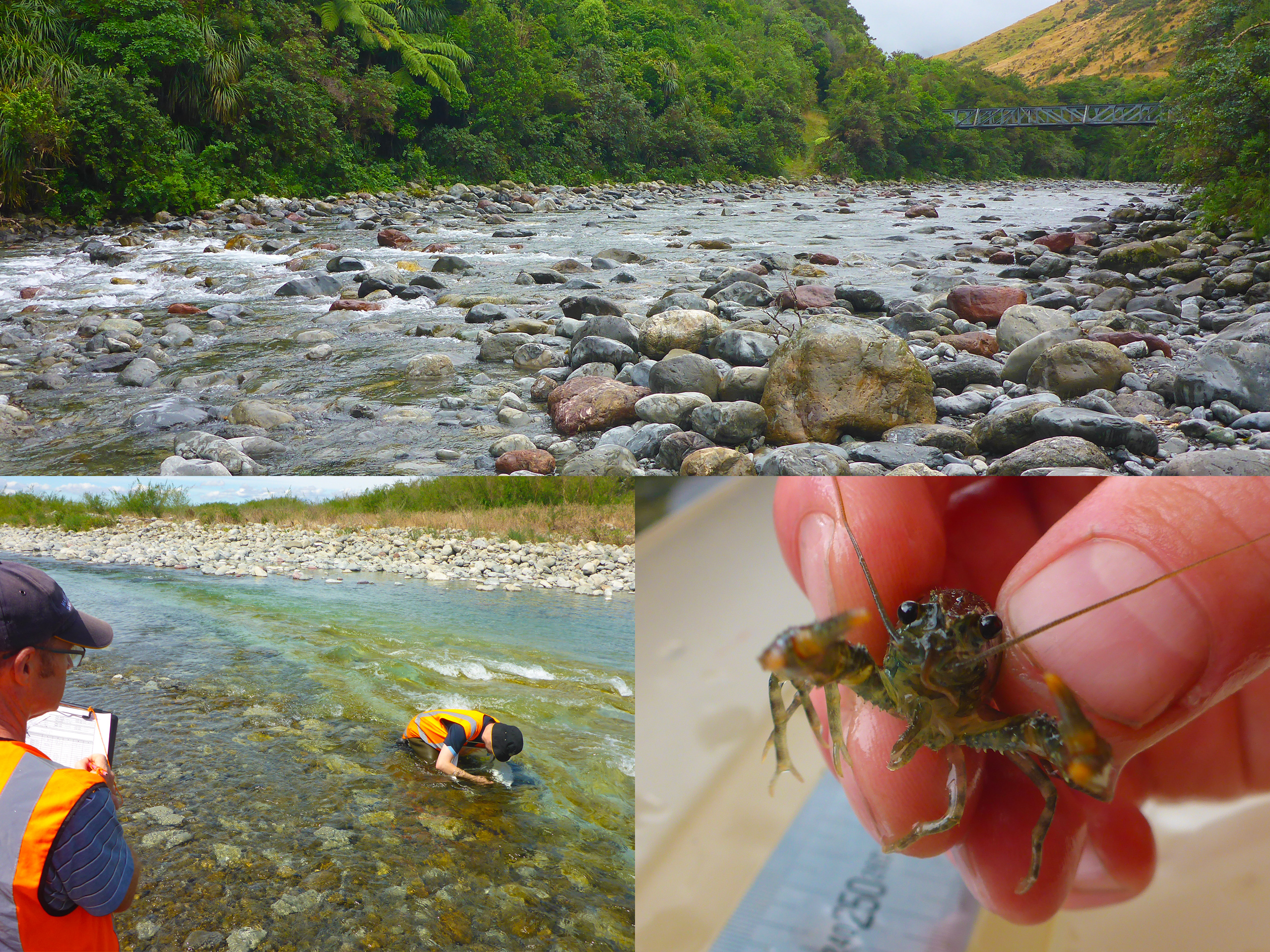
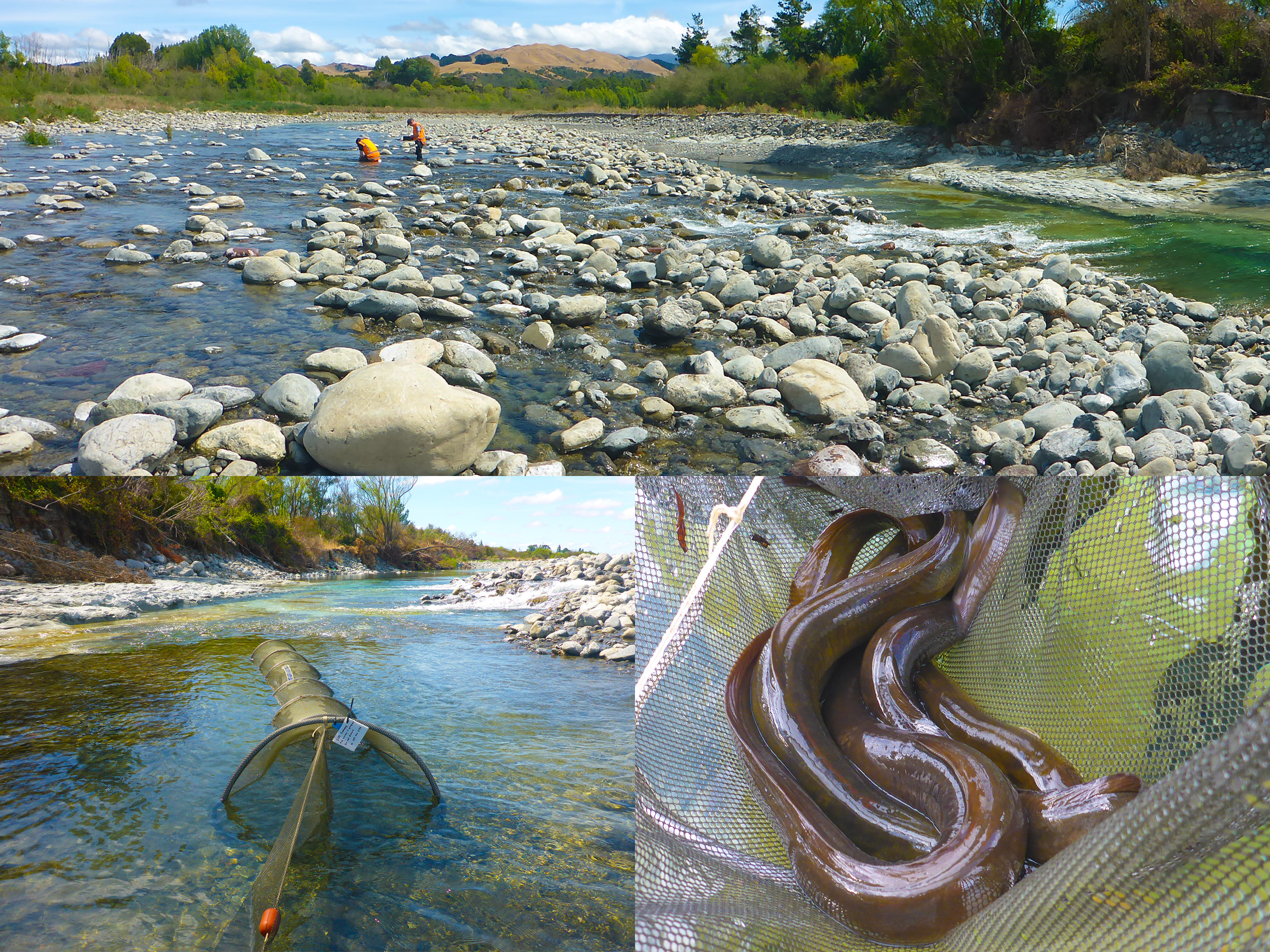
Masterton has drawn its town water from the Waingawa River for well over a century moving from capture of riverside spring flows in the 1900s to an upper-river siphon intake system established in 1982 that feeds the city’s water treatment plant. To support the Masterton District Council (MDC) with this essential supply, EOS Ecology has provided comprehensive technical guidance, spanning environmental monitoring relating to residual flows, advice around a revision of the minimum flow setting based on current knowledge and community and cultural values, and an Assessment of Environmental Effects for MDC’s renewal of their consent to take and divert that water.
Our fish and invertebrate surveys helped clarify how the river’s biological community responds to low-flow periods, whilst our technical advice helped guide MDC through the Ruamāhanga Whaitua Committee’s decision to increase the river’s minimum flows based on wider catchment values. Most recently in 2025, we completed an Assessment of Environmental Effects (AEE) for the MDC’s water take consent renewal. Rather than relying on a single snapshot survey, we built a robust description of the environment by combining a deep pool of historical monitoring data with our own long-term fish, macroinvertebrate, and eDNA survey data. This thorough approach allowed us to accurately evaluate three critical environmental factors: the risk of fauna entering the siphon intake, the necessity of fish passage around in-river infrastructure, and the downstream impacts of reduced river flows.
With the consent renewal now successfully completed, the continuity of Masterton’s town water supply is secure. To support the new, higher minimum flow requirements and protect the river’s diverse fish life, plans are now underway for a larger storage pond featuring an integrated fish screen and a fish-safe return channel. These forward-thinking designs ensure that this century-old water abstraction can reliably continue while keeping the Waingawa River’s freshwater ecology essentially intact.
Westland District Council Landfills
Reviewing, redesigning and then delivering the long-term surface water and groundwater monitoring at two closed and one active West Coast landfills – a programme robust enough to tell landfill leachate apart from other sources, and repeatable enough to run reliably year after year.
Closed landfills don’t stop needing attention the day they shut – their resource consents require long-term monitoring of the surrounding surface water and groundwater to confirm that buried waste isn’t leaching contaminants into nearby waterways. Westland District Council (WDC) holds two such closed sites on the West Coast, at Hokitika and Kumara, each with its own consent and its own schedule of water quality conditions to meet. In 2019 the Council asked EOS Ecology to review the existing monitoring programmes, which had become difficult to run reliably, and to put them on a sounder footing. Working closely with the Council, we audited every sampling site specified in the consents against what was actually achievable in the field – and found a recurring problem. Several of the consent-specified sites were ephemeral and thus unsuitable for consistent water quality sampling, whereas others were subject to other discharges that could make it hard to distinguish landfill effects. We relocated the unworkable sites to nearby points that reliably hold water, and added new monitoring locations above and below other potential sources, so any contaminant detected could be attributed to its correct origin rather than wrongly blamed on, or excused for, the landfill. Just as importantly, we documented each site’s location, access route, and method in detail, so the programme would be repeatable and straightforward to pick up in future rounds. Since the redesign, our science team has carried out the surface water and groundwater sampling each year and prepared the annual compliance reports the consents require.
EOS Ecology also assists WDC with its operational monitoring of active landfill sites, such as the Butlers landfill proximal to Stenhouse Creek. Between 2014–2023 we undertook biannual biological monitoring of macroinvertebrates and periphyton, and five-yearly monitoring of fish communities, along with analysing and interpreting Tier 1 and Teir 2 surface water, groundwater, and sediment quality data collected by WDC from five groundwater and surface water sites. Given the complexity of the monitoring programme, we also assessed the practicalities of the multi-tier monitoring system and provided technical advice for a consent variation to improve clarity around monitoring requirements.
In all cases, each report we produced sets out clearly where conditions were met and where they were breached, what the likely source was, and what follow-up the consent then triggers, while also flagging the practical realities of the work so the programme keeps improving. The result is exactly what long-term compliance monitoring should be: defensible, repeatable, and clear enough to keep the Council on top of its obligations.

Food Safety of Wild Kai
Long-term monitoring that answers a question the community genuinely asks – is it safe to eat the fish and shellfish gathered from our estuary and rivers? Testing wild-harvested mahinga kai against national food-safety standards and reporting the answer back to the public.
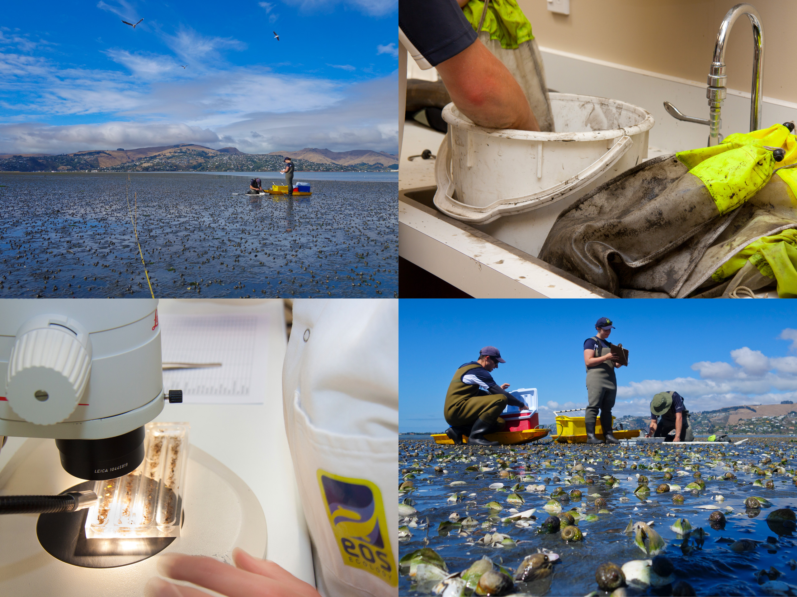
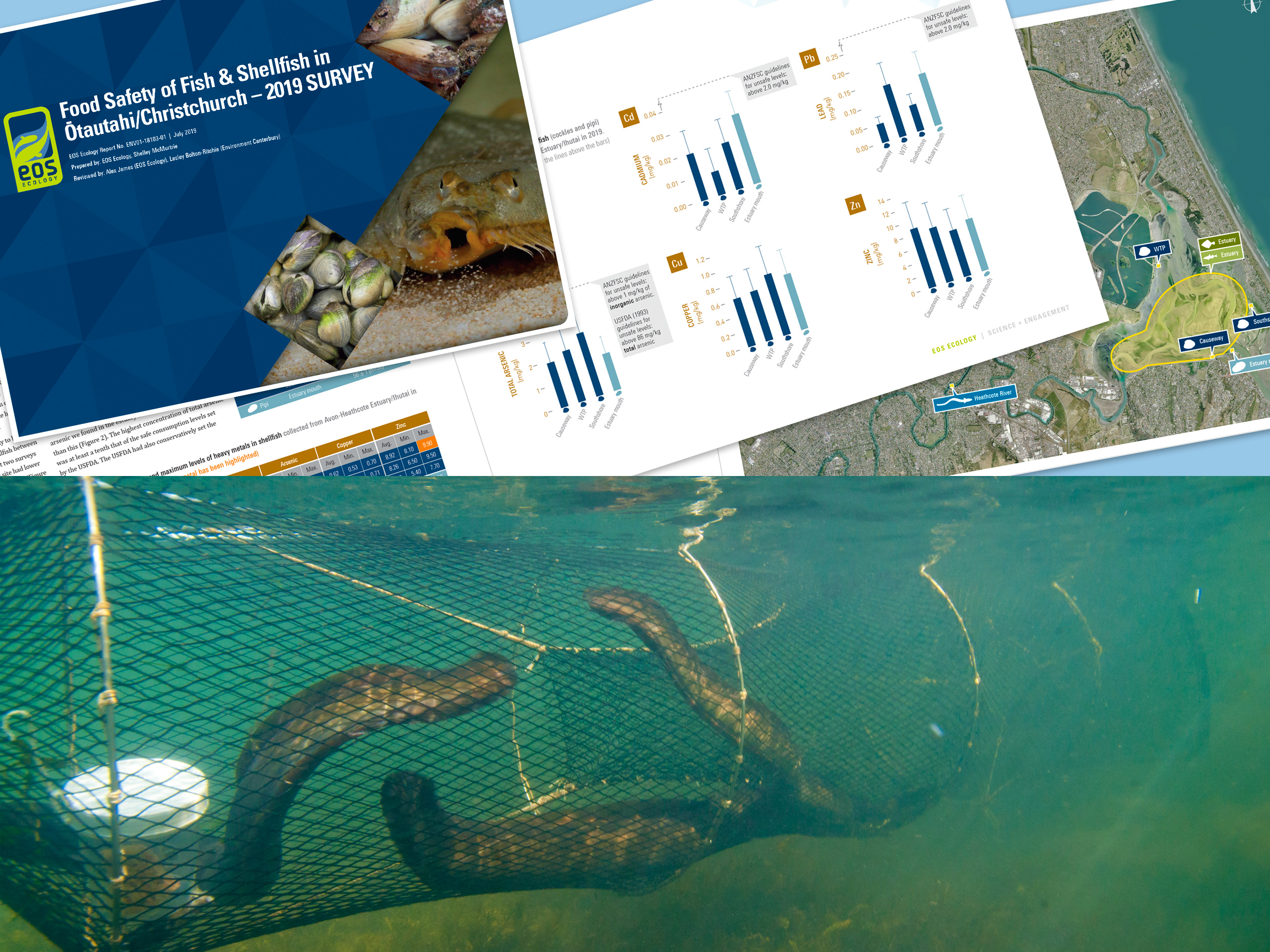
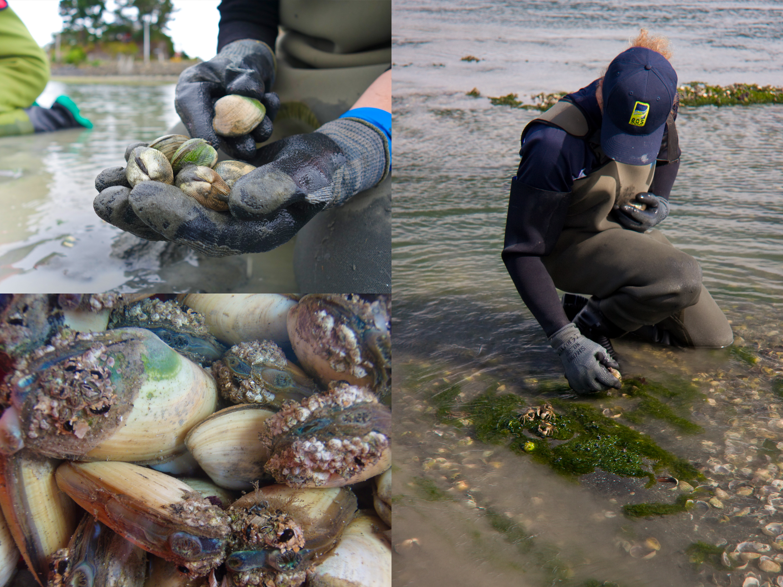
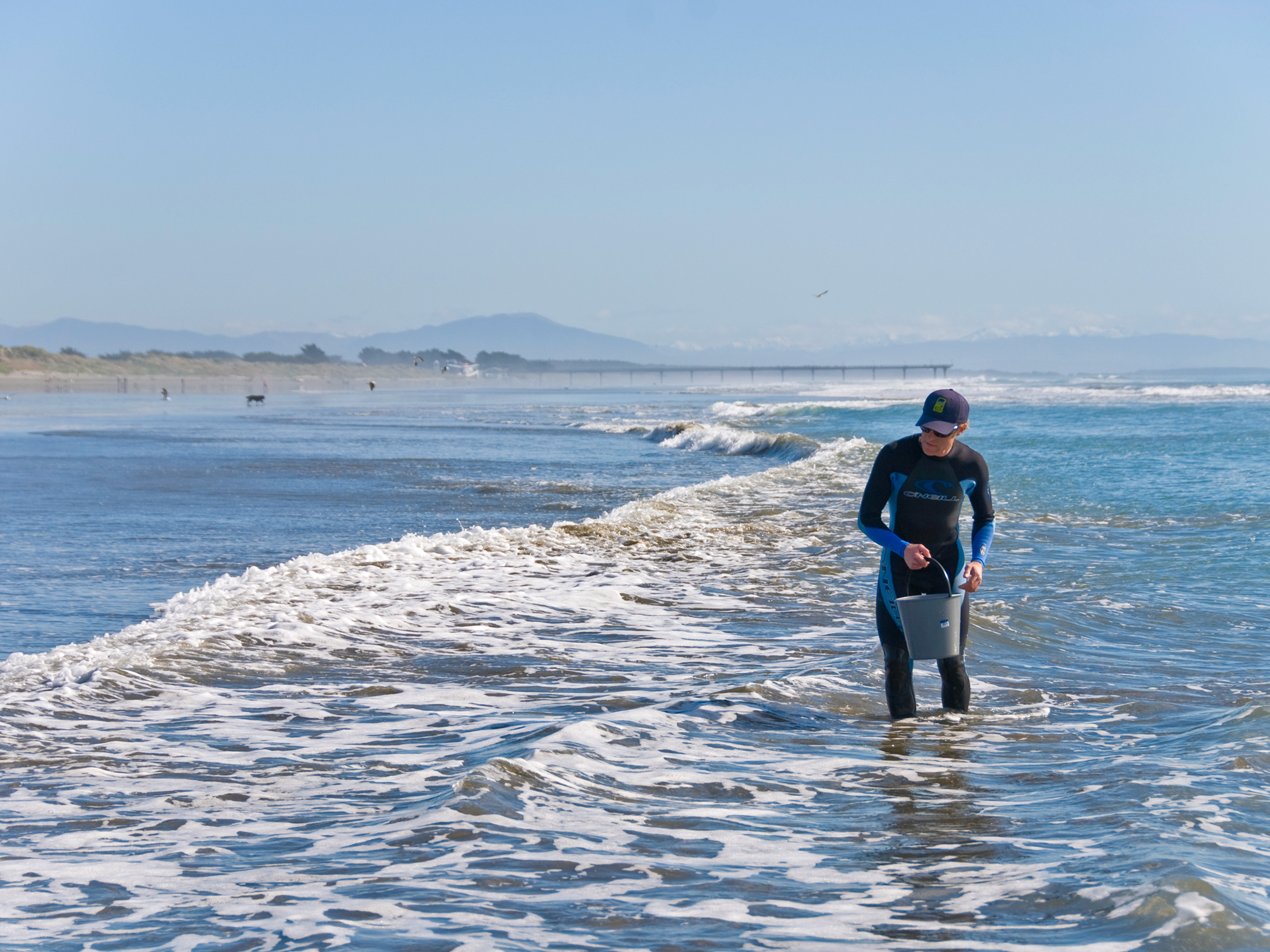
People have long gathered fish and shellfish from Te Ihutai/Avon-Heathcote Estuary and the rivers that feed it – but in a city environment, is that wild kai actually safe to eat? Since 2008, Environment Canterbury (ECan) has commissioned EOS Ecology to help answer that question, testing the levels of contaminants in the fish and shellfish that people are most likely to harvest from the estuary and the lower Ōtākaro/Avon and Ōpāwaho/Heathcote rivers. What began as a heavy-metals survey repeated every two years has matured into a broader food-safety programme, now run on a five-yearly cycle (most recently in 2025), with the results published as public-friendly reports.
The monitoring spans the species that matter most to gatherers: estuary shellfish such as cockles and pipi, estuary fish including yellow-eyed mullet and flounder, and shortfin eel from the rivers. Collecting them calls for a mix of boat- and land-based techniques – hand-gathering shellfish at low tide, fyke-netting eels overnight, and netting or line-fishing for estuary fish – all undertaken with a Ministry for Primary Industries (MPI) special permit. Samples are measured, then processed and tested by an independent laboratory for a suite of contaminants: heavy metals (cadmium, lead, arsenic), polychlorinated biphenyls (PCBs), and the faecal-indicator bacterium E. coli and enteric viruses such as norovirus. Results are assessed against the Australia and New Zealand Food Standards Code and the relevant MPI shellfish requirements, so the findings can be expressed in the terms that actually govern food safety.
The picture that emerges is nuanced, and that nuance is the point. In recent surveys the heavy metals and PCBs in fish and shellfish sat at safe levels for eating, but E. coli in estuary shellfish was widely variable and, at some sites, exceeded food-safety limits – a reminder that gathered shellfish can be unsafe at certain places and times, particularly after sewage overflows or heavy rain. EOS Ecology pairs this sampling and analysis with the science communication that makes it useful: engaging, plain-language reports that explain where contaminants come from, what the results mean, and whether the kai is safe to eat, which ECan then shares with the wider community. It is monitoring with a direct public-good purpose – turning careful contaminant data into clear guidance that helps people make safe decisions about the food they gather.
Wastewater Discharge Shellfish Monitoring
Using shellfish as living indicators of human-sewage contamination to assist with monitoring of Christchurch's wastewater discharge – a decade-plus BACI record with a direct line to public-health warnings.
For years, Christchurch discharged its treated wastewater into Te Ihutai/Avon-Heathcote Estuary, before that discharge was decommissioned and moved to an ocean outfall several kilometres offshore. Across that change from estuary-based to ocean outfall, Christchurch City Council commissioned EOS Ecology to monitor pathogen levels in shellfish, using cockles and tuatua as living indicators of human-sewage contamination. The work tested for the faecal-indicator bacterium E. coli, Salmonella, and norovirus, the latter being a human-origin virus whose presence is an unambiguous fingerprint of human sewage.
We built the shellfish pathogen monitoring programme around a before-after control-impact (BACI) design – quarterly monitoring for two years before and after the ocean outfall was commissioned in March 2010, with a control site in the neighbouring Saltwater Creek Estuary. The Canterbury earthquakes of 2010 and 2011 then intervened: prolonged raw-sewage overflows pushed viral and bacterial levels in the shellfish to unprecedented highs, and the monitoring was extended so the recovery could be followed and the earthquake signal separated from the genuine post-outfall picture.
The results were telling – levels of both E. coli and norovirus in cockles decreased following the commissioning of the ocean outfall, although the ongoing presence of norovirus, at sometimes high levels, after the ocean outfall was in place indicates the estuary was still receiving human sewage from time to time. Spikes in E. coli and norovirus levels in estuary cockles following the Christchurch earthquakes reflects sewage overflows when the city’s wastewater infrastructure was damaged from the earthquakes, with E. coli levels dropping back to pre-earthquake ocean outfall levels once infrastructure was repaired. Alongside this, we monitored bacteria and viral levels in tuatua along the city’s coastline from 2007 to 2021 to track the performance of the ocean outfall discharge itself. This began as monthly monitoring in 2007-2008, and then quarterly monitoring in 2010-2021, with monitoring increased to weekly when consent triggers were exceeded.
This was monitoring with an immediate public-safety purpose: whenever the testing found high pathogen levels in the shellfish, the warning signs advising people not to gather kai went up. Over more than a decade the programme also built a continuous BACI record of what happens when a treated-wastewater discharge is removed from an estuary, and tracked the receiving coastline through to 2021. It left EOS Ecology with deep, transferable experience in how stormwater and sewage discharges affect the food safety of shellfish, and in using shellfish themselves as sensitive, defensible indicators of contamination in coastal and estuarine waters.


Īnanga Spawning Habitat Surveys
Standardised, repeatable surveys of where whitebait spawn, and how good that habitat is, across Christchurch's rivers, lakes and Banks Peninsula streams – giving the city the evidence to protect and enhance a declining mahinga kai species.
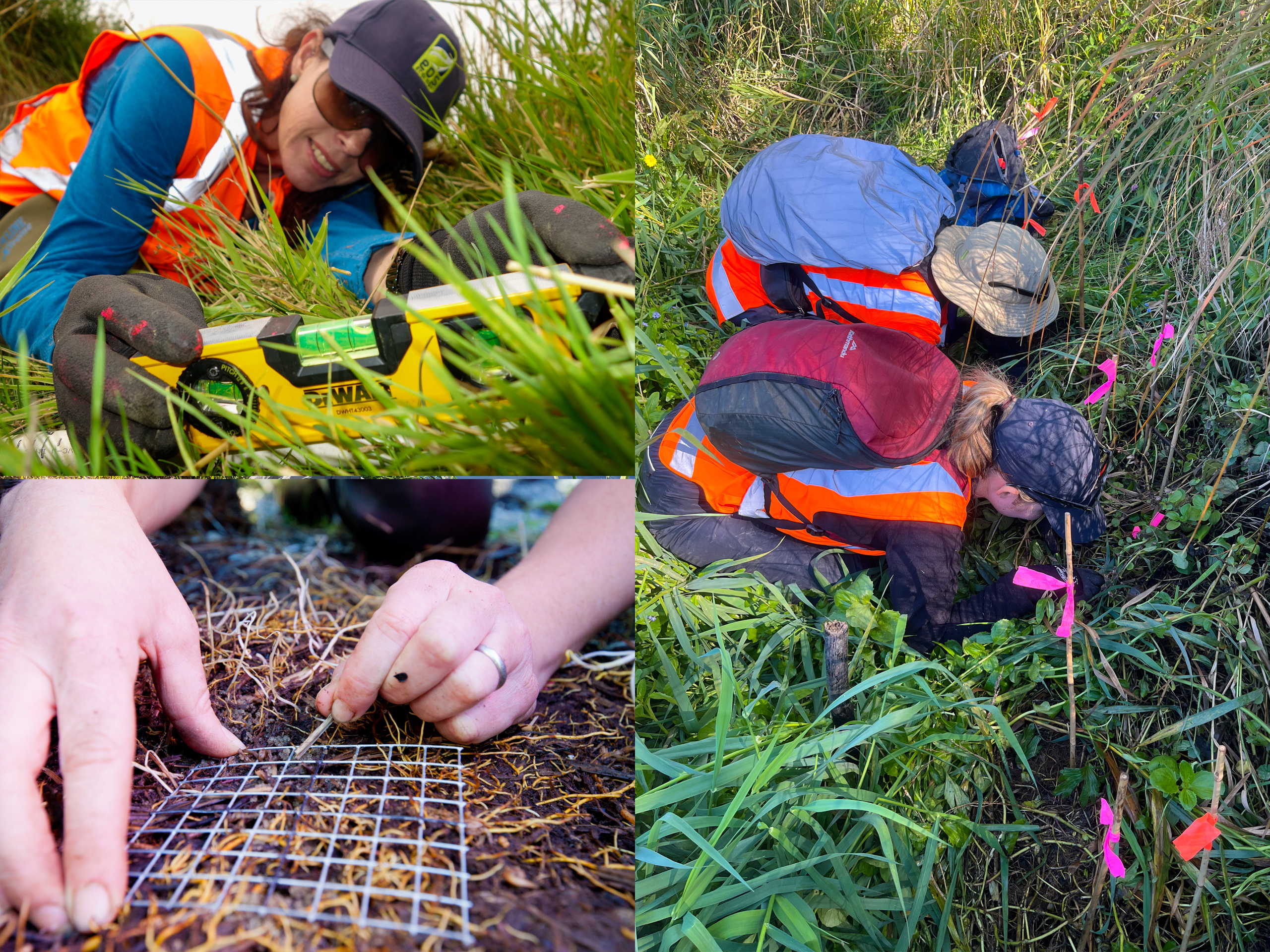
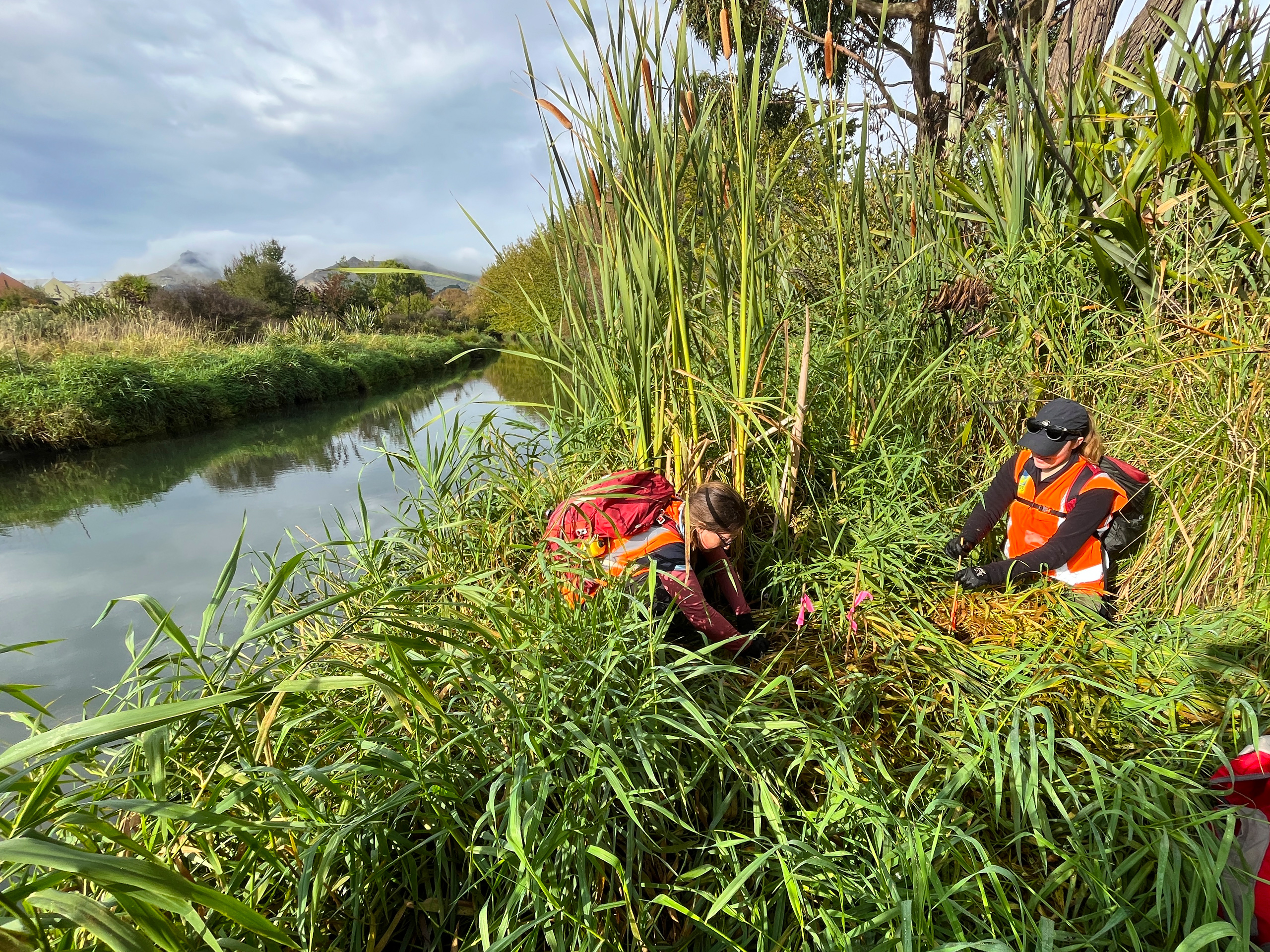
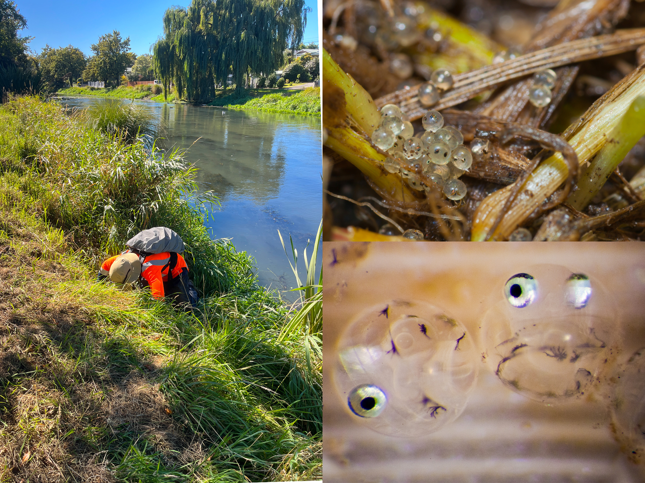
Īnanga, the most common and widespread of Aotearoa New Zealand’s five whitebait species, spawn in a very particular place: among dense riparian vegetation at the upper edge of the saltwater–freshwater interface, where eggs laid around the spring-high-tide line then develop out of the water until the next big tide. That makes their spawning habitat both highly specific and easily lost to mowing, stock, bank erosion or the wrong vegetation, and it leaves īnanga – a declining mahinga kai species – vulnerable. Christchurch City Council engages EOS Ecology to monitor that habitat across the city’s waterways: both assessing how suitable the potential spawning habitat is, and surveying where spawning is actually happening.
We run two complementary strands, both built on standardised, repeatable methods so the results hold up over time and sit alongside work done elsewhere in the country. Habitat is scored using the National Īnanga Spawning Programme’s system (also developed by EOS Ecology) which rates twelve attributes into an overall Good, OK or Bad rating for each spawning reach. Spawning surveys then follow established census methods: systematic egg searches through the riparian vegetation around the spring high-tide line, with egg patches mapped and measured, and their productivity calculated. Using the national protocol means each year’s findings can be compared directly with the last, and with the longer record built up by earlier University of Canterbury research in these same catchments.
Over successive years the programme has worked through Christchurch’s main īnanga catchments and beyond – Banks Peninsula streams at Pigeon Bay and Okains Bay, the Ōtākaro/Avon River catchment and its tributaries, the Ōpāwaho/Heathcote catchment and tributaries, and Linwood Canal – building a picture of where good habitat lies, where spawning is concentrated, and how that shifts year to year. The surveys repeatedly show that the detail matters: even reaches scored as poor habitat can still hold eggs, so the whole spawning zone is worth checking rather than just the obvious sites. Most importantly, the monitoring feeds straight back into management – pinpointing where the council should hold off mowing during the spawning season, where riparian planting or gentler bank angles would extend good habitat, and how modifying tide gates and barriers would improve fish and saltwater access. It is monitoring designed not just to record the state of a threatened species, but to tell the people who maintain these waterways exactly where and how to help it.
Post-Earthquake Aquatic Investigations
When the Canterbury earthquakes flooded Christchurch's rivers with liquefaction silt and raw sewage, EOS Ecology's deep local knowledge and pre-quake datasets made it part of the multi-agency response – rapidly assessing the damage, separating earthquake effects from background change, and guiding how the city repaired its waterways.
The 2010–2011 Canterbury earthquakes did more than damage buildings; they reshaped Christchurch’s waterways, slumping banks, uplifting streambeds, and driving liquefaction sand and silt, and raw sewage into the city’s rivers and streams. EOS Ecology’s deep knowledge of those waterways led to its inclusion in the Earthquake Environmental Response Team alongside Christchurch City Council (CCC), Environment Canterbury (ECan) and NIWA. With existing baseline data in hand, we were able to assess what the earthquakes had actually done to the rivers’ fish and invertebrate communities by comparing directly against how they had been before.
Because the damage varied so much from place to place, and because some reaches had no recent baseline at all, we designed several complementary studies rather than rely on a single survey. Where pre-earthquake data existed in the upper, wadeable waterways, we ran before-and-after comparisons of fish and invertebrate communities. In the lower, non-wadeable Ōtākaro/Avon and Ōpawaho/Heathcote rivers – where no baseline was available – we devised an in-situ bioassay, caging sensitive invertebrates upstream and downstream of sewage discharges and tracking their survival along with logging dissolved oxygen levels to assist in interpretation of results. The overall picture was one of resilience: no mass loss of species, and the city’s hardy, pollution-tolerant urban faunas largely persisted. But localised effects were real. Central-city sites showed reduced fish abundance, fewer pollution-sensitive caddisflies, and declining bluegill bully. Downstream of continuing sewage discharges, low dissolved oxygen and elevated ammonia cut the survival of sensitive invertebrates.
We also turned the science to immediate practical use, mapping the biodiversity hotspots so the enormous programme of earthquake repair and sediment-removal works in and along the rivers could be managed to avoid the most ecologically valuable places. Around ten months after the February 2011 earthquake, we surveyed the lower Ōtākaro/Avon River’s fish and invertebrates – the first such survey of that non-wadeable reach in over two decades – and recommended it become the template for long-term monitoring of the non-wadeable portions of all four main Christchurch rivers.
Given the strong public interest, we designed our technical reports to be more engaging, and took the findings from all technical studies looking at the effects of the earthquakes and produced public summaries for estuary and river environments. It is a demonstration of what long-term ecological knowledge makes possible: the ability to respond fast and rigorously when it matters most, and to leave behind both a defensible record and the tools to keep watching.


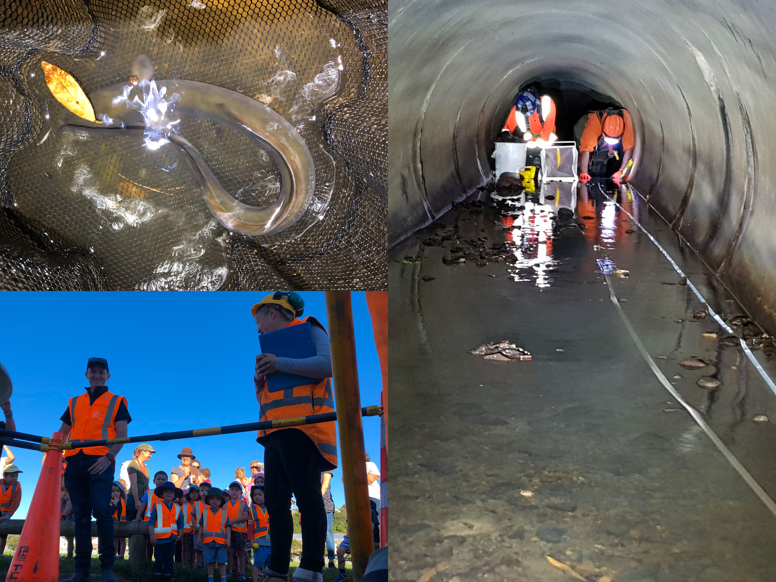
Wellington’s Piped Streams Ecology
A first-of-its-kind investigation into the freshwater life inside Wellington's underground urban piped streams – developing novel confined-space survey methods to establish that piped streams are living habitat and active fish-migration corridors, not just conveyance.
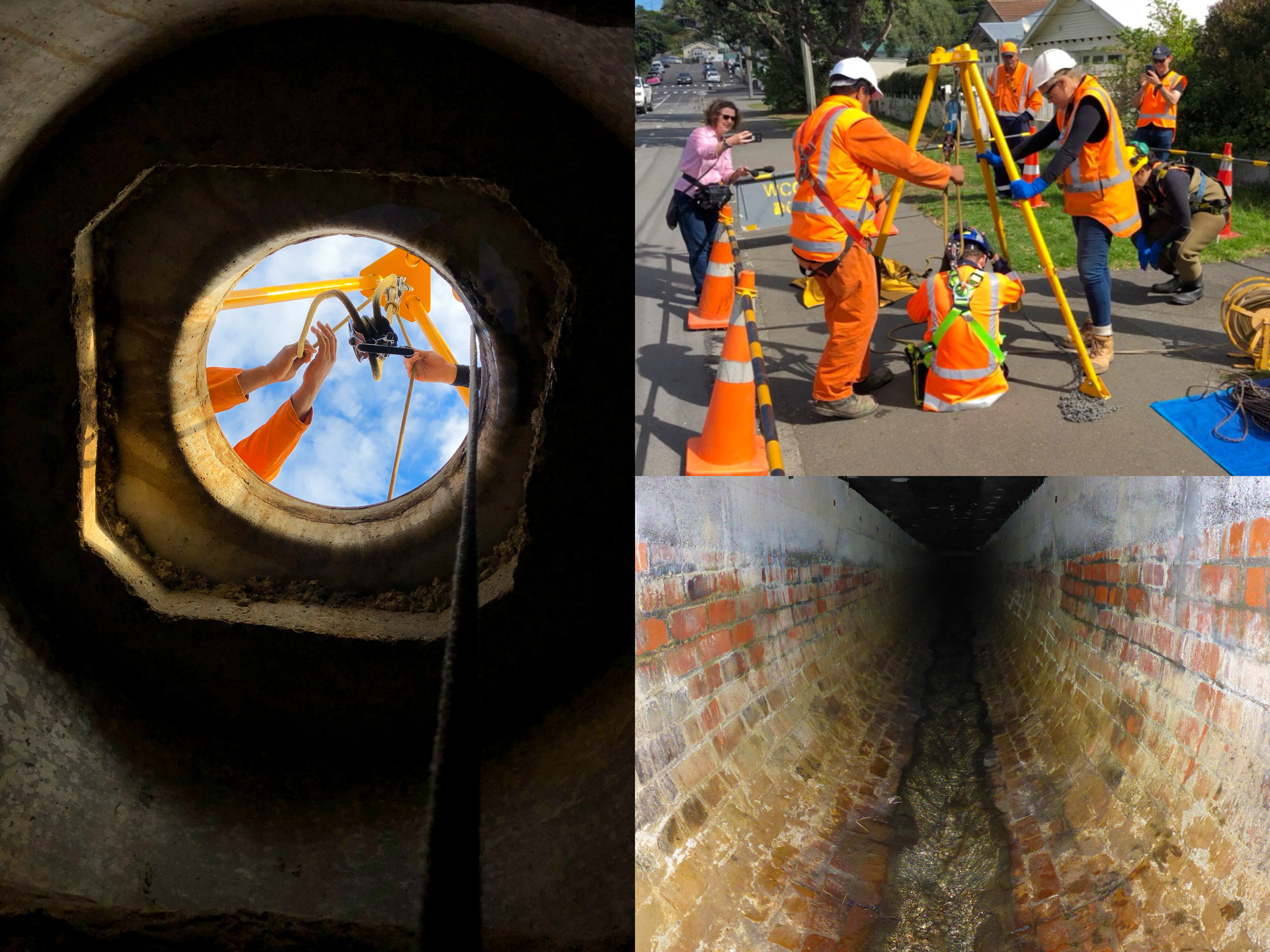
In hilly, heavily developed Wellington, most of the city’s small streams have been progressively buried in pipes sitting below roads and buildings – in some catchments more than 90% of the natural channel length is now underground. Ecological information had only ever been gathered from the visible open sections, while the piped reaches connecting them were managed purely as stormwater infrastructure and their ecology essentially unknown. Building on our earlier integrated catchment work on Wellington’s open streams, Greater Wellington Regional Council and Wellington City Council commissioned EOS Ecology to answer a simple but unexplored question: what actually lives in the pipes beneath the streets, and do these hidden waterways have value beyond moving water?
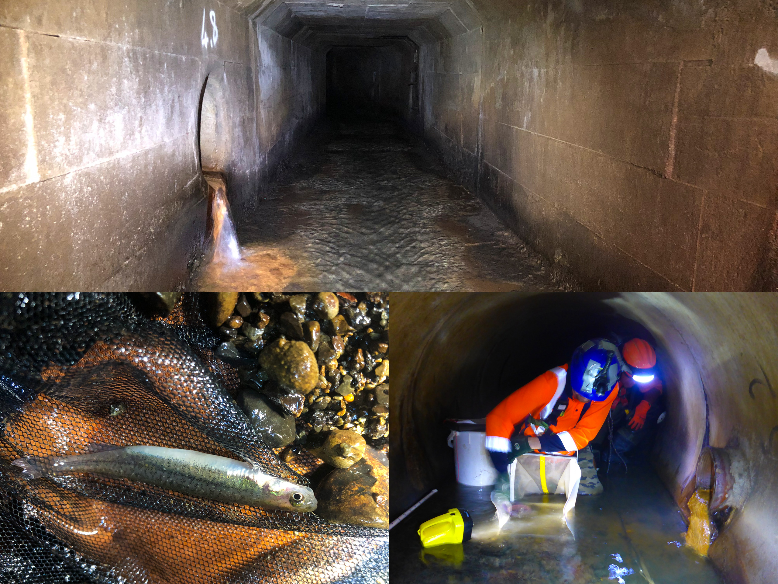
Answering it meant developing field methods for an environment few ecologists had ever sampled. Using Wellington Water’s stormwater and manhole GIS layers, we identified access points, then lifted manhole lids across three urban catchments – Pae Kawakawa Stream (Island Bay), Miramar Stream (Miramar), and Waipapa Stream (Hataitai) – gas-testing the air and characterising habitat before any entry. Because the pipes are confined spaces, the fieldwork was carried out under specialist confined-space safety procedures, and we adapted and combined a suite of techniques to suit: long-handled kick-net and in-pipe Surber sampling for macroinvertebrates, trail cameras positioned at manhole entrances together with spotlighting and netting for fish, and sticky traps for flying insects. Six sites were surveyed in detail across two field rounds in 2019.
The pipes turned out to be far from lifeless. Fish were present at five of the six sites – both longfin and shortfin tuna/eels, alongside banded kōkopu and īnanga – with a clear pattern of eels dominating the pipes while banded kōkopu and kōura hold the open reaches. That distribution confirmed migratory native fish are using the pipe network as both habitat and as a migration corridor between the sea and isolated open-channel remnants. In-pipe sampling recorded 31 macroinvertebrate taxa, and even spider webs and the flying insects caught on sticky traps pointed to a resident community living in near-total darkness. The study established the first defensible baseline for these forgotten ecosystems and a tested set of methods to monitor them, and made a practical case for treating piped streams as more than stormwater conveyance – from recognising them in regional planning through to retrofitting pools, baffles and fish cover to improve habitat. The work drew national media attention and reframed how urban piped waterways can be valued and managed.
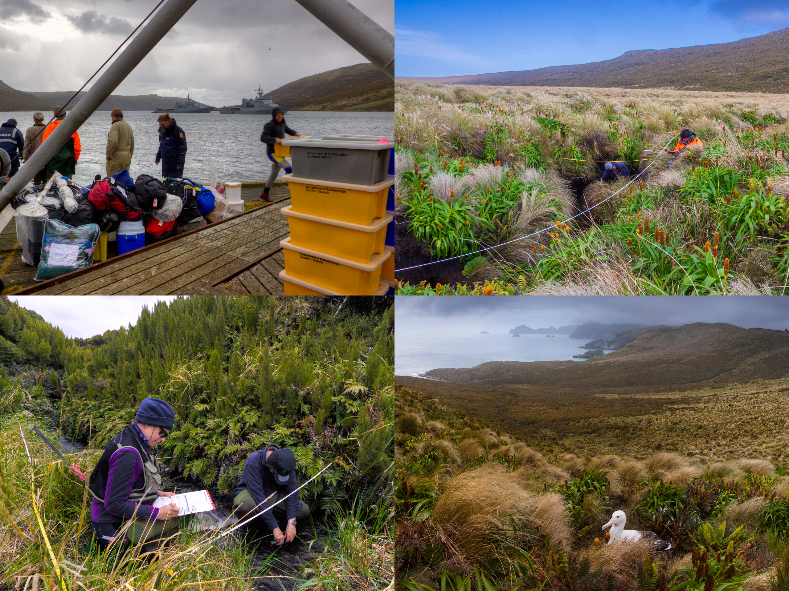
Campbell Island Bicentennial Expedition
Coordinating the largest multidisciplinary research expedition to remote, subantarctic Campbell Island in more than 30 years, and leading the first comprehensive survey of its streams and tarns – work that more than tripled the island's known freshwater fauna and set a baseline for its long-term conservation.
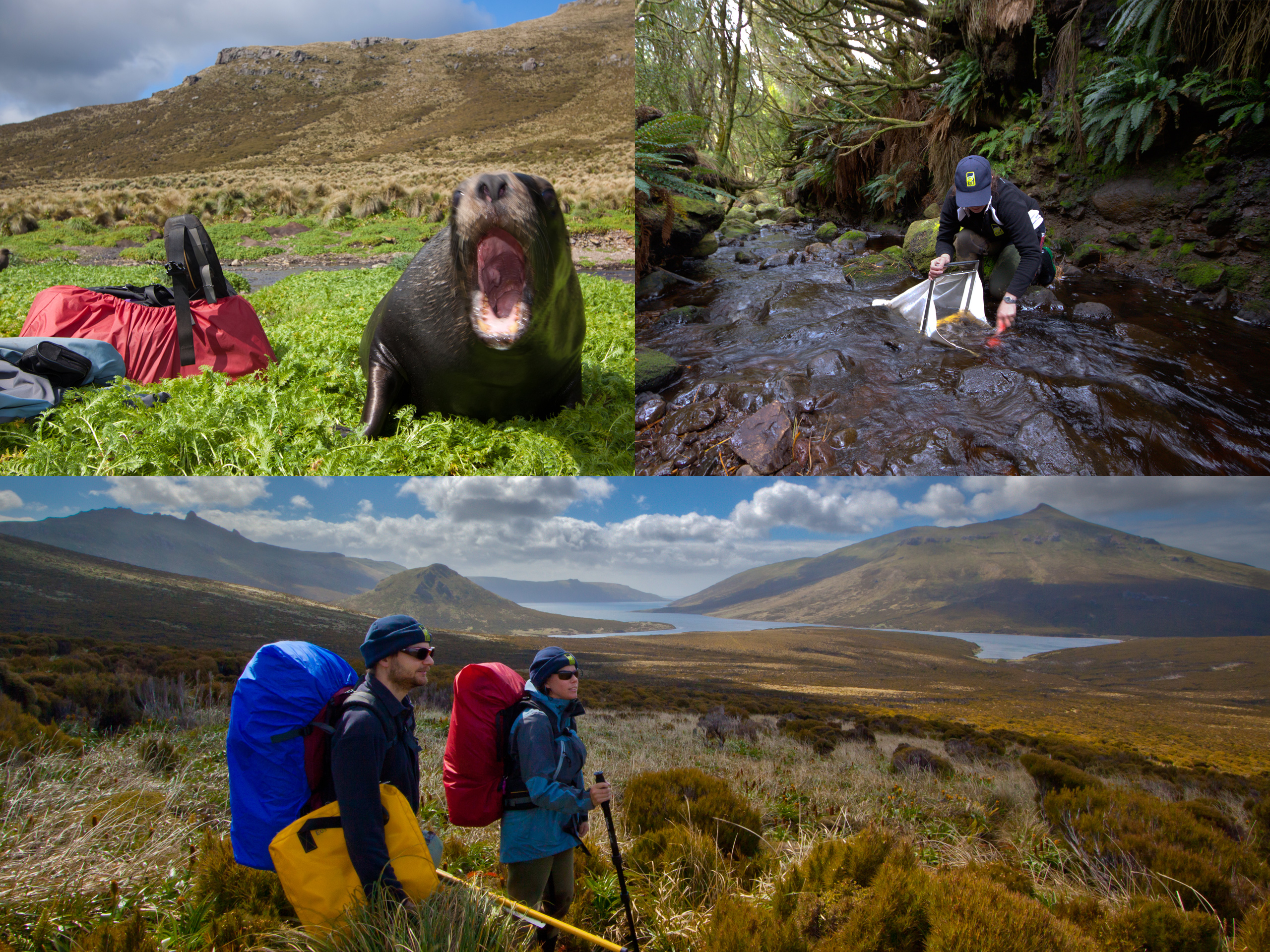
Motu Ihupuku/Campbell Island lies some 700 kilometres south of the Aotearoa New Zealand mainland, deep in the Southern Ocean – a World Heritage subantarctic island whose freshwater streams and tarns were among the least-studied aquatic environments in the country. In the summer of 2010–2011, EOS Ecology developed and coordinated the Campbell Island Bicentennial Expedition, the largest multidisciplinary research expedition to the island in more than 30 years. Run under the Fifty Degrees South Trust, and supported logistically by the Royal New Zealand Navy and the Department of Conservation, a 14-person, 11-week expedition brought together specialists in freshwater ecology, botany, terrestrial invertebrates, and human history – pulling that off in such a remote, demanding environment was itself a considerable feat of planning, logistics and inter-agency coordination.
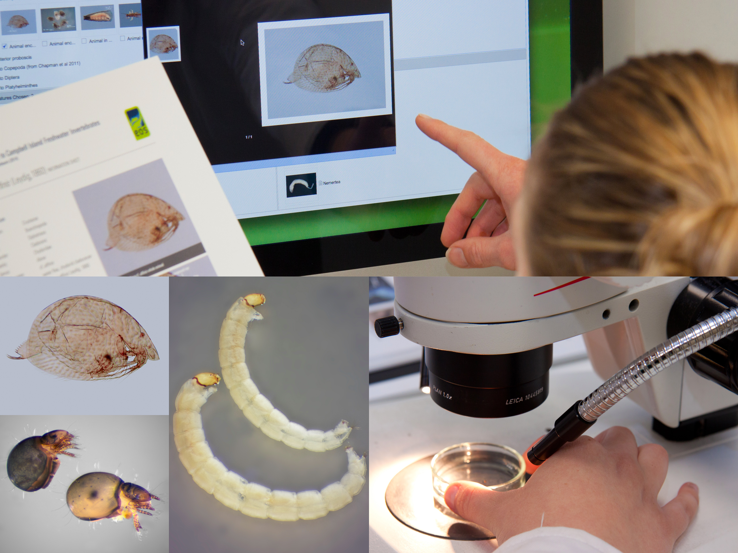
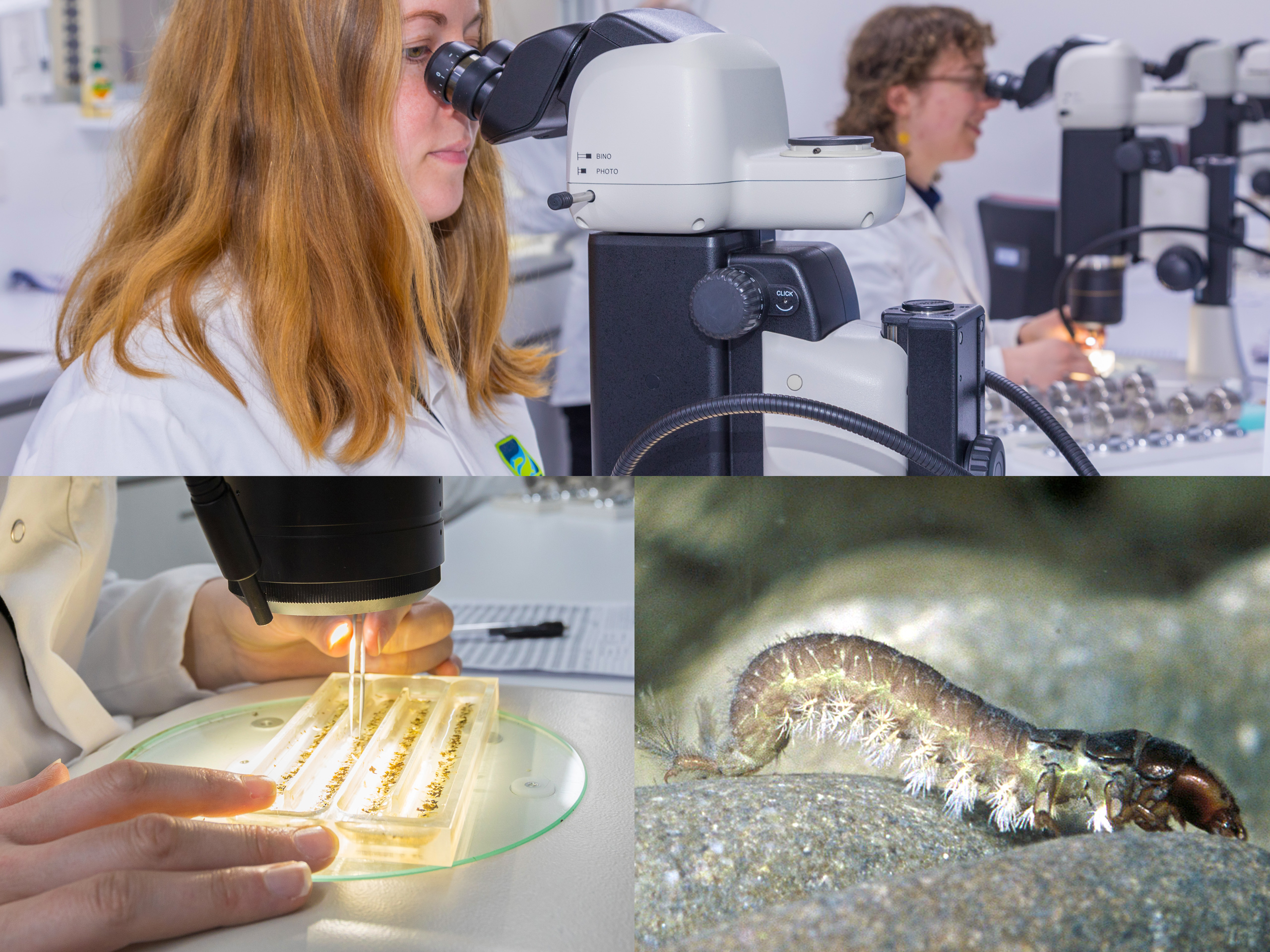
Alongside coordinating the expedition, EOS Ecology led its freshwater ecology team and carried out the first comprehensive survey of the island’s waterbodies – more than 25 waterway sites and 35 tarns. The fieldwork combined habitat assessment with extensive sampling of aquatic invertebrates, periphyton, and microbes, water and sediment quality, sediment cores, and specimens for eDNA and stable-isotope analysis. The processing and taxonomic work that followed back on the mainland transformed what was known about the island: its documented freshwater fauna rose from just 13 taxa to more than 50, including species new to science and the first taxonomic treatment of a remarkably diverse freshwater oligochaete (worm) fauna – the greatest such diversity recorded from any subantarctic island. The work produced the first online interactive identification keys to the island’s freshwater invertebrates, an invertebrate reference collection now housed at Te Papa, peer-reviewed publications that even reconstructed the island’s past climate from diatoms preserved in sediment cores, and the classification of two new genera and four new species to science, including one named in honour of EOS Ecology (Biprostatus eos) and one after our principal scientist (Macquaridrilus mcmurtrieae) who spearheaded the expedition.
Because so few people will ever set foot on Campbell Island, EOS Ecology also designed and ran the expedition’s public-engagement programme, sending blogs, social-media updates, and live radio and television interviews back to the mainland by satellite – real-time glimpses of life and science on a subantarctic island. The lasting value, though, is the baseline. Where previously very little was understood about the ecology of the island’s streams and tarns, the expedition established a defensible baseline dataset and the identification tools to use it – directly supporting DOC’s long-term management of the island and its goals under the Aotearoa New Zealand Biodiversity Strategy, while the freshwater oligochaete discoveries continue to inform the global puzzle of how life colonises isolated oceanic islands.