The projects below show our infrastructure work in practice, across settings as diverse as a working river port, a state highway through rugged country, improving urban rivers and their landscapes, stormwater treatment designs, and a century-old water race being retired. The work spans the full delivery life cycle – from consenting strategy and design through to on-site construction oversight – and from both sides of the consenting table – whether we’re inside the applicant’s project team or advising the regulator.
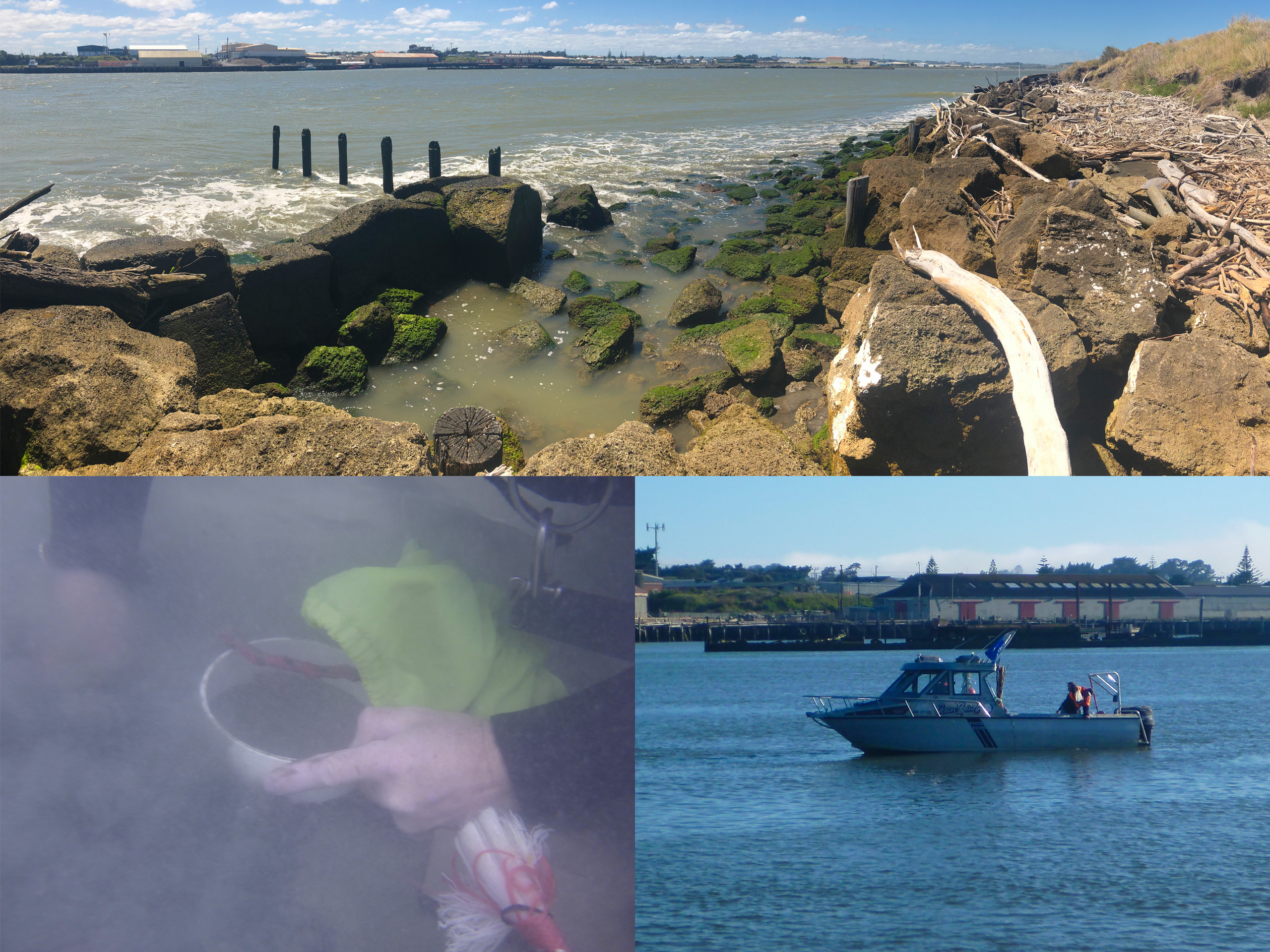
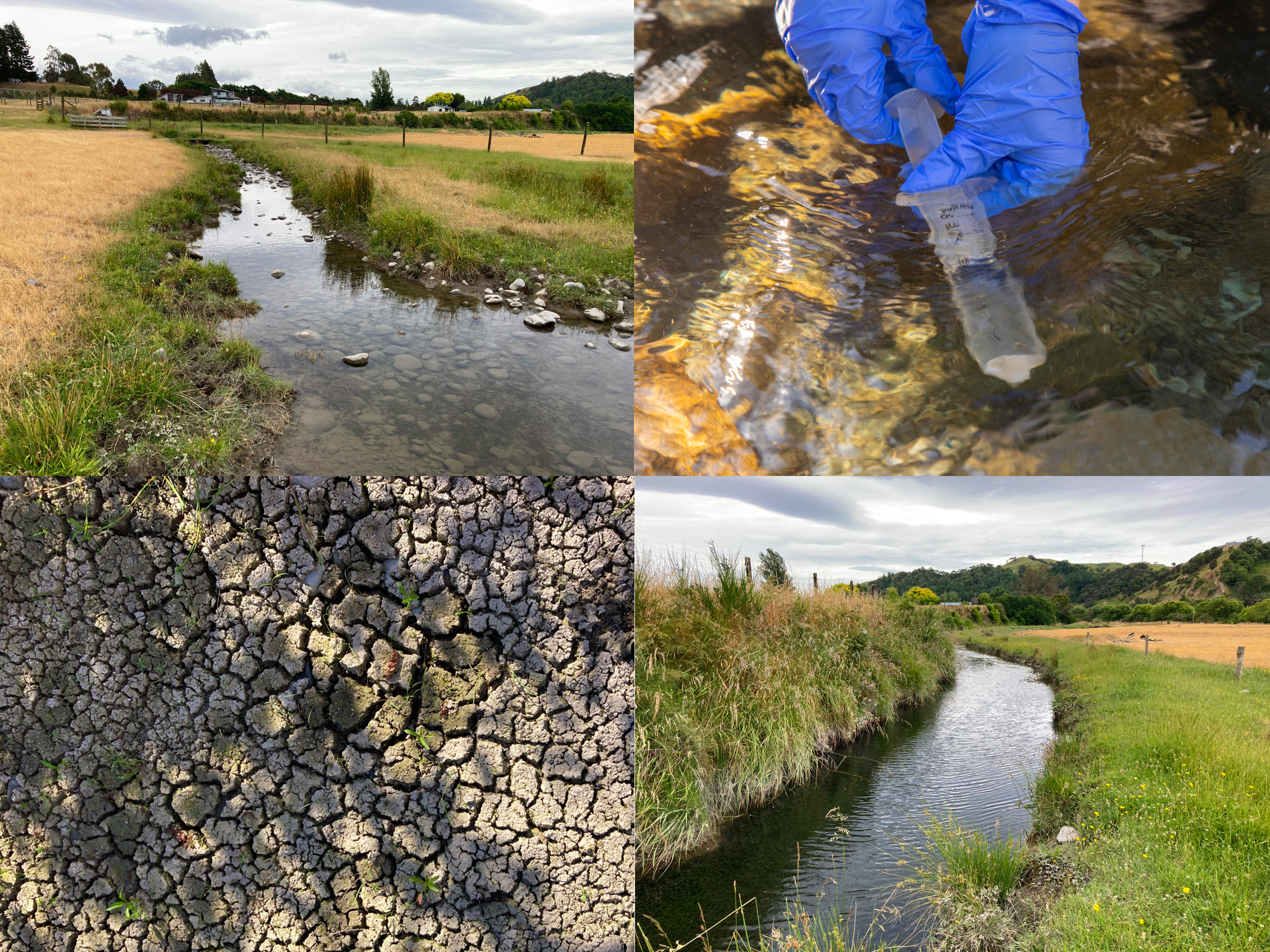
Whanganui River Mouth & Port – Te Pūwaha
Aquatic ecology (freshwater, estuary, coastal) across two workstreams of the iwi-led Te Pūwaha partnership – supporting works that stabilise the river mouth and rebuild the port, including rivermouth moles, Tanae Groyne and the port wharves.
Te Pūwaha is an iwi-led partnership between Whanganui iwi, the district and regional councils, and industry, formed to revitalise the Whanganui Port and the lower river and estuary under an iwi-led ‘abundance’ framing. EOS Ecology was commissioned across two workstreams: by Horizons Regional Council to assess upgrades to the river training infrastructure (mole repairs, reinstatement of Tanae Groyne, and use of South Beach as a haul route); and by Whanganui District Council to assess works around the port itself, including pile removal, alteration of river training structures, and potential new community assets.
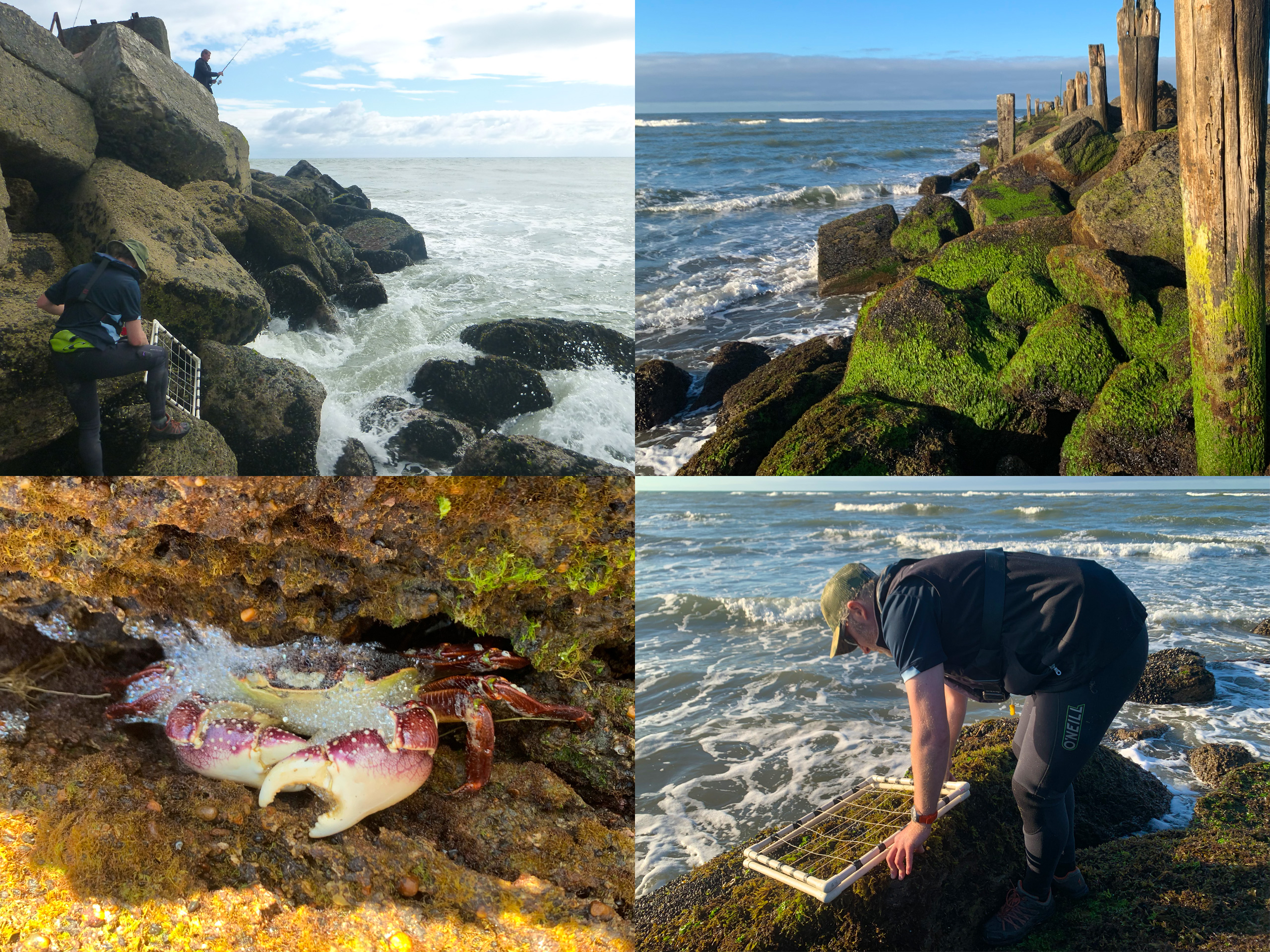
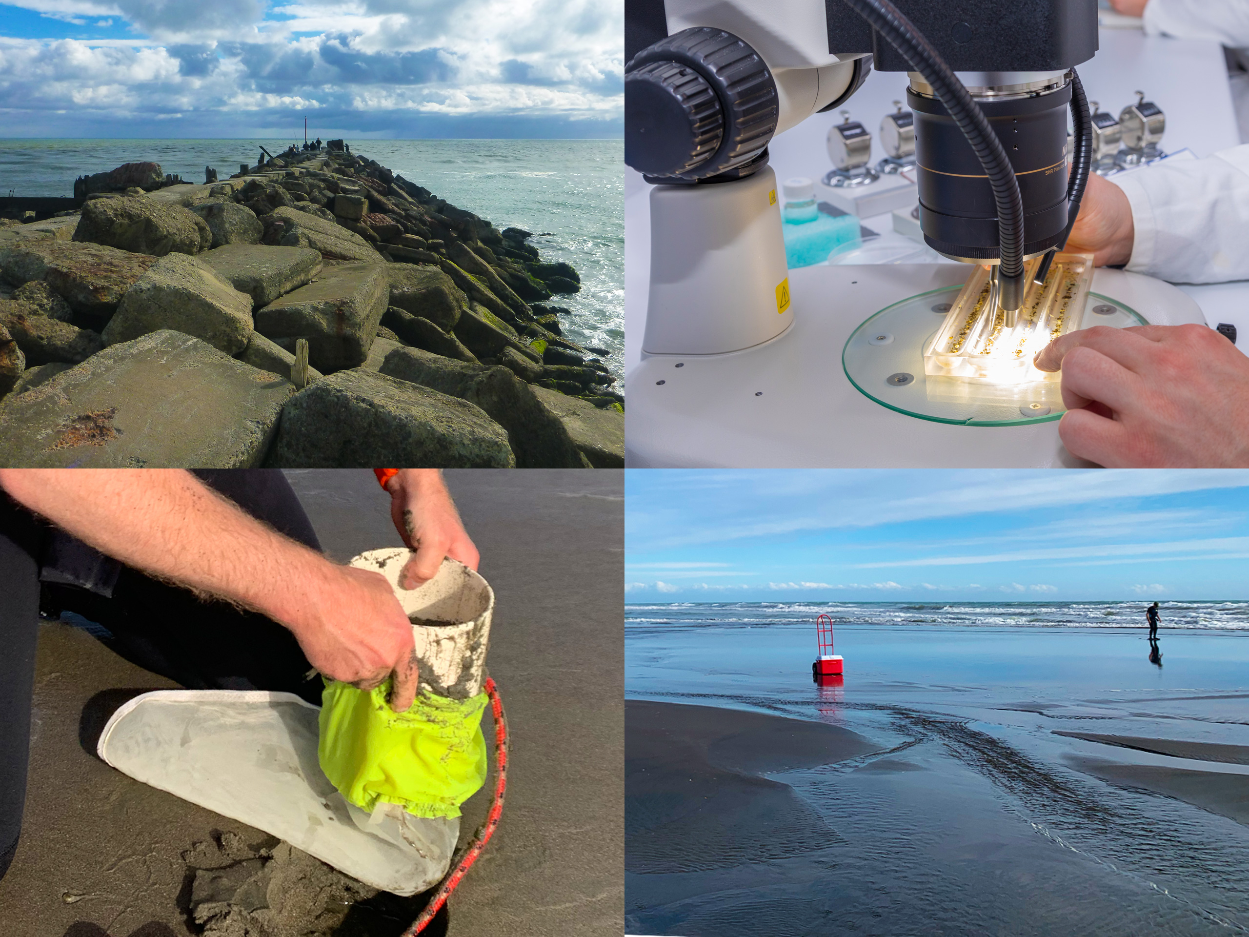
We designed and implemented an ecological survey programme to assess benthic ecology and sediment quality within the Whanganui River mouth and South Beach environment. Across field programmes in 2018 and 2021, we quantified the macroinvertebrate and macroalgal communities at 62 intertidal rocky shore sites along the moles and port basin wall, sampled the soft-sediment infauna of the estuary’s intertidal and subtidal habitats at 56 soft sediment intertidal and 28 subtidal sites spread throughout the port basin and wider river mouth area, and surveyed the proposed South Beach haul route. All infauna samples were processed in our in-house specialised aquatic invertebrate processing laboratory. We designed the surveys to cover a range of habitats and proposed activities, ranging from regular port activities to larger channel dredging and river mole infrastructure repair and upgrades.
Throughout the project we participated in huis with project partners, and collaborated with planners and coastal engineers to ensure ecology was considered throughout the infrastructure design process. With a complex and evolving project, we continued to achieve a high standard in all our outputs, responding to and incorporating changes to the wider project design into the AEE reporting. A total of six AEE reports, two addendum AEE reports, and a supplementary memo were produced for multiple phases of consent applications. Ecological advice was provided around multiple aspects of the wider project, including revetment wall upgrades, port wharf renewal, dredging activities, and the design of new community assets. Environmental risks were identified and assessed for the construction and operational effects, and appropriate mitigation measures were recommended. No Section 92 Requests for Information arose from the six AEEs or two Addendum AEEs, indicating that they complied with all requirements of the resource consenting process.
The expansive surveys undertaken across the project also provides a valuable ‘before’ dataset for any future monitoring plans. In addition to meeting requirements for the resource consent application, the design of the ecological survey programme allowed the intertidal and subtidal surveys to serve as baseline data, and the survey methodology could be repeated in the future to fulfil the need for ongoing ecological monitoring under resource consent conditions.
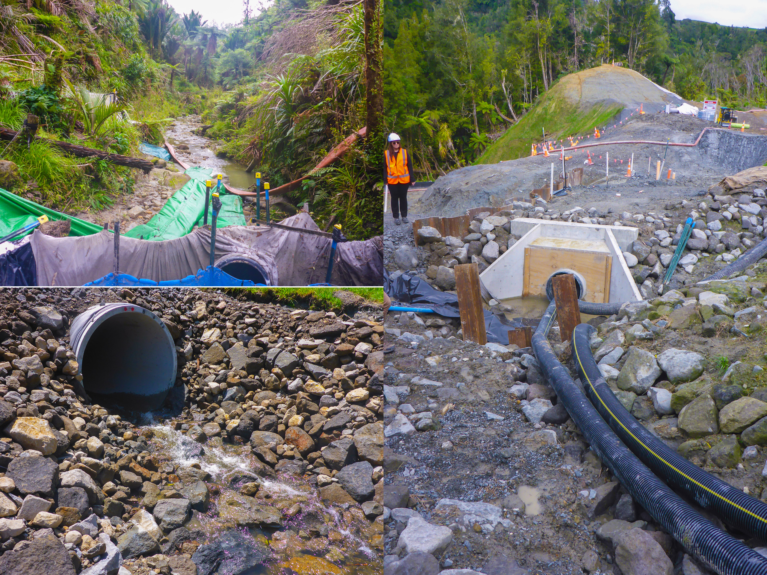
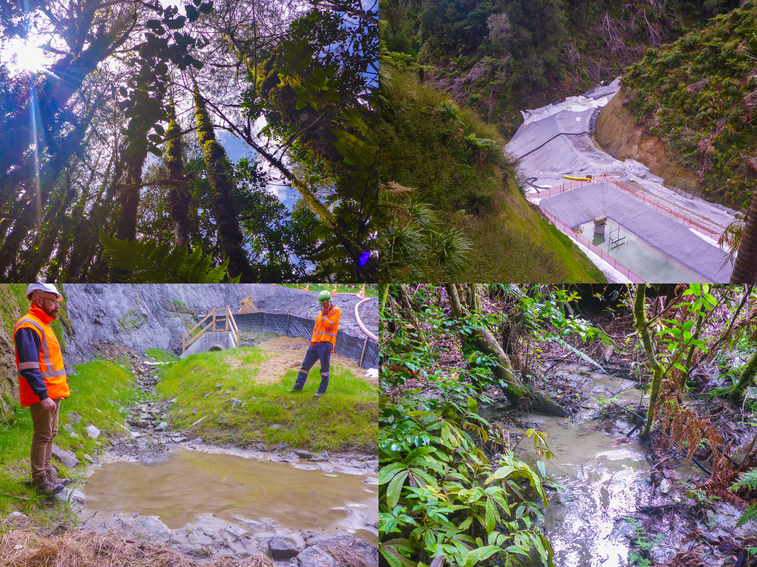
Te Ara o Te Ata – Mt Messenger Bypass
Helping Taranaki Regional Council interpret consent compliance for a new section of SH3 being built through some of Aotearoa New Zealand's most rugged, ecologically sensitive country – from culvert design changes to fish passage as construction unfolds.
Te Ara o Te Ata – Mt Messenger Bypass is a new section of State Highway 3 being constructed by NZ Transport Agency Waka Kotahi through rugged, ecologically sensitive country in northern Taranaki. Sitting on the regulator’s side of the project, EOS Ecology provides Taranaki Regional Council (TRC) with the technical advice and interpretation it needs to assess whether the consent holder is meeting its environmental commitments on the ground.
Our work spans the construction-phase compliance regime – technical reviews of annual reporting, ecological management plans, culvert design reports, water quality monitoring data, incident reporting, and the additional consent applications that arise as the project progresses. We attend site visits where needed and translate freshwater ecology questions into clear, decision-ready advice so TRC can make timely, defensible calls.
Fish passage and erosion control have been the standout challenges. The mountainous topography and continually improving fish distribution data mean culvert designs need to be reassessed as construction unfolds, and EOS Ecology has been instrumental in reviewing those design changes and overseeing both temporary and permanent fish passage solutions – helping to ensure one of the country’s most significant current roading projects does not impact on native freshwater communities of the region.
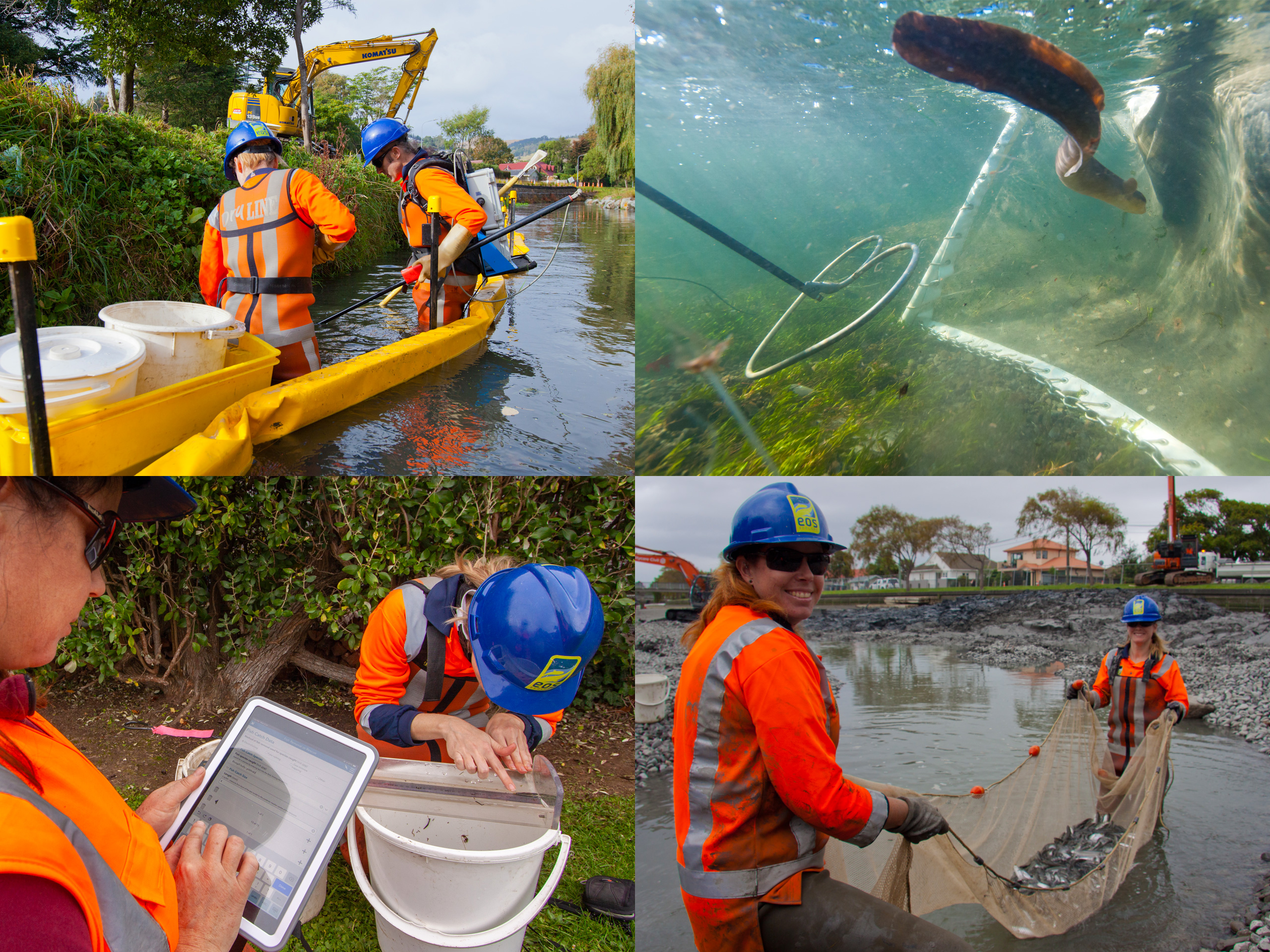
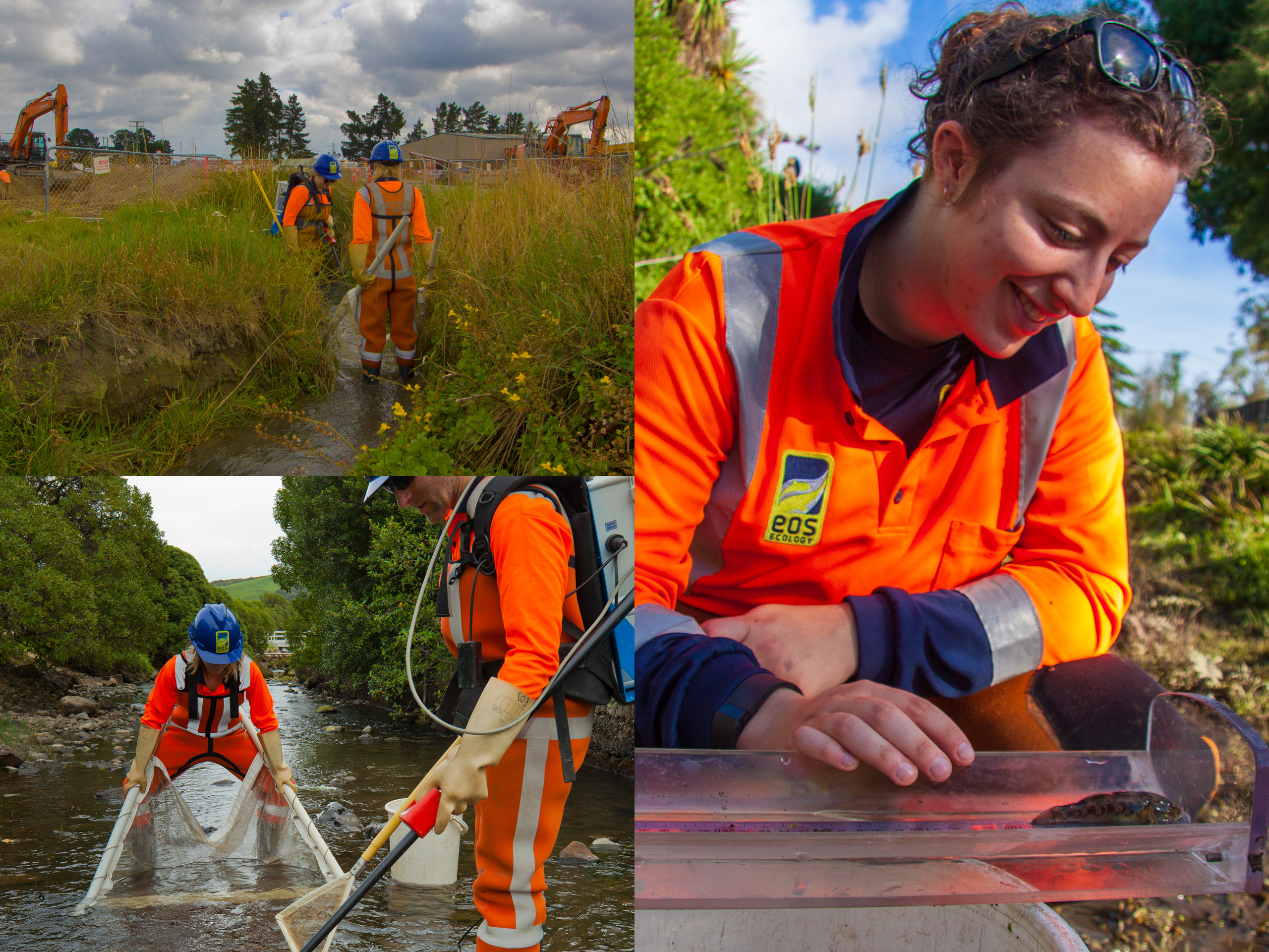
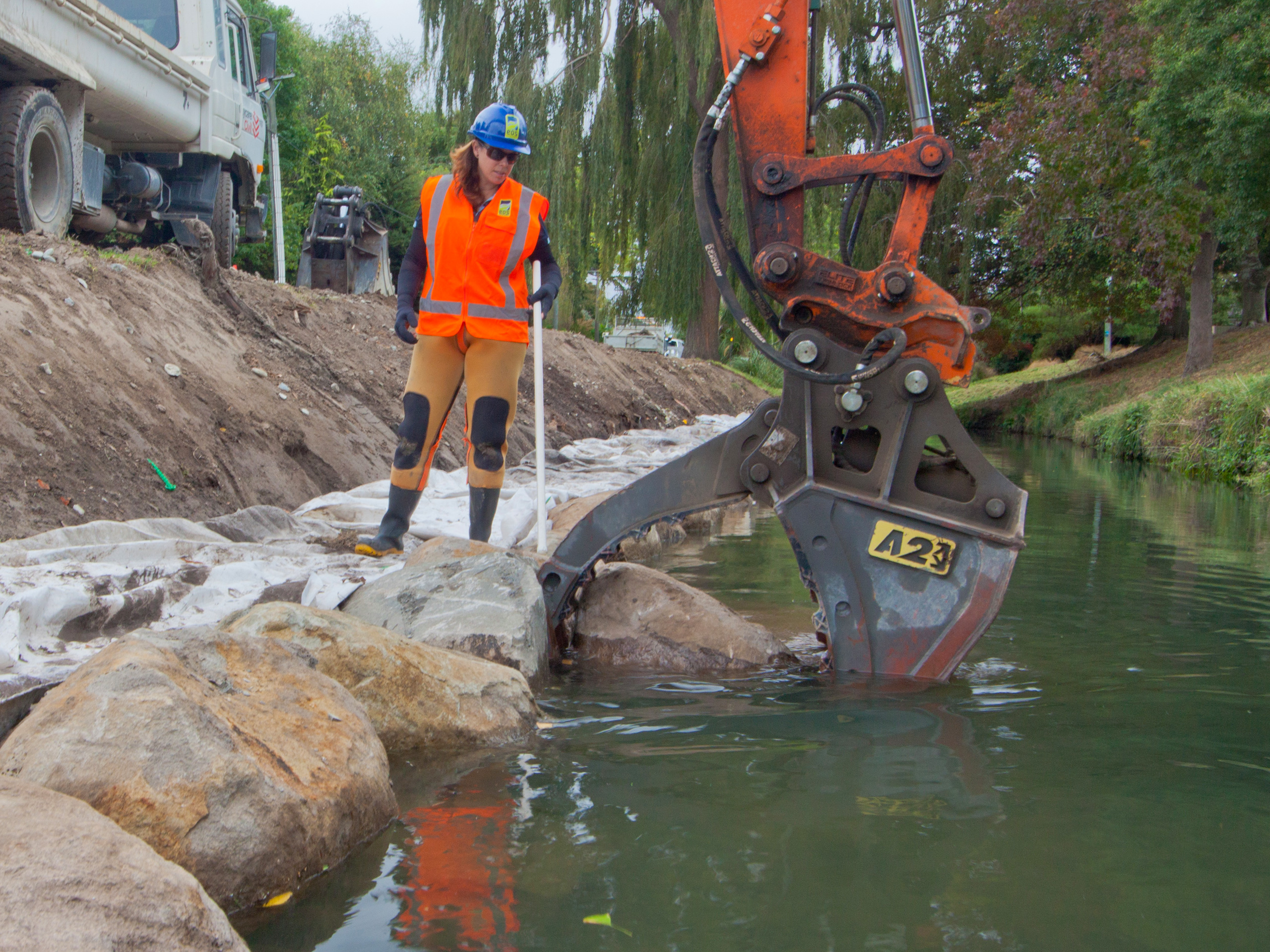
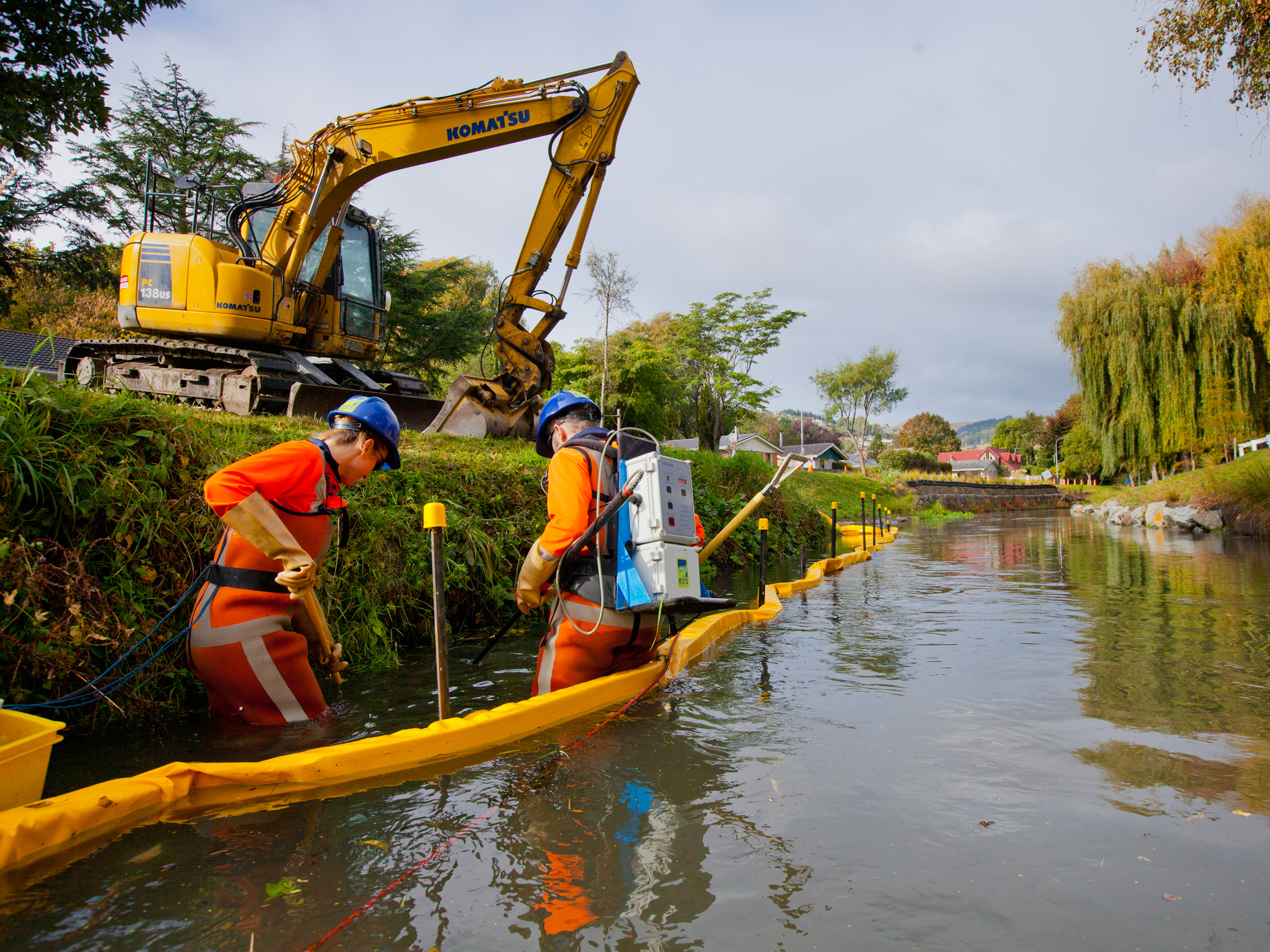
Ōpāwaho/Heathcote River Bank Stabilisation
Embedding native fish habitat into a 6 km hard-edged bank stabilisation programme and rescuing almost 3,000 fish across two years of in-channel construction.
Christchurch City Council’s (CCC) bank stabilisation project tackled bank instability along 6 km of the mid reaches of the Ōpāwaho/Heathcote River. As the ecology design lead, EOS Ecology worked alongside planners, engineers and landscape architects from BECA, responsible for ensuring a primarily hard-edged engineering solution still delivered ecological value. Design features included eel pipes (‘tuna tubes’), a rougher-edged profile on the rock armouring, low-flooded riparian banks, low-flow channel narrowing, and mid-channel cobble clusters. We also prepared the ecological Assessment of Environmental Effects supporting the resource consent.
Across two construction stages from early 2018 to mid-2019, we provided on-site ecological oversight of the Citycare crew, checking designed habitat features were installed as intended. We worked with CCC’s river maintenance team to trial mid-channel cobble cluster installations before broader roll-out, making sure the new structures would not create issues for routine maintenance, before they were installed across several gravel reaches to diversify habitat and provide spawning sites for fish and invertebrates.
Alongside the design work, we led the fish rescue programme responding to in-river construction: 88 site visits across two construction stages, relocating 2,869 fish and waikōura in total. Methods were tailored to site conditions: electrofishing in shallow sections; Gee’s minnow traps and fyke nets in deeper waters; sites isolated with geodesign barriers, sediment curtains or sheet piling and re-fished where heavy rain overtopped them. Species rescued included common, upland, giant, and bluegill bully; shortfin and longfin eel; īnanga; common smelt; brown trout; and rarer natives, including waikōura/freshwater crayfish and lamprey ammocoetes.
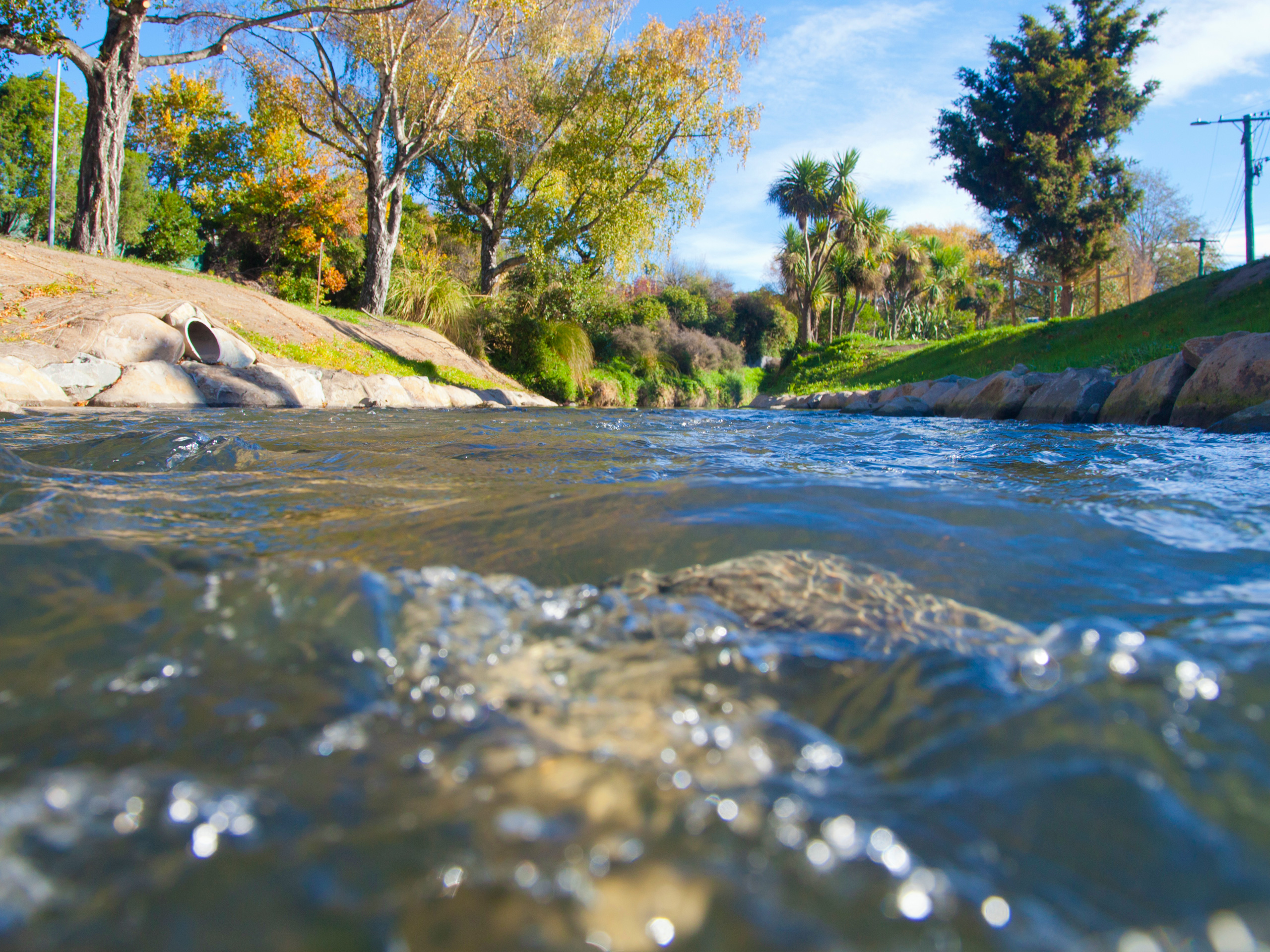
No. 1 Drain Stormwater Facility & Naturalisation
Aquatic ecology specialist within the Harrison Grierson-led team turning an earthquake-damaged concrete drain through Shirley Golf Course into a realigned natural channel, central stormwater pond and downstream wetland.
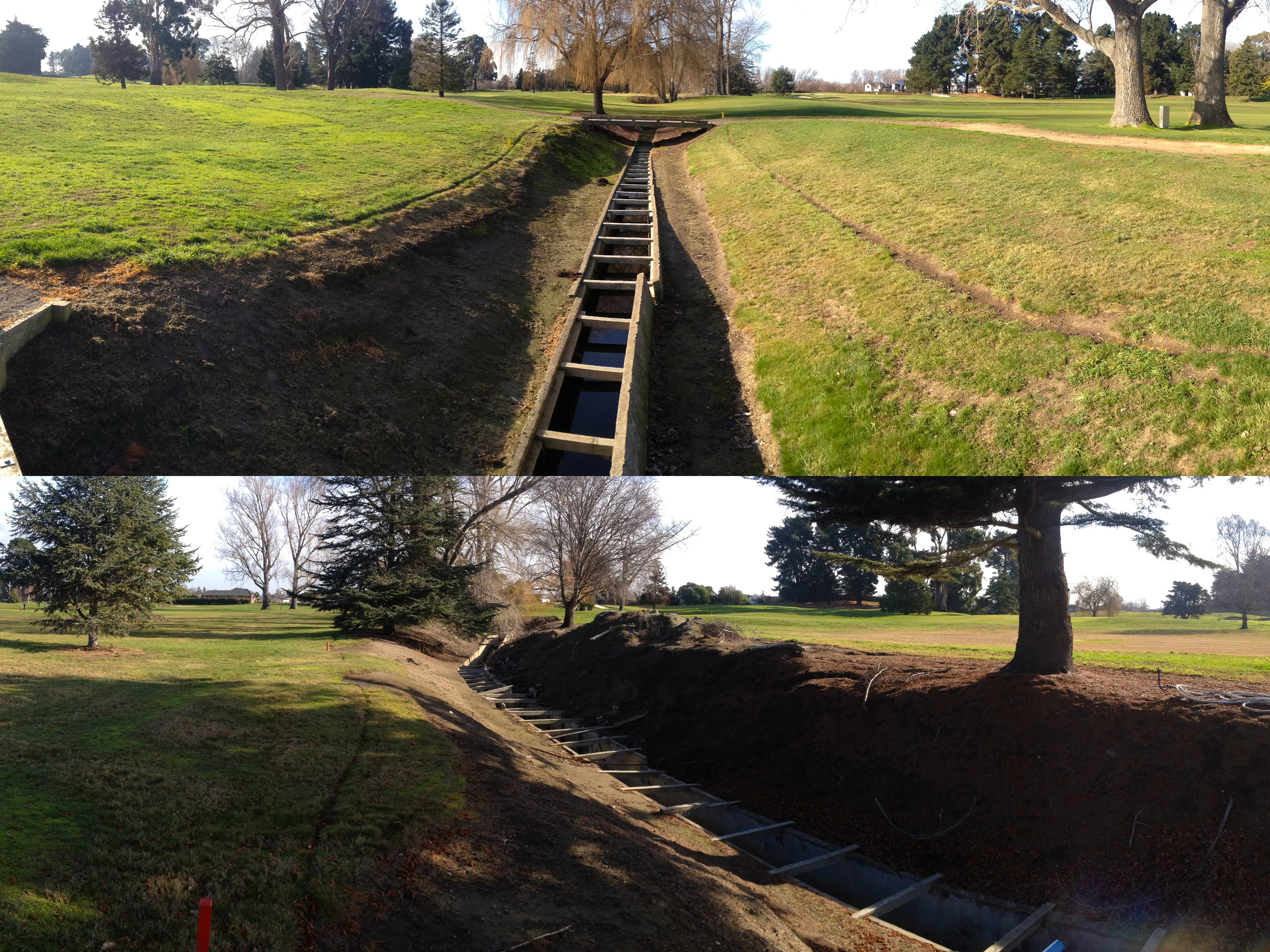
No. 1 Drain, a concrete-lined urban waterway running through Shirley Golf Course in Ōtautahi/Christchurch, was damaged in the Canterbury earthquakes. As part of Christchurch City Council’s (CCC) Land Drainage Recovery Programme, naturalisation was selected as the repair option: replacing the concrete with a realigned natural channel, and an integrated stormwater treatment system consisting of a central pond with floating wetlands. EOS Ecology was the aquatic ecology specialist within the Harrison Grierson-led design and construction-management team.
Whilst CCC already held consents to construct and operate the new system, the interception of groundwater fell outside their existing consents. EOS Ecology prepared the AEE report for the consent application, covering the potential effects of the interception of near-surface groundwater on surface water ecology and water quality and providing recommendations for monitoring.
As the ecology lead for the design phase, we provided ecological input to the multi-criteria analysis that helped to identify the best treatment solution for the site; a gaps analysis on ecology, water and sediment quality and advice around how to fill the gaps needed to best inform the system design, and contributed ecological input into the detailed design of the channel and integrated stormwater basin, including specifying the planting and ecological elements of the contract documentation.
Buller Stream Stormwater Facility
Aquatic ecology specialist within the GHD-led team designing a stormwater treatment train that turns the lower 170 m of an artificial drainage channel into a sediment forebay, three treatment cells and a wetland – on a triangle of wet pasture in Mairehau, Christchurch.
The Buller Stream Stormwater Facility is a Christchurch City Council (CCC) treatment system on a triangle of wet pasture in Mairehau. It captures the lower 170 m of Topps Drain, an artificial drainage channel, and routes the flow through a series of ponds, weirs and a wetland before discharging to Buller Stream. EOS Ecology was brought in by GHD, who led the engineering design, to provide aquatic ecology input across the project life cycle.
From the start, we contributed at the design table, helping to shape the first-flush pond design (wet vs dry) and wetland layout, construction staging (including pukeko management), plant species selection, and the form-and-planting interface with the project landscape architect. Our baseline field surveys helped to confirm the ecological value of the existing system and what fish could utilise the new habitat, helping to inform our fish passage input during the design phase.
Our AEE assessed the existing habitat and framed the potential effects of the construction and operational phases of the programme, and provided guidance for mitigation to be implemented to achieve a ‘less than minor’ effects outcome. Our ecological oversight during the construction phase ensured that the recommended habitat improvements – such as deeper pools, logs, and boulders for habitat complexity, native riparian planting, and fish passage features built into the weirs (embedded rocks, v-notch base-flow channels, a baffled pipe outlet, and a fish-friendly flap gate) – were able to be achieved on the ground.


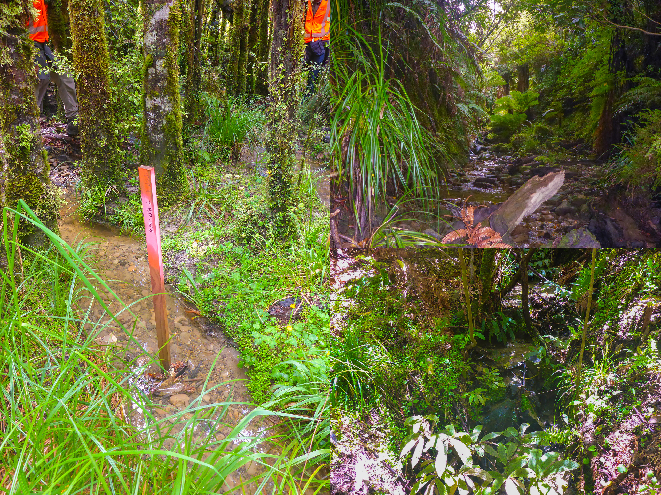
Ōpaki Water Race Closure Management Plan
Mapping, sampling and consenting work behind the staged retirement of a 100-year-old water race scheme, including a three-stage shutdown, fish translocation programme, and the often-overlooked drainage role the channels still play once the intake is shut.
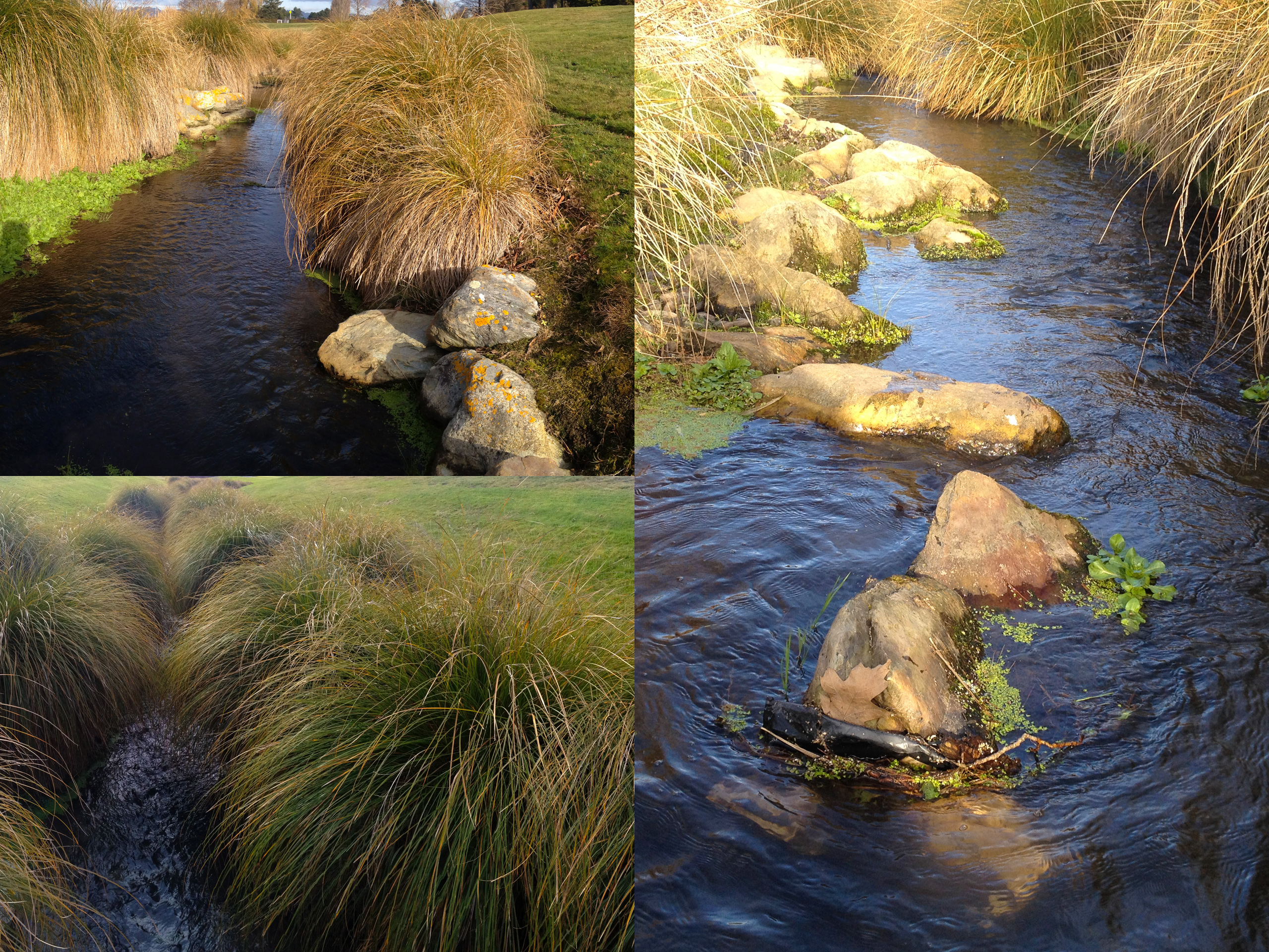
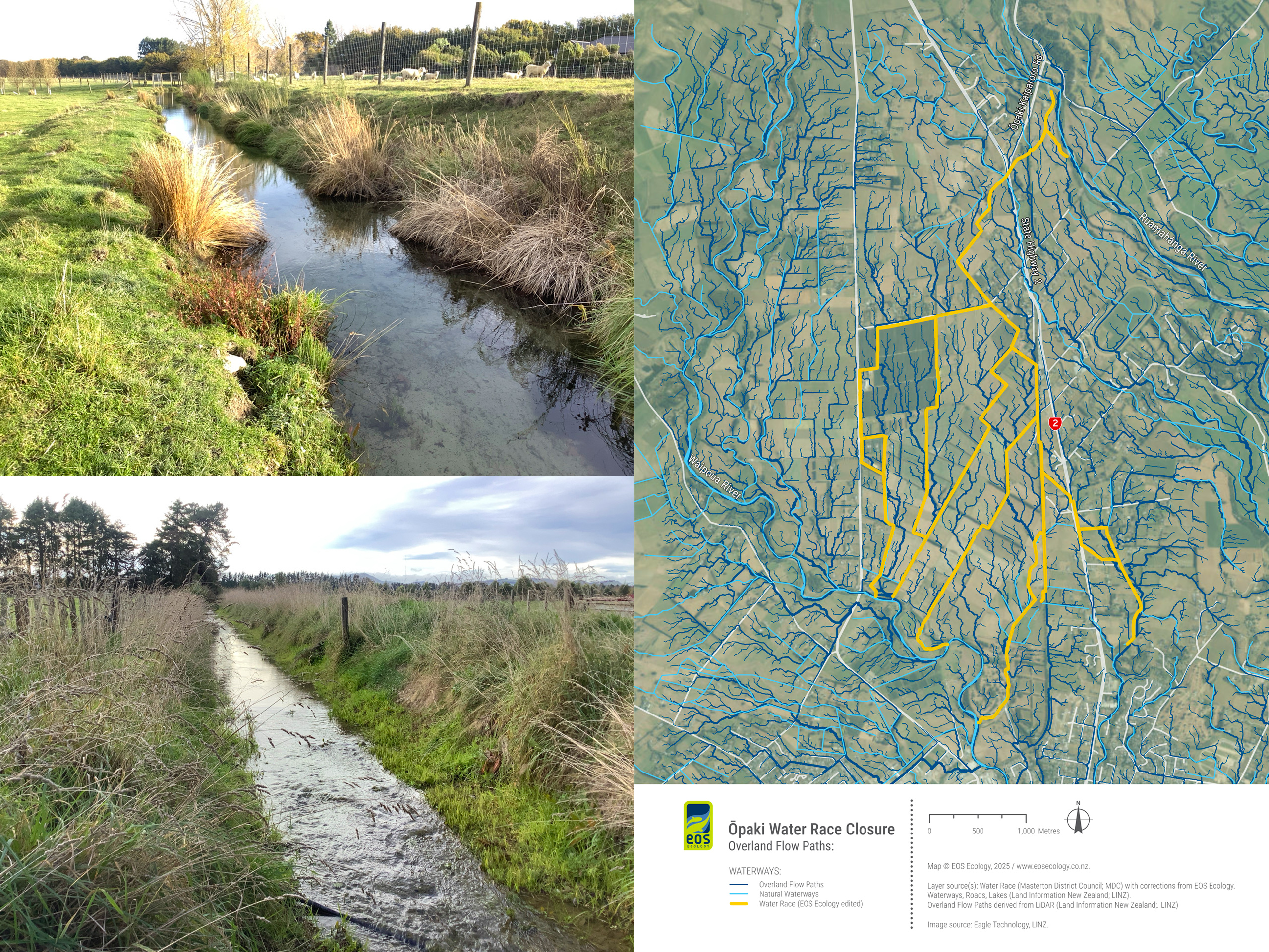
The Ōpaki Water Race (ŌWR) sits just north of Masterton and has delivered water from the Ruamāhanga River across the landscape for over 100 years, fanning out to five discharge points – four to the Waipoua River and one to the Fifth Street Wetland (which feeds Henley Lake via the Ōpaki Stream). Masterton District Council (MDC) holds the short-term consents that expire in 2026 and intends to retire the scheme. Condition 4 of the consent requires a Closure Management Plan certified by Greater Wellington Regional Council (GWRC) at least one year before closure – covering high-value habitat areas, a translocation plan, and the timing and method of closure. EOS Ecology was engaged by MDC to deliver on these ecological components.
We started with a site visit and desktop/GIS exercise to provide an accurate spatial layer of the network, mapping the overland flow paths the race intercepts, and identifying the wetlands, ponds, and springheads needing direct assessment. Our fieldwork added eDNA sampling and Rapid Habitat Assessments at key reaches, whilst wetland condition was assessed by GWRC at two locations. The surveys and mapping helped to ascribe condition value to the network and the habitats the water feeds, so as to prioritise the closure and closure management process.
Our development of the Closure Management Plan was informed by this ecological data and sets out a phased shutdown, with sections isolated by temporary bunds before the main intake is removed. Fish translocations will be used to remove fish and key large ‘mega’ invertebrates (waikōura and kākahi) prior to shut down, with release sites spread across multiple locations within the Ruamāhanga and Waipoua Rivers. The plan also identifies a matter often overlooked: because the ŌWR now intercepts numerous natural overland flow paths and performs a critical drainage function for surrounding landowners, the channels need to be maintained even after the intake is shut – closure of the scheme is not abandonment of the channels.
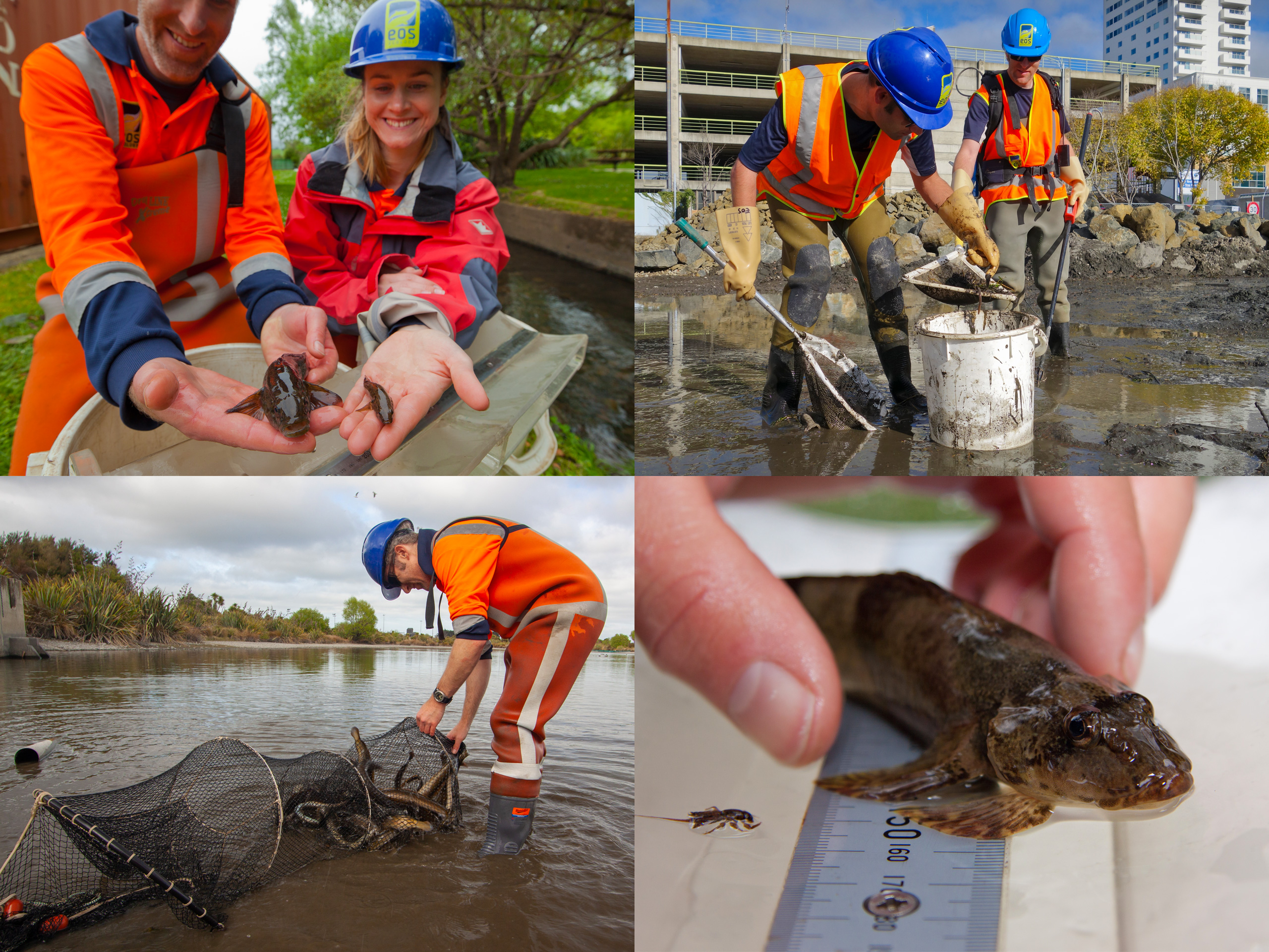
Fish Rescue & Relocation
Responsive, contractor-friendly fish rescue and relocation across the full range of in-channel infrastructure works – from bank repair and bridge replacement to culvert renewal, dewatering, and river sediment removal.
Most in-channel construction work – replacing or repairing a bridge, culvert or weir, stabilising a bank, realigning a stream, building a stormwater facility or other infrastructure, repairing or building a fish passage structure, dredging a channel or removing sediment – requires fish, waikōura/freshwater crayfish and kākahi/freshwater mussels to be removed before machinery moves in. EOS Ecology runs fish rescue and relocation as an ongoing service for councils, infrastructure asset owners, engineering and design consultancies, and the contractors who build their projects – working under the relevant Ministry for Primary Industries, Department of Conservation and Fish & Game permits.
We tailor capture methods to what each site needs. In shallow, wadeable channels and dewatered sections, electrofishing is the workhorse – backed by stop nets and isolation barriers (Hydro Response geodesign barriers, sediment curtains, sheet piling). Where water is too deep we deploy baited Gee’s minnow traps and fyke nets overnight. In tidal or saline reaches where electrofishing will not work, we switch to fyke nets, Gee’s minnow traps and drag netting – a combination that removed almost 7,000 fish from a single lower Ōpāwaho/Heathcote River dredging programme. In long culverts that cannot be electrofished, we use spotlighting and hand-netting alongside overnight Gee’s minnow traps. And on river sediment-removal works, where fish are inadvertently lifted out with the spoil, we developed a stockpile-electrofishing technique that recovers juvenile eels, lamprey, bullies and even flounder from slushy sediment in the truck tip-out.
What clients tell us they value is our responsiveness – turning up on site at short notice when a contractor calls, coordinating with the construction crew so the rescue happens at the right point in the build, and re-fishing whenever a barrier is overtopped by rain or removed for access. Fish are identified, sized and released to suitable habitat upstream or downstream of any permanent barriers. The same operational discipline extends to Department of Conservation-supported transfers of threatened species – kōwaro/Canterbury mudfish from wild populations to newly created or restored habitat – but the principle is the same throughout: protect the native species that depend on these waterways while keeping the construction programme moving.