National Wetland Delineation Protocols – Digital Transformation
Translating Aotearoa New Zealand’s national Wetland Delineation Protocols into an integrated digital system, replacing paper forms and manual calculations with guided decision logic, real-time results, and end-to-end spatial data capture to reporting outputs.
context
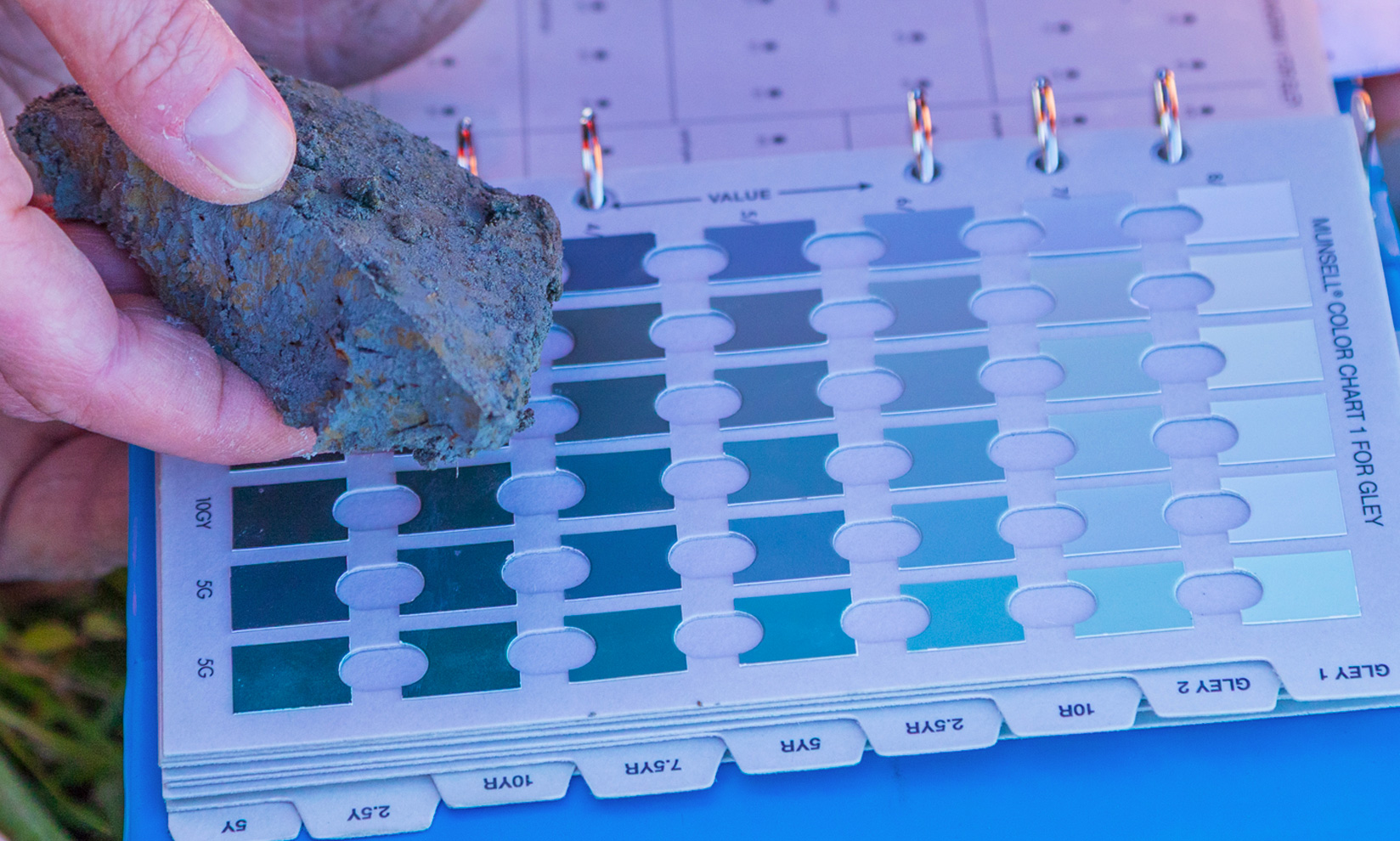
Aotearoa New Zealand has lost more than 90% of its original wetland extent, with those remaining representing a key link to our natural heritage. Under the RMA and NPS-FM 2020, natural inland wetlands are recognised, but confirming whether an area is legally a wetland requires a complex, multi-step delineation process. In 2022, the Ministry for the Environment (MfE) published the national Wetland Delineation Protocols, using three diagnostic tools: hydrophytic vegetation, hydric soils, and wetland hydrology. The protocols are scientifically robust and nationally consistent, but entirely paper-based, creating significant friction, potential calculation errors, and missed decision points for practitioners working in the field.

challenge
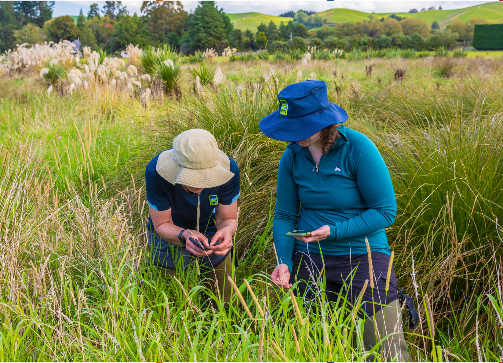
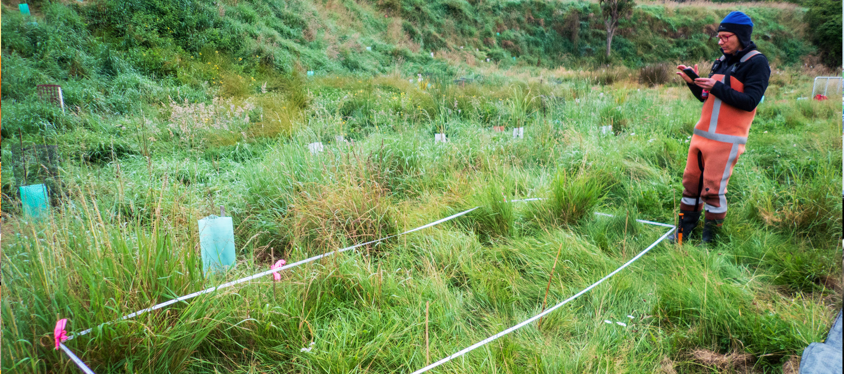
- A paper-based protocol with branching decision trees across three diagnostic tools, where practitioners must manually track logic paths, look up species indicator status from printed lists, and perform multi-step calculations (dominance, prevalence, FAC-neutral) by hand, often at the end of a physically demanding day in the field.
- Paper forms remain disconnected from spatial data, imagery, and desktop assessments, requiring substantial manual transcription to produce defensible reports.
- The protocol’s complexity creates a high barrier to consistent application, particularly for catchment groups and less experienced practitioners who are increasingly being asked to undertake wetland delineation work as regulatory demand grows.
our role
EOS Ecology has transformed the national Wetland Delineation Protocols into an integrated digital system – from the initial desktop review, through to field work and reporting outputs. By bridging the gap between high-level science and practical application, the system empowers those that use it to focus on what counts – the identification of wetland plants and accurate delineation of wetlands. It preserves every element of the published protocols while removing the friction, reducing the errors, and providing guided decision logic that makes it significantly harder to make the wrong call.
how we approached it
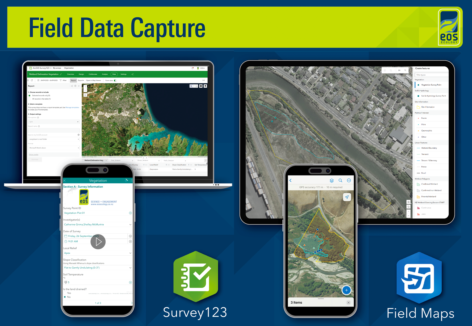
- Consolidated the vegetation, soil, and hydrology delineation protocols into digital workflows with conditional logic that guides practitioners through each decision tree, showing only the questions and fields relevant to their current path, and hiding complexity that doesn’t apply.
- Built custom JavaScript files to automatically and dynamically calculate the hydrophytic vegetation dominance test, prevalence index, FAC-neutral test, and pasture exclusion assessment. Results calculate in real time as data is entered – change a value and everything recalculates immediately. This provides field teams with the certainty they need to move forward, eliminating unnecessary repeat surveys and maximising field efficiencies.
- The calculation files are modular, so future updates to species lists or scoring methods can be applied without rebuilding the system.
- Pre-loaded our app with 1,400+ plant species with automatic lookup of wetland indicator status and exotic pasture flags, eliminating the need to carry and cross-reference printed species lists. Where species are not yet in the database, users can add them with manually assigned indicator values; the system prompts for validation before delivering results.
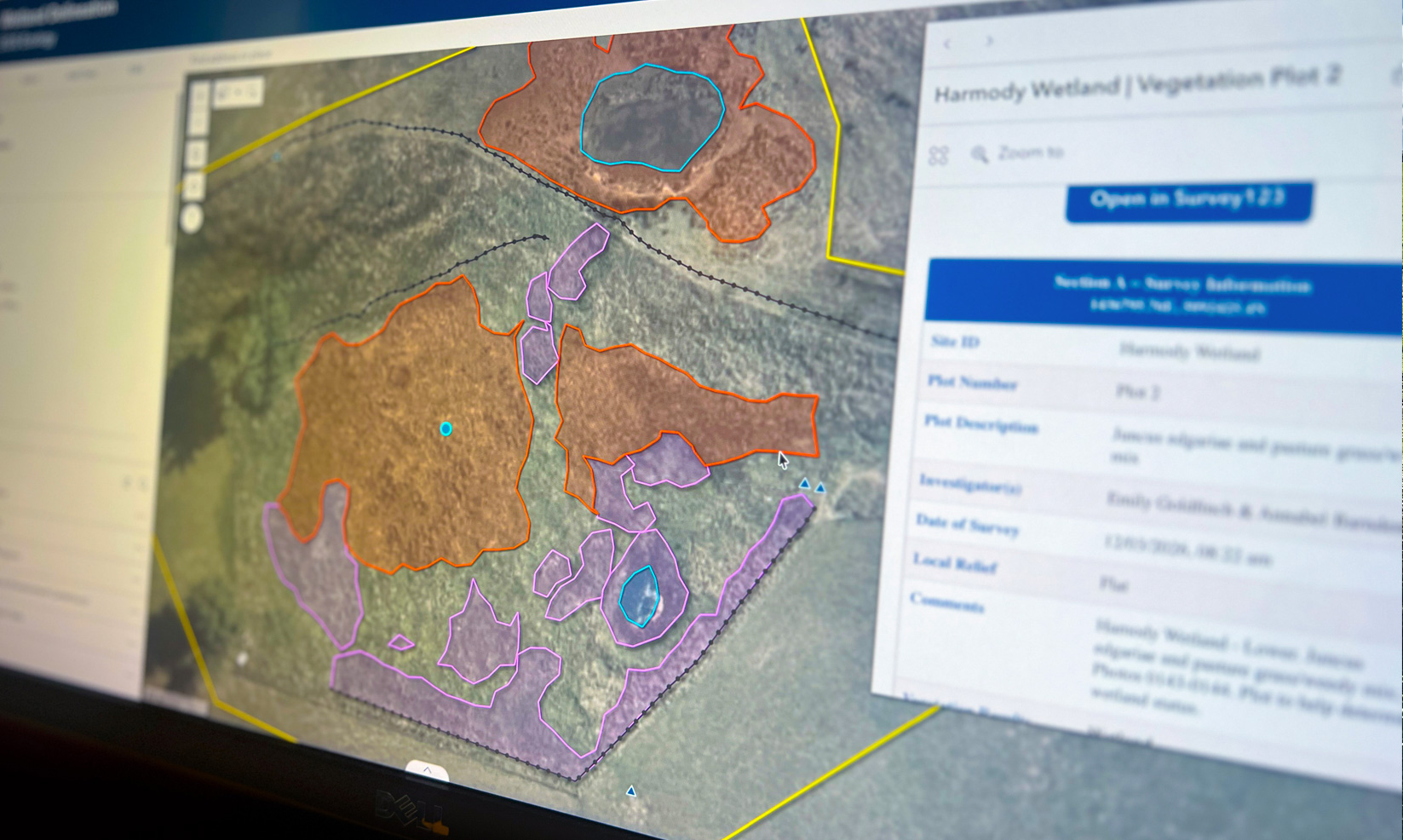
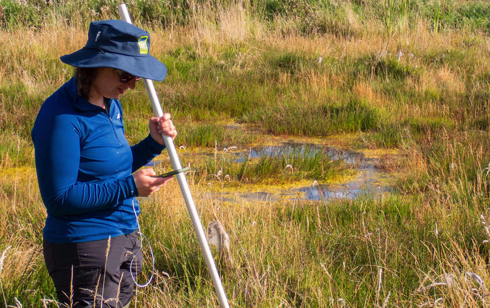
- Integrated ArcGIS Field Maps (for spatial capture: transects, plots, boundaries) with Survey123 (for diagnostic surveys) so spatial and attribute data connect from the moment of capture. Entire field system works offline for remote sites.
- Built an Experience Builder interface as our desktop hub for preliminary assessment, post-visit QA/QC, and curated protocol resources.
- Closed the end-to-end loop by creating templated outputs of the data for input into final reports, providing full transparency of the wetland delineation findings and greatly improving the ability for anyone to check the validity of the results.
- Undertook extensive desktop and field testing by our team of specialists and in consultation with the Bioeconomy Science Institute (formerly Manaaki Whenua Landcare Research) to ensure the system works as expected.

outcome
Our digital system has transformed wetland delineation from a complex paper process that was error-prone and disconnected, into an integrated workflow where decision logic is embedded, calculations are automated, species data is pre-loaded, and spatial and diagnostic information are linked from capture through to reporting. Backed by a system that takes the guess work out of delineations, our scientists and other users now have the space to focus on the assessment itself, building the accuracy that differentiates a sound delineation from an unreliable result.
wider impact
- Demonstrates that critical national environmental protocols can be fundamentally improved through digital transformation without altering the underlying science – the guided decision logic approach is directly transferable to other complex field assessment procedures.
- By lowering the barrier to consistent, defensible wetland delineation, the system has the potential to increase practitioner capacity across Aotearoa New Zealand at a time when demand for this work is growing significantly.