
Selwyn District Council Catchment Management Plans Implementation Platform
Translating seven Catchment Management Plans into a live spatial decision-support platform, bringing together high-resolution waterway mapping, ecological interventions, and catchment context into a single interactive tool built for operational use.
2025–2026
context
Between 2021–2026, EOS Ecology and Aqualinc Research developed Catchment Management Plans (CMP) for Selwyn District Council’s (SDC) seven rated land drainage schemes – a programme that fundamentally changed how these lowland waterway networks were valued and managed. Each CMP established the ecological, cultural, and hydrological values of the catchment, identified the key issues and challenges it faced, and outlined a suite of catchment-scale approaches and site-specific interventions to guide long-term management.
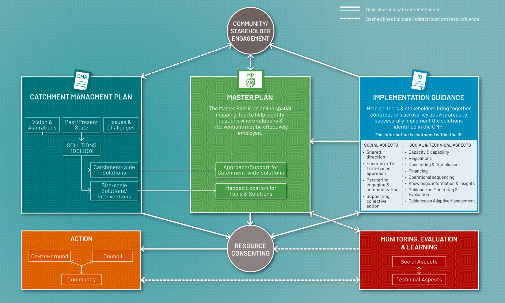
But knowing what interventions are needed to effect environmental change is only the starting point. Knowing where to implement them across seven catchments, hundreds of landholdings, and thousands of individual waterway reaches requires an interactive spatial solution that can hold all the information in one place, make it queryable, and keep it current as decisions are made and conditions change. That is the role of the Master Plans.

the challenge
- Existing national and regional waterway datasets often lack the spatial resolution needed for operational catchment management. They routinely omit smaller drainage channels, intermittent waterways, and overland flow paths. Without an accurate understanding of how water moves across the landscape, the placement of interventions cannot be precise or defensible.
- The CMPs identify a range of ecological interventions suitable for the seven catchments based on waterway characteristics, but they do not specify where these interventions should be located. We needed a robust, spatially informed process to determine intervention locations at both the local and catchment scales.
- With hundreds of interventions to map, categorise, and track – each with its own spatial geometry, delivery responsibility, and implementation timeframe – managing this information through static documents or spreadsheets was neither practical nor scalable.
- The platform needed to serve two distinct user groups simultaneously: SDC staff and stakeholders requiring read-only access to current catchment data, and project scientists requiring editing access to update intervention attributes and geometries as the programme progresses – without either compromising data integrity.
- The evidence base varied across the seven catchments due to differences in scope and budget during earlier planning phases. Ararira, Osbornes Drain and Wairiri Valley benefited from dedicated CMPs, while the remaining four catchments were combined into a single study. As a result, the level of detail available to inform master planning was not uniform. The challenge was to develop a consistent methodology that delivered equally robust and actionable outcomes across all catchments, irrespective of the depth of information available.
our role
EOS Ecology designed and built the Master Plan platform as the spatial implementation layer for the CMP programme. Working alongside Aqualinc Research, we were responsible for the high-resolution waterway mapping, the ArcGIS Online platform architecture, the spatial mapping of all CMP interventions, and the data governance framework that keeps the system accurate and current. The Master Plans translate the CMPs from planning documents into an operational tool, one that SDC can use to coordinate, prioritise, and track implementation across all seven rated catchments.
how we approached it
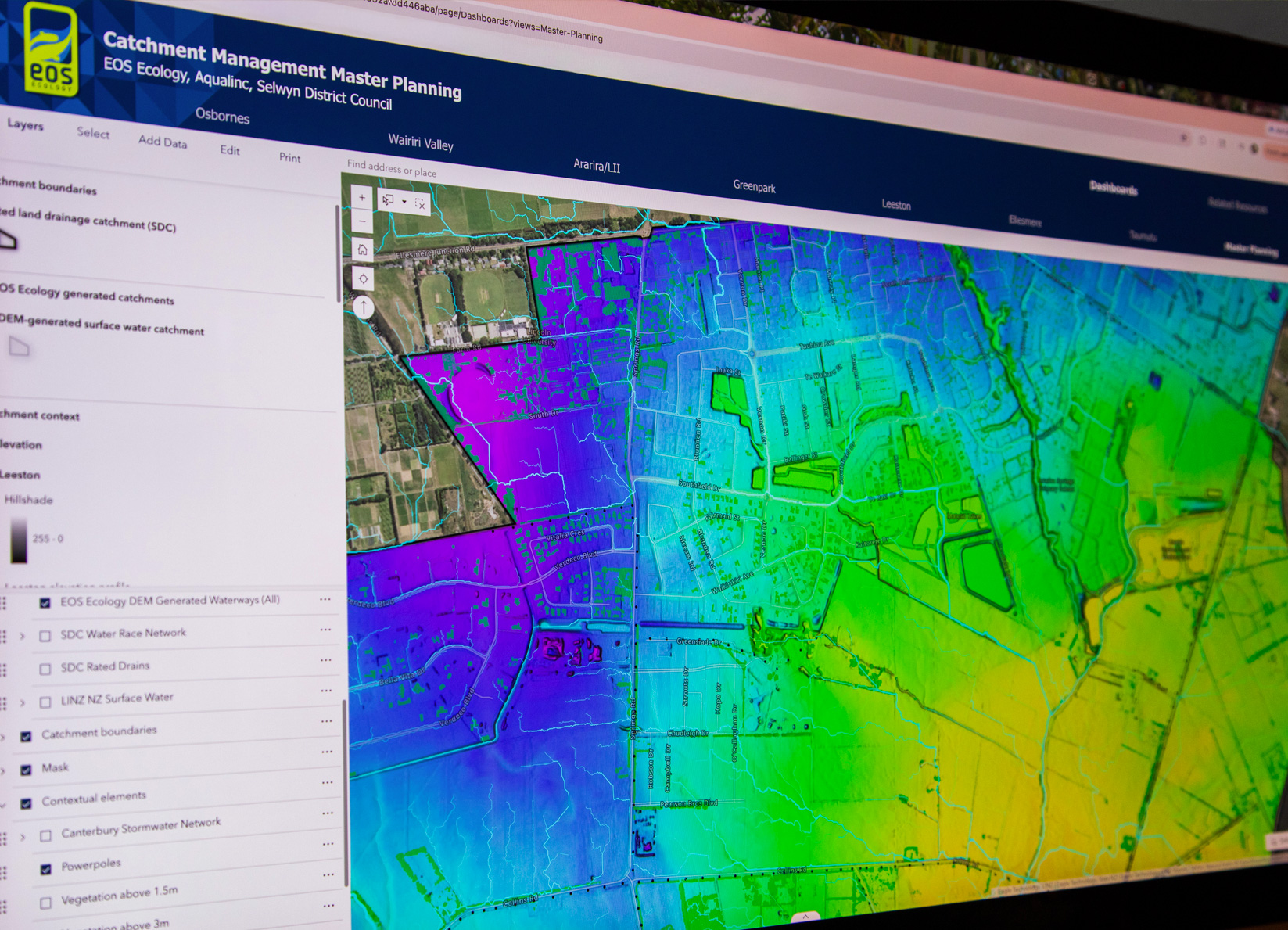
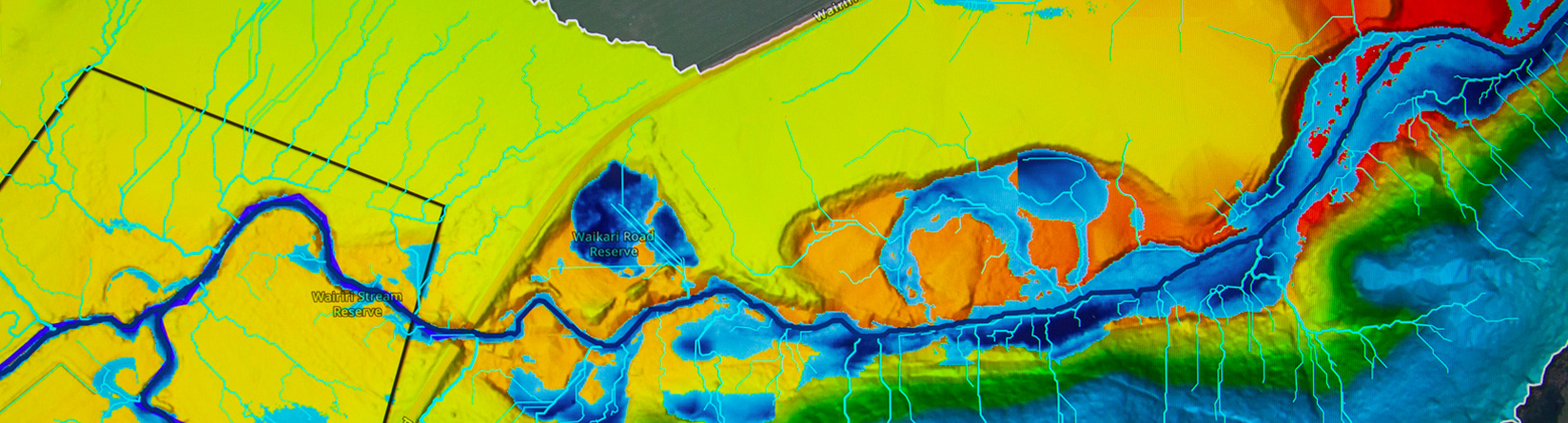
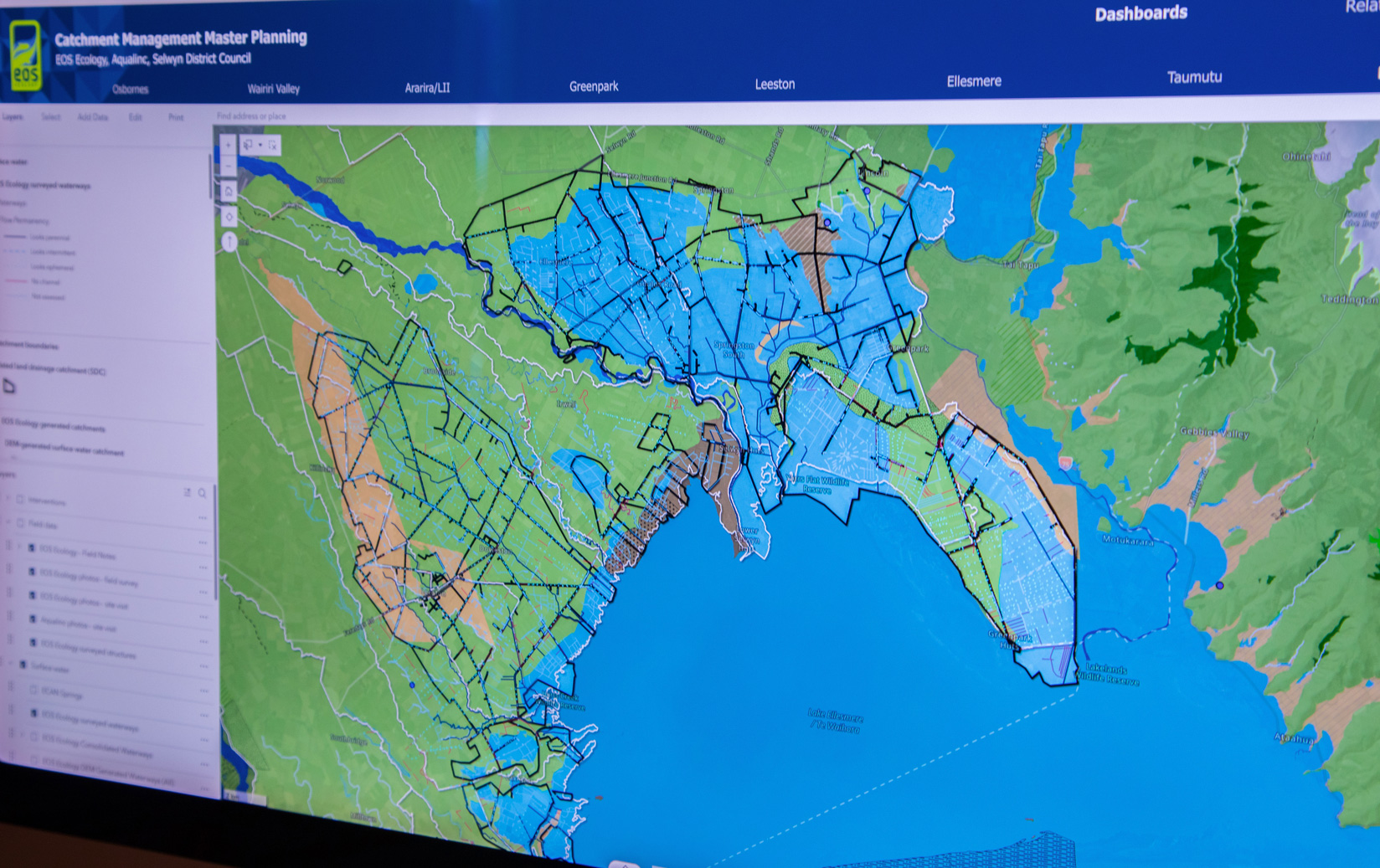
- Built high-resolution waterway networks from 1 m LiDAR-derived Digital Elevation Models for all seven catchments. This involved an element of manual modification due to the influence of culverts, driveways, road crossings, and dense vegetation on surface water flow. We then ran a suite of native hydrological tools via ArcGIS to delineate accurate channels, overland flow, and catchment/subcatchment polygon boundaries. The resulting waterways & flow paths layers significantly increased the lineal length of defined channels compared to existing regional datasets, revealing drainage networks that were previously unmapped.
- For the Osbornes Drain and Wairiri Valley catchments, subcatchment boundaries were delineated based on the derived flow paths layers, enabling a more granular spatial framework for targeting interventions. Flow permanence attributes were consolidated by cross-referencing the DEM-derived networks against field survey data, producing an accurate channel layer with flow permanency attribution that surpasses existing datasets such as the LINZ waterways layer.
- Generated vegetation height layers from 1 m Digital Surface Models, deriving canopy height data above 1.5 m and 3.0 m thresholds and removing building footprints to isolate vegetation cover. These layers inform riparian planting and setback interventions by showing where existing vegetation is present and where gaps exist along waterway margins.
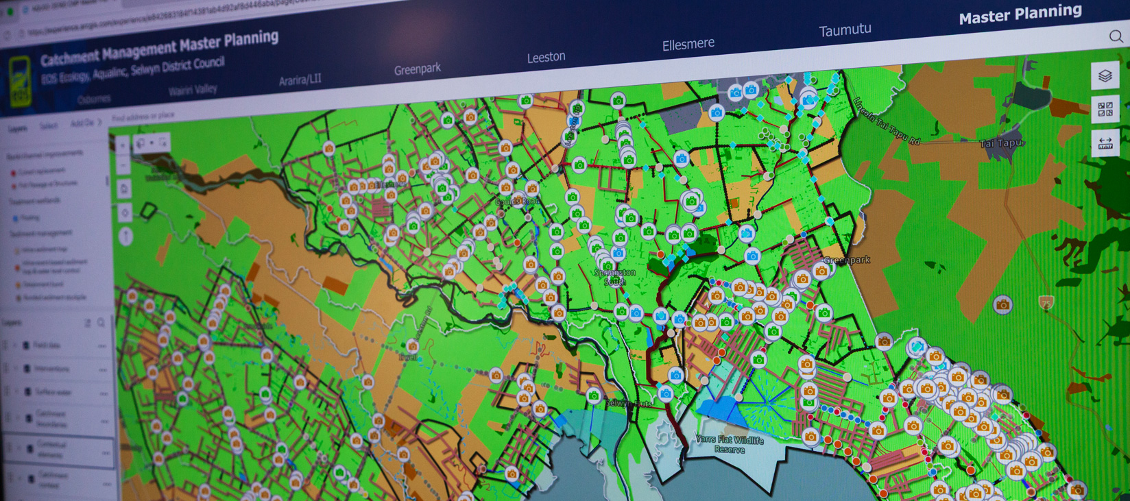
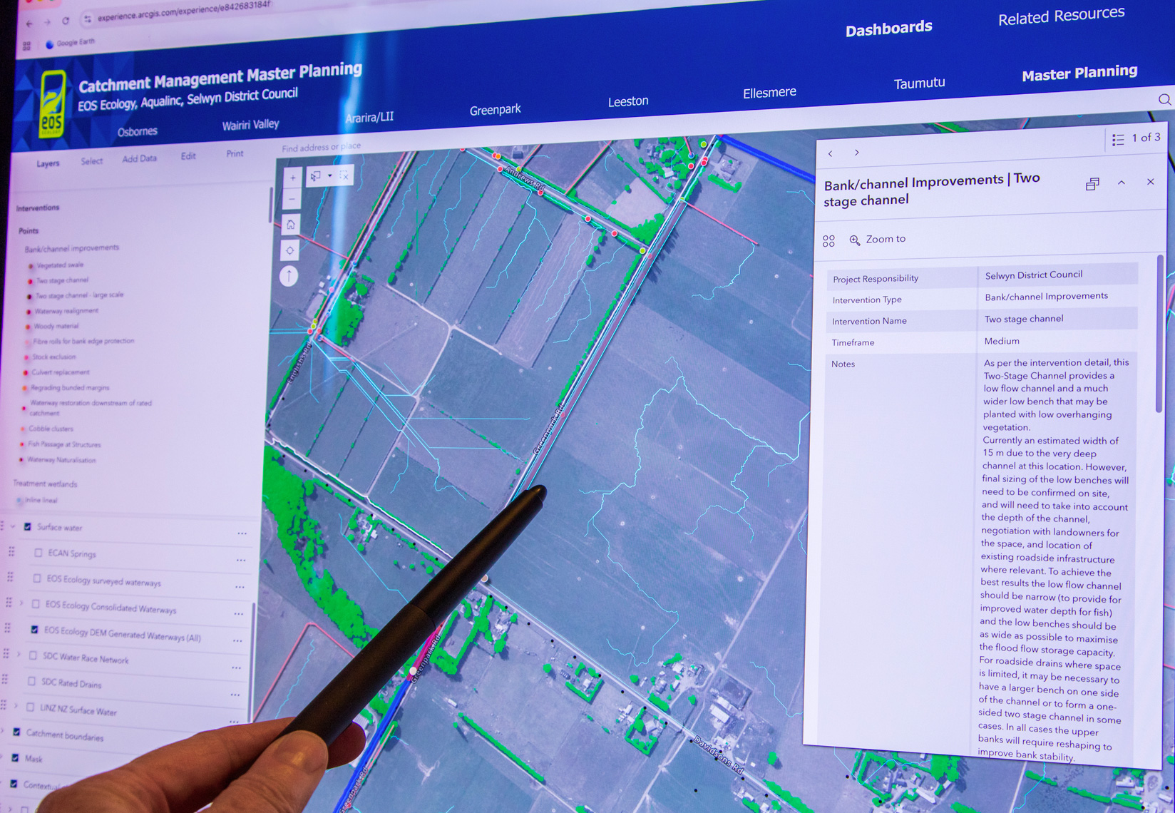
- Mapped all CMP interventions spatially using a combination of manual digitisation from field observations and automated spatial modelling from the DEM-derived waterway networks. Each intervention was assigned standardised attributes (type, geometry, responsibility, catchment, and timeframe) aligned with the CMP toolbox frameworks, with bespoke attribution added where site-specific context required it.
- Designed the ArcGIS Online platform architecture around a layered data governance model. During development, primary hosted feature layers were edited exclusively by EOS Ecology and Aqualinc Research scientists. Read-only view layers automatically synchronise updates to SDC-facing dashboards, one per catchment, ensuring council staff always see current data without risk of accidental modification. A secure Master Planning Editor provides direct access to the source layers for authorised personnel, including SDC staff upon handover.
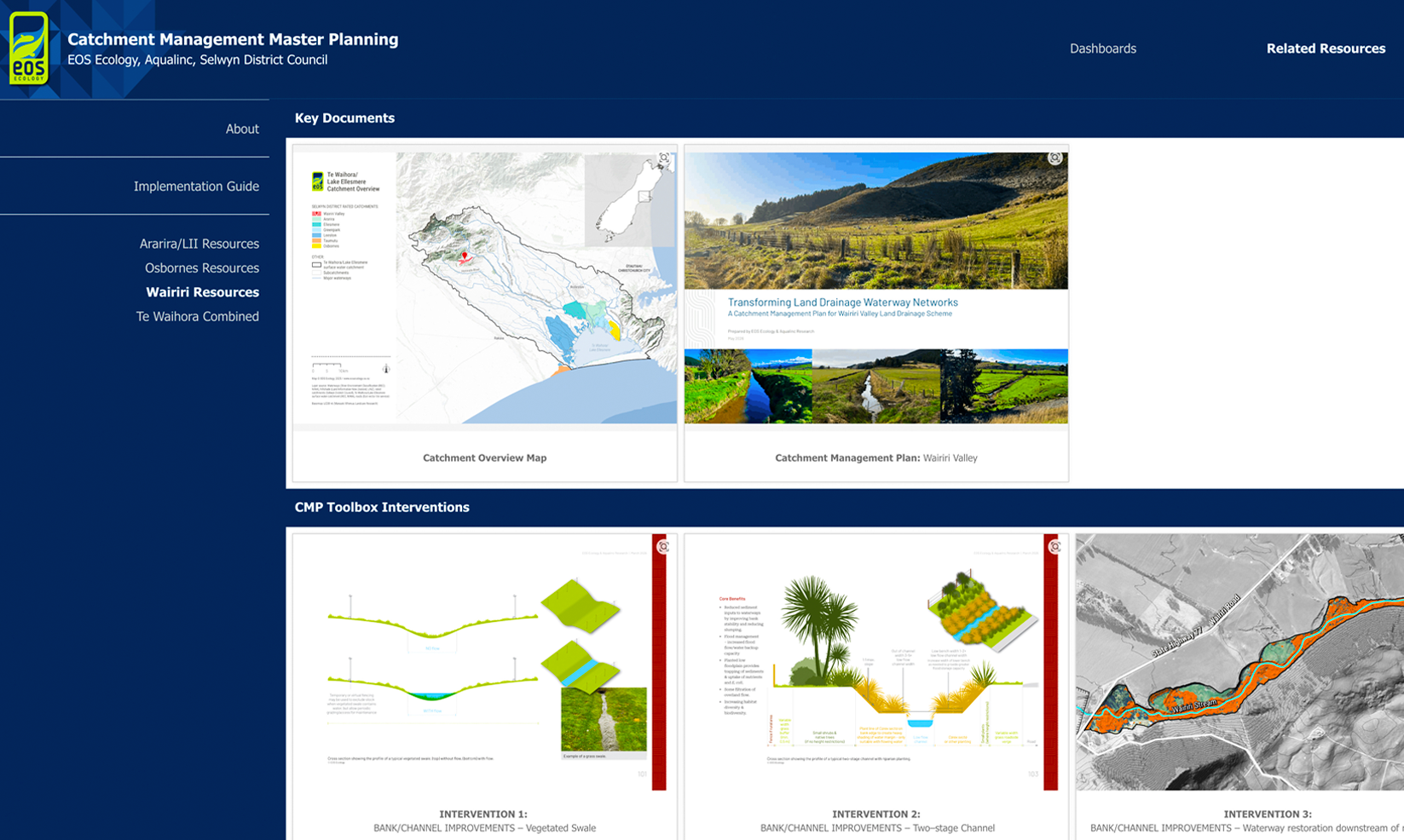
- Built the platform as an ArcGIS Experience Builder application to work within SDC’s geospatial ecosystem, integrating multiple web maps, a related resources hub linking to the published CMPs and Implementation Guide, and a curated set of contextual layers – soil types, flood-prone areas, historic vegetation, elevation profiles, property boundaries, and infrastructure – providing the spatial context needed for implementation decisions.

outcome
For the first time, SDC has a single spatial platform that holds all seven catchment management plans, their associated interventions, and the high-resolution waterway and catchment data needed to implement them. The platform replaces a fragmented landscape of static documents, regional GIS layers, and field notes with a live, queryable system where every intervention can be located, filtered, and understood in its spatial context.
The LiDAR-derived waterway mapping has given SDC a fundamentally more accurate picture of its drainage networks, revealing channels and flow paths that existing regional and national datasets had missed entirely. For the Osbornes Drain and Wairiri Valley catchments, the subcatchment delineation and flow permanence attribution provide a level of spatial resolution that enables precise, evidence-based targeting of interventions at the reach scale.
The data governance architecture ensures the platform remains accurate and reliable as a long-term management tool. Updates made by authorised SDC personnel propagate automatically to read-only dashboards, maintaining a single source of truth across the programme.
wider impact
- Demonstrates that catchment management planning and spatial implementation tools are strongest when designed together. The Master Plans were not retrofitted to the CMPs – the spatial framework, waterway mapping, and intervention schema were developed as part of the same programme, ensuring the planning and implementation layers speak the same language.
- The LiDAR-derived waterway mapping methodology is directly transferable to other districts and regions facing critical information deficits: national and regional datasets that lack the resolution needed for operational catchment management. The approach establishes a replicable workflow for generating high-resolution waterway networks from publicly available LiDAR data.
- The platform architecture – layered data governance, read-only dashboards for stakeholders, secure editing for authorised personnel – provides a model for how councils can maintain live spatial decision-support tools without compromising data integrity.