Wai Connection – Tatai Ki Te Wai
National Science and Technical Lead for one of Aotearoa New Zealand’s largest community freshwater programmes – building the Focus Catchment Map Series, spatial tools, and science resources that helped Provider Organisations empower the catchment groups they supported. Also provided direct science and engagement support to 79 catchment groups in the Waitaha/Canterbury region.
2023–2026
context
Aotearoa New Zealand’s Essential Freshwater reforms created both a legal obligation and a community opportunity – a coherent national framework for freshwater management that needed not just regulatory action, but genuine engagement with the people living and working in catchments. Wai Connection – Tatai Ki Te Wai was designed to connect that framework to the people it depends on: a national programme delivering on-the-ground catchment group support across Aotearoa New Zealand through the Mountains to Sea Conservation Trust (MTSCT) network of regional Provider Organisations. To function at a national scale, the programme needed a scientific and technical backbone capable of turning complex freshwater data and policy into tools that catchment groups and landowners could actually use. EOS Ecology was able to deliver on that key role, as well as deliver direct support in Waitaha/Canterbury as this region’s MTSCT Provider Organisation.

challenge
- To help catchment groups and the community better understand their local catchment, and to help guide them in their restoration efforts, we needed to find a way to pull together data from 150+ national and regional sources in formats originally designed for technical specialists, not for the people making decisions on the ground.
- Providing consistent, high-quality scientific support across hundreds of catchments simultaneously, each with different ecology, data availability, and community character, required building robust systems and tools, not delivering services on a case-by-case basis.
- Bring cohesiveness to a national programme delivered by different organisations in each region by creating a coherent ‘look and feel’ for the programme resources, and helping to build a nationally delivered, regionally focused programme platform.
- EOS Ecology held a genuinely dual responsibility: designing and maintaining the national science infrastructure and resources, while simultaneously serving as the Waitaha/Canterbury regional delivery provider.
our role
EOS Ecology held two contracted roles within ‘Wai Connection’: firstly as National Science and Technical Lead, responsible for the scientific, spatial, and communication infrastructure that enabled the programme to function consistently across all regions; and secondly as the MTSCT Provider Organisation for Waitaha/Canterbury, delivering direct catchment group support and engagement across the region. Our team of scientists, GIS specialists, science interpreters, and graphic designers provided wraparound support to 13 regions, while our Waitaha/Canterbury delivery team worked directly with catchment groups, rūnanga, and landowners on the ground.
how we approached it
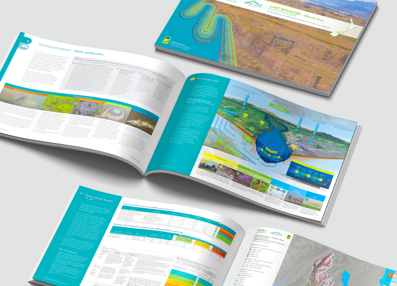
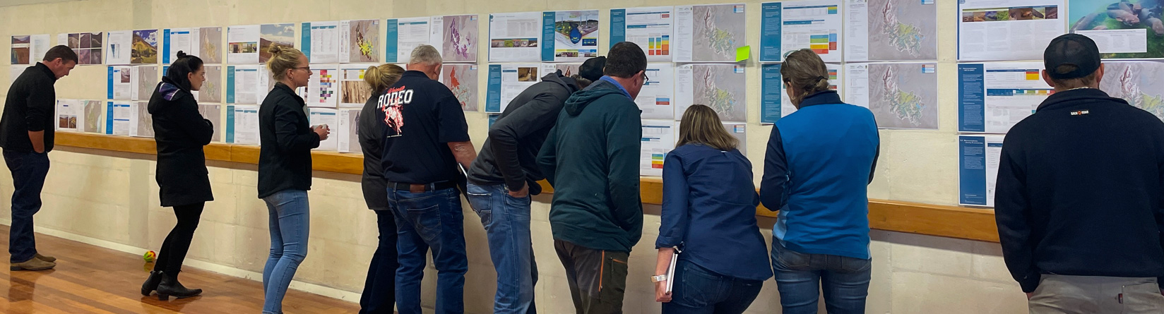
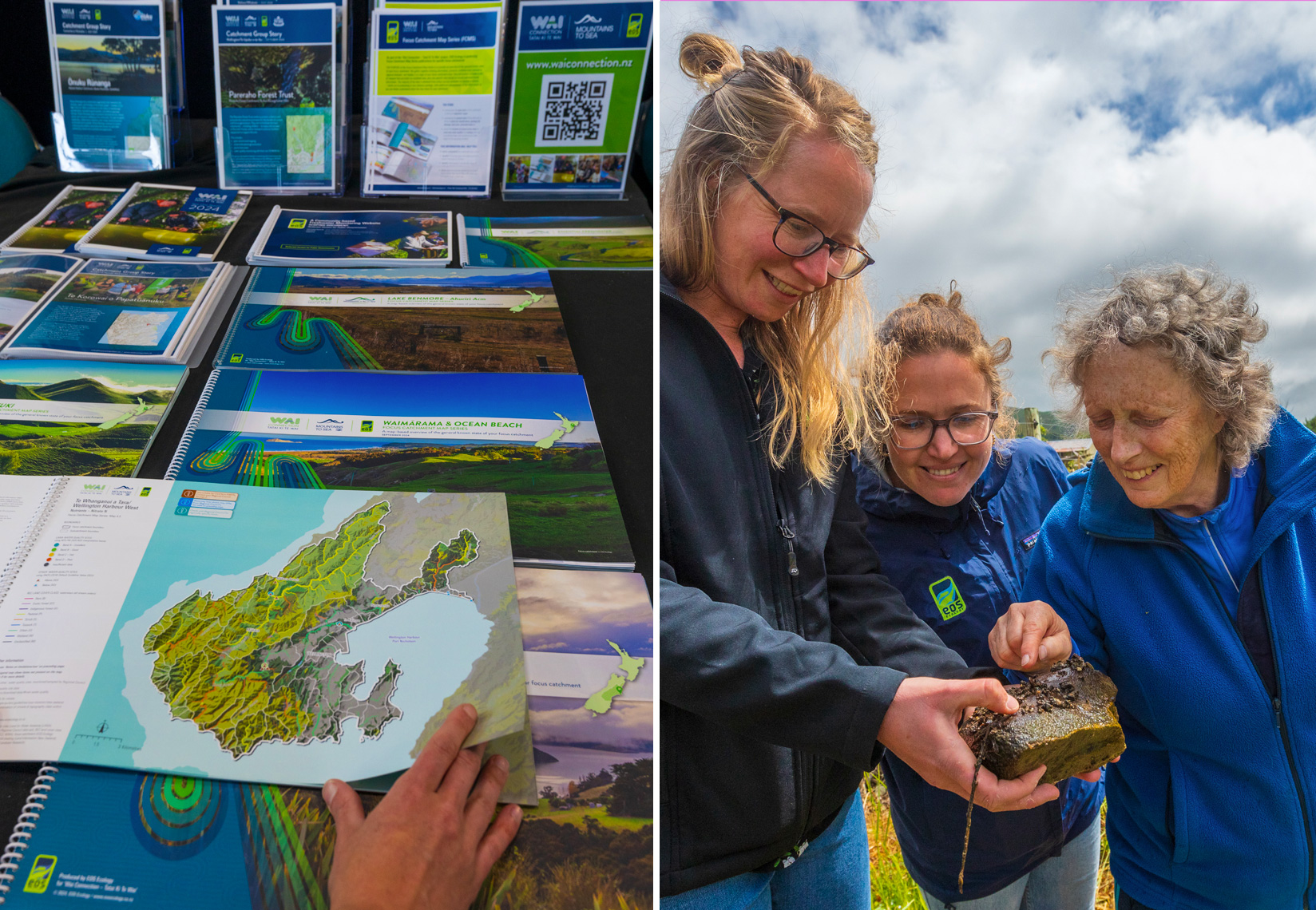
- Designed and produced the Focus Catchment Map Series (FCMS) – EOS Ecology’s own product and the programme’s flagship science output. Each FCMS is a 30-map, print-ready A3 publication synthesising 150+ national and regional data sources into a single, interpreted, catchment-specific resource covering past land cover, waterway classifications, water quality, fish and macroinvertebrate communities, and coastal receiving environments. Across the programme we produced 52 FCMS publications spanning 8 regions and 3.7 million hectares, processing over 2.85 million raw data records from 9,228 monitoring sites.
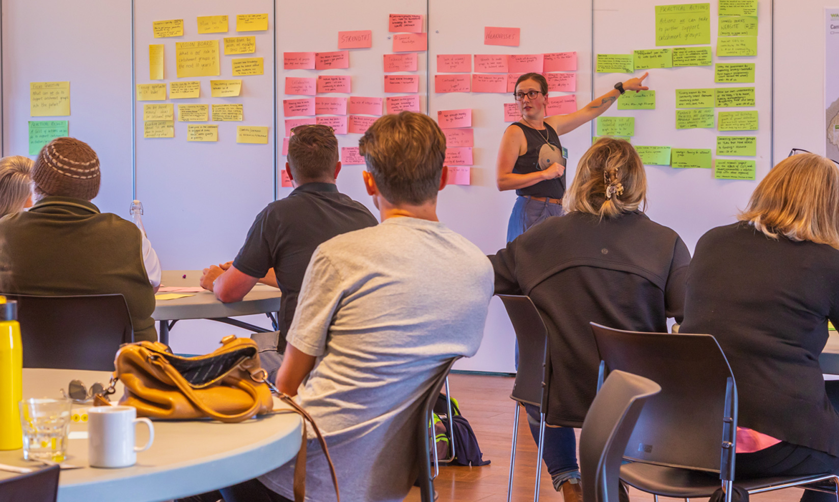
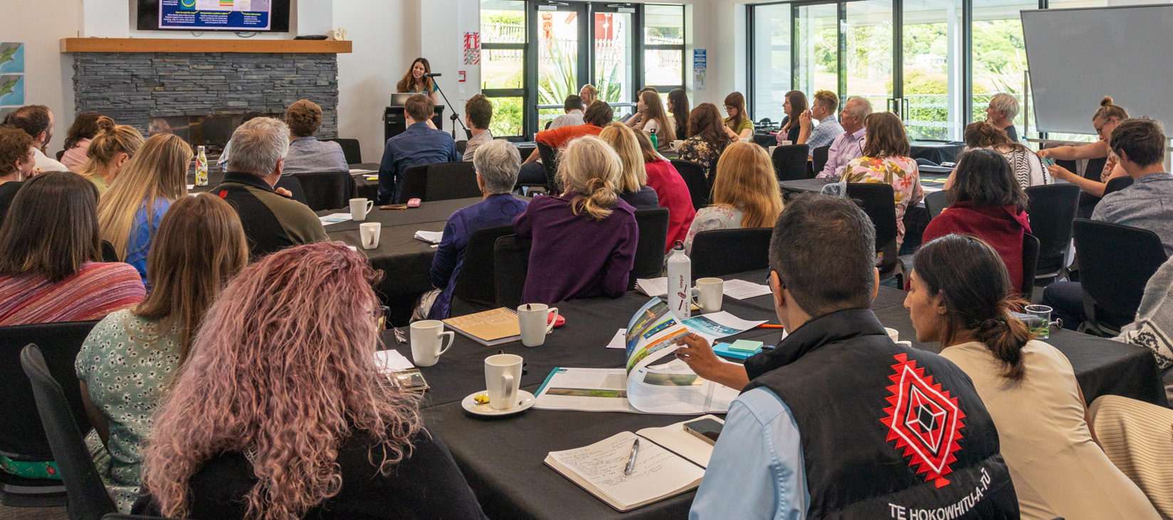
- Delivered 47 FCMS science workshops, engaging 118 organisations nationally. Each was a three-hour session facilitated by an EOS Ecology senior scientist, pairing publication handover with guided interpretation, designed so that each catchment group left not just with the maps, but with the ability to use them.
- Built the full FCMS support ecosystem – Default Guideline Values and Visual Clarity quick guides, an FAQ document, overview PowerPoint, short- and long-form videos, and the 19-page Essential Freshwater Summary translating the NPS-FM 2020 and associated regulations into plain language.
- Developed the programme’s visual and digital infrastructure – project brand, graphic assets, the ‘Wai Connection’ website with a provider portal featuring GIS-based interactive maps and dashboards, a resources hub, online surveys, and 30+ catchment group stories from across Aotearoa New Zealand.
- Scoped a Community-based Freshwater Monitoring (CBFM) website – developed both the structure architecture for a platform to hold and interpret catchment group monitoring data, and the first comprehensive online map of catchment groups across the motu.
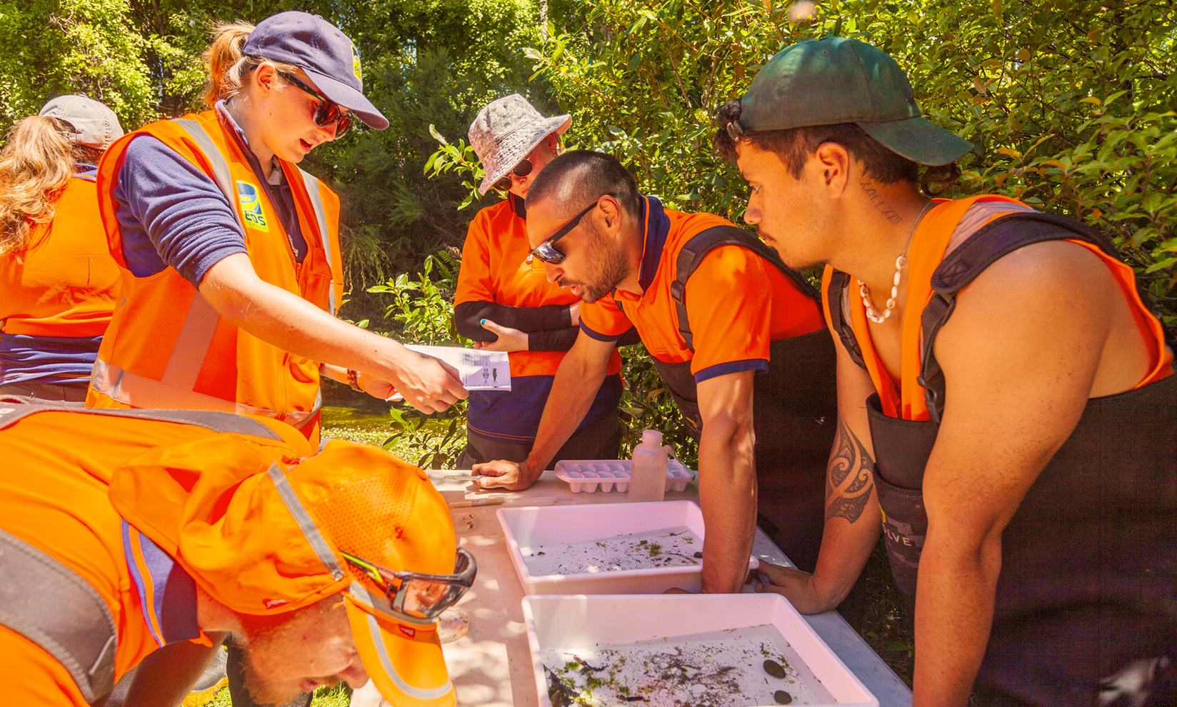
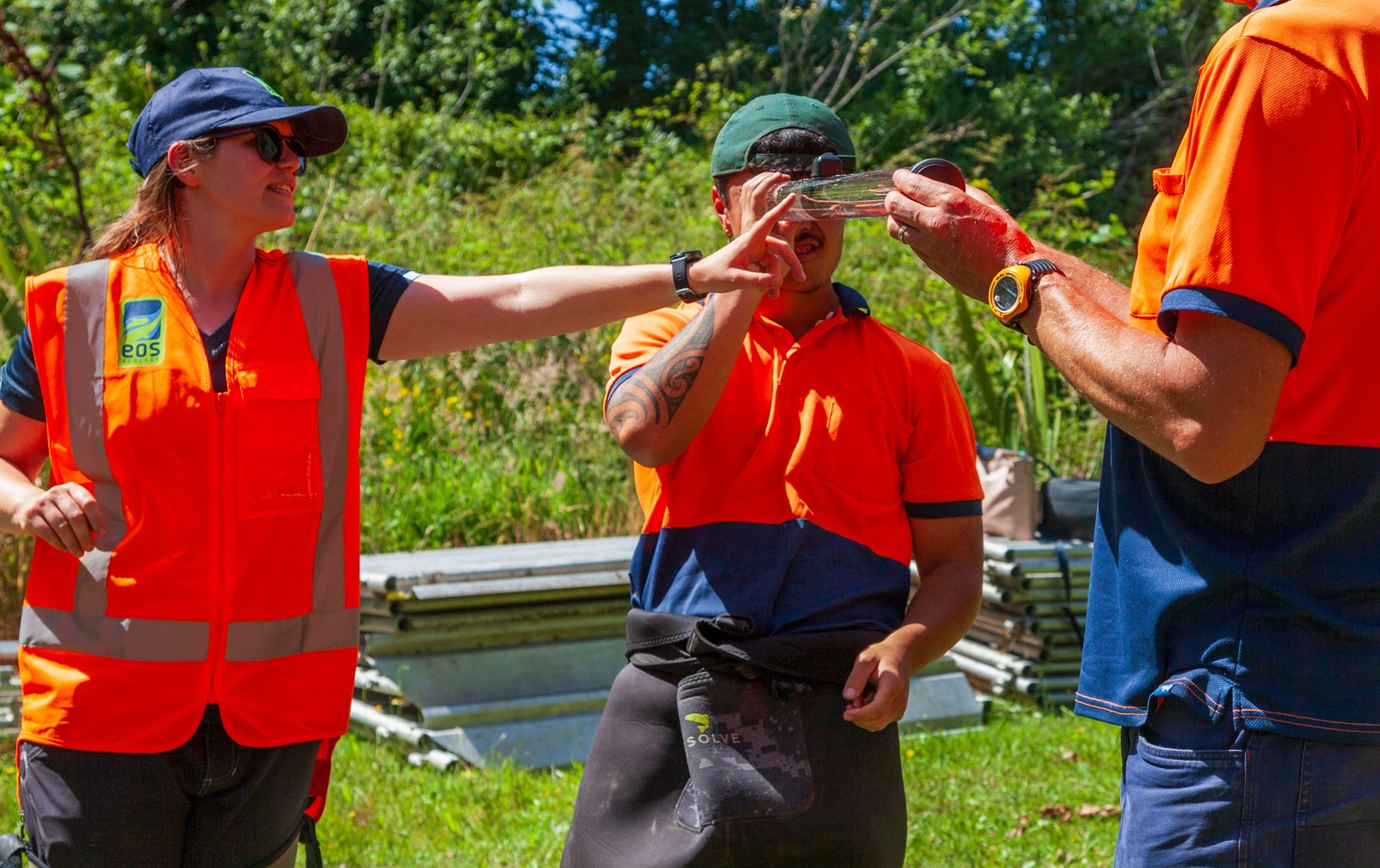
- Delivered the Canterbury regional programme – directly supported 79 catchment groups from Kaikōura to Hakataramea. This included freshwater monitoring training, restoration planning, long-term monitoring programme design, school collaboration through our ‘Nature Agents’ programme, public events, and regional hui. We worked alongside iwi groups to support mātauranga Māori cultural health assessments, providing supplementary resources and advice around western science approaches. Alongside New Zealand Landcare Trust, MPI, and Environment Canterbury, we established the Waitaha Regional Advisory Group.

outcome
For the first time, catchment groups across eight regions of Aotearoa New Zealand have a scientifically grounded, spatially relevant picture of their waterways, presented in a way that can be understood and acted on. By developing the FCMS in conjunction with regional council, we were able to ensure that it didn’t conflict with other mapping and reporting being undertaken by them. The response from councils reinforced the approach: Tasman District Council’s Trevor James called the FCMS “an answer to my dreams” for how it brought river health and coastal data together, while Environment Canterbury’s Elaine Moriarty described the outputs as “easy to access, visually appealing and scientifically accurate.”
Beyond the FCMS itself, we provided wider science support across the programme – water quality monitoring advice, eDNA sampling guidance, and posters and infographics explaining complex system processes and fish species found in each region. The ‘Wai Connection’ website became the central repository for these resources, as well as a place for Provider Organisations to access GIS tools and dashboards in their day-to-day work. The CBFM scoping document built on this, demonstrating the need for a centralised platform to hold and interpret monitoring data for catchment groups, and how one could be built and managed.
In Waitaha/Canterbury, EOS Ecology’s regional delivery team connected catchment groups across North-, Mid- and South-Canterbury, running wānanga, supporting restoration planning and monitoring, and building long-term community capacity to engage with freshwater management. The programme’s high expectations were met, many project KPIs being exceeded, with the programme continuing into 2026 with a focus on farmer-led catchment groups.
wider impact
- The FCMS methodology is a replicable framework, transferable beyond ‘Wai Connection’ to councils, iwi, and catchment management organisations seeking to make environmental monitoring data useful at community level. The science workshop delivery model – pairing publication handover with scientist-facilitated workshops – demonstrates how science products can be designed from the outset to create understanding, not just transfer information.
- EOS Ecology’s dual role as the National Science and Technical Lead and Waitaha/Canterbury Regional Delivery provider demonstrates what it looks like to embed genuine science systems capability inside a community programme – ensuring tools are designed not only by technically trained specialists, but also by those who work at the water’s edge with catchment groups.